Chest opened
+${chestReward.xp} XP
Explorer
NOUVEAU ×${chestReward.collectible.quantity}
tapez pour fermer

See the monuments around you in AR Open chests in the app

Around Us is built for your phone — point your camera at the streets and discover the monuments and places around you in augmented reality. Around Us is built for your phone — chests unlock when you walk, explore and capture nearby places.

Enable Location

We need your location to show you interesting places around you

Discover nearby places

Find interesting locations and hidden gems around you

Precise directions

Get accurate directions and distances to places

Your location is never shared with other users. It's only used when you tap the location button.

Fort Rock

Log in to your account

Start exploring — it's free

Trusted by 87,326 travelers worldwide

Continue with Google
Continue with Apple
or

We will send you a code to connect

By continuing, you accept our Terms and Conditions and our Privacy Policy

Check your inbox

We've sent a pincode in your inbox. Please enter the code below.

Discussion Reviews 1 Photos
16.9k Popularity

Fort Rock, Tuff ring in Lake County, Oregon, US

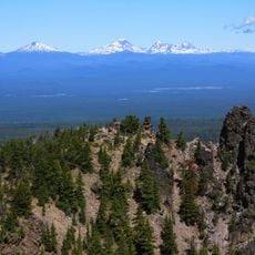
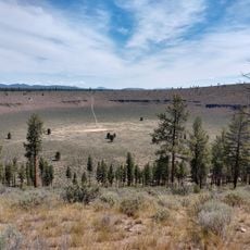
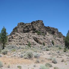
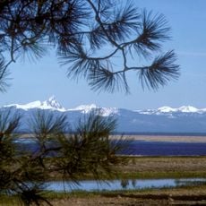
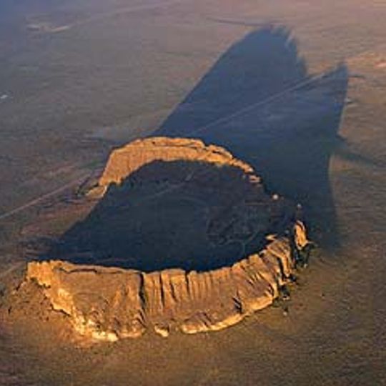
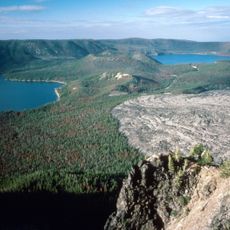
Fort Rock is a volcanic tuff ring that rises above the surrounding plain, displaying a broad circular shape with steep walls on all sides. The walls expose layers of volcanic material that visitors can see directly while walking around or climbing the formation.

This formation created when volcanic activity shaped the landscape thousands of years ago, leaving behind a distinctive geological structure. William Sullivan gave the place its name in the 1870s during his search for lost livestock in the region.

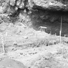
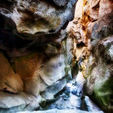
The cave within this formation once sheltered early inhabitants, as proven by ancient discoveries that show people used this place thousands of years ago. These findings reveal how the site served as a natural refuge in the high desert landscape.

The site is accessible and offers trails for exploring the area and observing geological features up close. Visitors should come prepared for open terrain with little shade and weather that can change quickly in this high desert location.

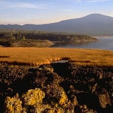
This formation grew from an unusual process where molten lava met wet lake mud, triggering powerful steam explosions that scattered volcanic material outward. The eruptions created the ring shape by spraying material in an expanding circle rather than a single cone.

The community of curious travelers

AroundUs brings together thousands of curated places, local tips, and hidden gems, enriched daily by 60,000 contributors worldwide.
Start exploring
Location
GPS coordinates
43.37208,-121.07400
Latest update
September 12, 2026 02:03
Around this place
Newberry Volcano
United States of America

Newberry Volcano

23.7 mi
United States of America

Newberry National Volcanic Monument

32.2 mi
Lava River Cave
United States of America

Lava River Cave

39.1 mi
Lava Butte
United States of America

Lava Butte

40.3 mi
Fort Rock Cave
United States of America

Fort Rock Cave

1.5 mi
Hole-in-the-Ground
United States of America

Hole-in-the-Ground

6.8 mi
Crack in the Ground
United States of America

Crack in the Ground

20.8 mi
Wickiup Reservoir
United States of America

Wickiup Reservoir

38.3 mi
Fossil Lake
United States of America

Fossil Lake

29.5 mi
Lost Forest Research Natural Area
United States of America

Lost Forest Research Natural Area

37.5 mi
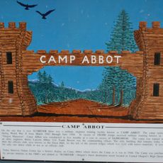
Camp Abbot
United States of America

Camp Abbot

39.3 mi
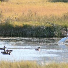
Summer Lake Wildlife Area
United States of America

Summer Lake Wildlife Area

33 mi
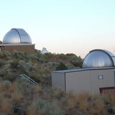
Pine Mountain Observatory
United States of America

Pine Mountain Observatory

29.8 mi
Picture Rock Pass Petroglyphs Site
United States of America

Picture Rock Pass Petroglyphs Site

26.4 mi
La Pine State Park
United States of America

La Pine State Park

36.1 mi
Fort Rock Valley Historical Homestead Museum
United States of America

Fort Rock Valley Historical Homestead Museum

1.4 mi
Paulina Peak
United States of America

Paulina Peak

23.7 mi
Klamath Marsh National Wildlife Refuge
United States of America

Klamath Marsh National Wildlife Refuge

40 mi
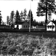
Cabin Lake Guard Station
United States of America

Cabin Lake Guard Station

8.2 mi
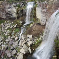
Paulina Falls
United States of America

Paulina Falls

25.7 mi
Davis Lake volcanic field
United States of America

Davis Lake volcanic field

39.3 mi
Sunriver Observatory
United States of America

Sunriver Observatory

40.1 mi
Paulina Lake Guard Station
United States of America

Paulina Lake Guard Station

25.6 mi
East Lava Field
United States of America

East Lava Field

17.3 mi
Ed Eskelin Ranch
United States of America

Ed Eskelin Ranch

11.7 mi
Odell Butte
United States of America

Odell Butte

40.3 mi
Lava Butte Lookout
United States of America

Lava Butte Lookout

40.3 mi
Newberry Crater
United States of America

Newberry Crater

25.5 mi
Show the full map
Reviews
Share your experience

No review yet

Discussions
Start a discussion...

No discussion yet

« Fort Rock - Tuff ring in Lake County, Oregon, US » is provided by Around Us (aroundus.com). Images and texts are derived from Wikimedia project under a Creative Commons license. You are allowed to copy, distribute, and modify copies of this page, under the conditions set by the license, as long as this note is clearly visible.

Discover hidden gems everywhere you go!

From secret cafés to breathtaking viewpoints, skip the crowded tourist spots and find places that match your style. Our app makes it easy with voice search, smart filtering, route optimization, and insider tips from travelers worldwide. Download now for the complete mobile experience.
Around Us App Screenshot

A unique approach to discovering new places

Le Figaro

All the places worth exploring

France Info

A tailor-made excursion in just a few clicks

20 Minutes

Around Us
Travel Guide & Maps
Download

Send to your phone

QR Code
1

Open the camera app on your mobile.

2

Point at the QR code with your camera. A notification will appear.

3

Tap the notification to open the link.