Enable Location

We need your location to show you interesting places around you

Discover nearby places

Find interesting locations and hidden gems around you

Precise directions

Get accurate directions and distances to places

Your location is never shared with other users. It's only used when you tap the location button.

Picture Rock Pass Petroglyphs Site

Log in to your account

Start exploring — it's free

Trusted by 65,090 travelers worldwide

Continue with Google
Continue with Apple
or

We will send you a code to connect

By continuing, you accept our Terms and Conditions and our Privacy Policy

Check your inbox

We've sent a pincode in your inbox. Please enter the code below.

Discussion Reviews 1 Photos
3.1k Popularity

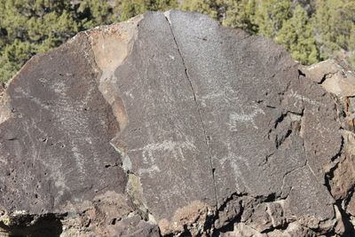
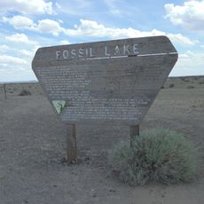
Picture Rock Pass Petroglyphs Site, Native American petroglyphs at Picture Rock Pass in Lake County, Oregon.

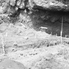
Picture Rock Pass Petroglyphs Site is an archaeological site in Lake County, Oregon, located along Highway 31 on a south-facing basalt boulder. The boulder holds ten carved figures in total, made up of three human forms and seven representations of four-legged animals.

The carvings were made thousands of years ago, at a time when the region was shaped by ancient lakes and waterways that have since disappeared. The site likely sat along a natural corridor that communities used as they moved through the landscape.

The carved figures of people and four-legged animals likely reflected what mattered most to the communities who made them, from hunting to marking a known route. Similar motifs appear at other rock art sites across the Pacific Northwest, suggesting shared practices across a wide area.

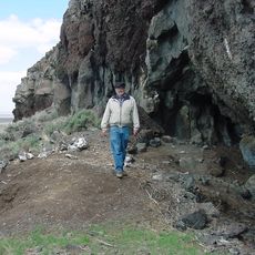
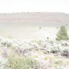
The site is easy to reach from Highway 31, with parking on the north side of the road and a short walk to the carvings. No climbing or special gear is needed, and the terrain is manageable for most visitors.

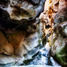
Despite sitting right beside a busy road, the basalt boulder has remained free of damage or graffiti. The rock's naturally dark surface makes the carved lines stand out clearly, especially in the angled light of morning or late afternoon.

The community of curious travelers

AroundUs brings together thousands of curated places, local tips, and hidden gems, enriched daily by 60,000 contributors worldwide.

Start exploring
Location
GPS coordinates
43.04700,-120.79800
Latest update
March 3, 2026 13:53
Around this place
Newberry Volcano
United States of America

Newberry Volcano

80.5 km
Paisley Caves
United States of America

Paisley Caves

37.6 km
Newberry National Volcanic Monument
United States of America

Newberry National Volcanic Monument

80.9 km
Fort Rock
United States of America

Fort Rock

42.6 km
Fort Rock Cave
United States of America

Fort Rock Cave

44.4 km
Hole-in-the-Ground
United States of America

Hole-in-the-Ground

51.2 km
Crack in the Ground
United States of America

Crack in the Ground

32.8 km
Summer Lake Hot Springs
United States of America

Summer Lake Hot Springs

37.8 km
Fremont-Winema National Forest
United States of America

Fremont-Winema National Forest

72.8 km
Fossil Lake
United States of America

Fossil Lake

39.8 km
Lost Forest Research Natural Area
United States of America

Lost Forest Research Natural Area

53.1 km
Summer Lake Wildlife Area
United States of America

Summer Lake Wildlife Area

11 km
Gearhart Mountain Wilderness
United States of America

Gearhart Mountain Wilderness

59.7 km
Abert Rim
United States of America

Abert Rim

86.6 km
Pine Mountain Observatory
United States of America

Pine Mountain Observatory

83.7 km
Fort Rock Valley Historical Homestead Museum
United States of America

Fort Rock Valley Historical Homestead Museum

40.4 km
Paulina Peak
United States of America

Paulina Peak

80.5 km
Klamath Marsh National Wildlife Refuge
United States of America

Klamath Marsh National Wildlife Refuge

66.5 km
Chandler State Wayside
United States of America

Chandler State Wayside

82.5 km
Cabin Lake Guard Station
United States of America

Cabin Lake Guard Station

53.7 km
Paulina Falls
United States of America

Paulina Falls

83.8 km
Bly Ranger Station
United States of America

Bly Ranger Station

74.8 km
Paulina Lake Guard Station
United States of America

Paulina Lake Guard Station

83.5 km
East Lava Field
United States of America

East Lava Field

46.9 km
Ed Eskelin Ranch
United States of America

Ed Eskelin Ranch

24.5 km
Fort Rock State Natural Area
United States of America

Fort Rock State Natural Area

42.6 km
Newberry Crater
United States of America

Newberry Crater

83 km
Star Theater
United States of America

Star Theater

74.9 km
Show the full map
Reviews
Share your experience

No review yet

Discussions
Start a discussion...

No discussion yet

« Picture Rock Pass Petroglyphs Site - Native American petroglyphs at Picture Rock Pass in Lake County, Oregon » is provided by Around Us (aroundus.com). Images and texts are derived from Wikimedia project under a Creative Commons license. You are allowed to copy, distribute, and modify copies of this page, under the conditions set by the license, as long as this note is clearly visible.

Discover hidden gems everywhere you go!

From secret cafés to breathtaking viewpoints, skip the crowded tourist spots and find places that match your style. Our app makes it easy with voice search, smart filtering, route optimization, and insider tips from travelers worldwide. Download now for the complete mobile experience.

Around Us App Screenshot

A unique approach to discovering new places

Le Figaro

All the places worth exploring

France Info

A tailor-made excursion in just a few clicks

20 Minutes

Around Us
Travel Guide & Maps
Download

Send to your phone

QR Code
1

Open the camera app on your mobile.

2

Point at the QR code with your camera. A notification will appear.

3

Tap the notification to open the link.