Abert Rim, Volcanic cliff in Lake County, Oregon
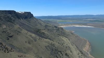
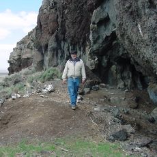
Abert Rim is a volcanic cliff rising 2,500 feet (760 meters) along a 30-mile (48-kilometer) stretch of the eastern shore of Lake Abert. The face displays clear layers of hardened lava flows that reveal millions of years of volcanic history in the rock.
The formation was created by intense volcanic activity millions of years ago, which tilted massive rock blocks and created fault scarps. Tectonic forces shaped this landscape through extended periods of geological change.
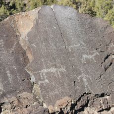
Klamath and Paiute peoples have inhabited these lands for thousands of years, relying on the surroundings for hunting and gathering. Their lasting presence shapes how visitors experience and understand this landscape today.
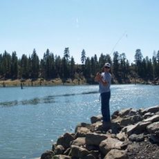
Multiple trails provide access to the rim, and spring and fall offer the most comfortable hiking conditions with moderate temperatures. Plan for exposed terrain without shade, bringing plenty of water and sun protection for your visit.
The rock layers contain fossils from ancient times that offer clues to the region's past development. Large eagles nest on the cliffs and use thermal currents rising from the land below to soar effortlessly over the lake.
The community of curious travelers
AroundUs brings together thousands of curated places, local tips, and hidden gems, enriched daily by 60,000 contributors worldwide.