Enable Location

We need your location to show you interesting places around you

Discover nearby places

Find interesting locations and hidden gems around you

Precise directions

Get accurate directions and distances to places

Your location is never shared with other users. It's only used when you tap the location button.

Rogue–Umpqua Divide Wilderness

Log in to your account

Start exploring — it's free

Trusted by 61,516 travelers worldwide

Continue with Google
Continue with Apple
or

We will send you a code to connect

By continuing, you accept our Terms and Conditions and our Privacy Policy

Check your inbox

We've sent a pincode in your inbox. Please enter the code below.

Rogue–Umpqua Divide Wilderness

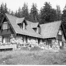
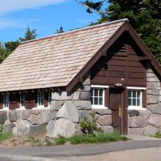
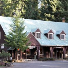
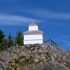
Rogue–Umpqua Divide Wilderness, Protected wilderness area in southwestern Oregon, United States.

Description

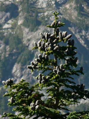
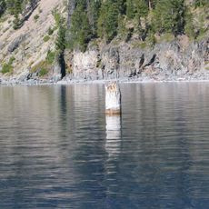
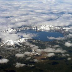
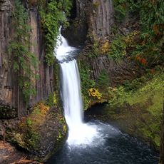
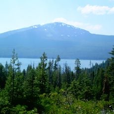
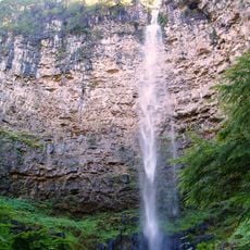
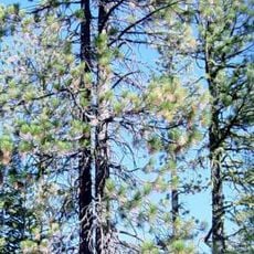
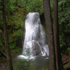
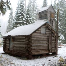
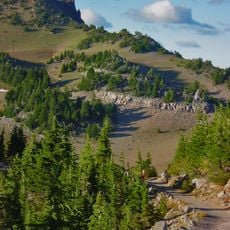
The Rogue-Umpqua Divide Wilderness is a mountainous protected area in southwestern Oregon covered by dense conifer forests with scattered meadows and rocky ridgelines at higher elevations. The landscape features rushing streams, steep valleys, and exposed peaks that create a rugged and isolated environment throughout the seasons.

History

Congress designated this area as protected wilderness in 1984, securing its status within the federal conservation system. The remote location ensured the landscape remained largely undisturbed prior to official protection measures.

Culture

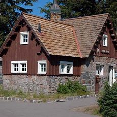
Native American tribes established strong connections to this land, utilizing its natural resources and waterways for sustenance through generations.

Practical

The area features around 100 miles of marked trails suitable for hikers of different abilities. Summer and early fall offer the best conditions for visiting, as snow melts from higher elevations and paths become more passable.

Did you know?

The main trail follows a ridge that divides two river systems, creating distinct ecosystems on either side of the crest. This geographical positioning allows visitors to experience two different natural zones within a single journey through the wilderness.

Location
GPS coordinates
43.06639,-122.46278
Latest update
December 12, 2025 17:45

AroundUs brings together thousands of curated places, local tips, and hidden gems, enriched daily by 60,000 contributors worldwide. Discover all places nearby (Oregon).

Around this place
Old Man of the Lake
United States of America

Old Man of the Lake

32.2 km
Mount Mazama
United States of America

Mount Mazama

32.6 km
Toketee Falls
United States of America

Toketee Falls

22 km
Crater Lake Lodge
United States of America

Crater Lake Lodge

31.5 km
Mount Bailey
United States of America

Mount Bailey

22.1 km
Rim Village Historic District
United States of America

Rim Village Historic District

31.3 km
Watson Falls
United States of America

Watson Falls

20.4 km
Boulder Creek Wilderness
United States of America

Boulder Creek Wilderness

31.9 km
Watchman Lookout Station
United States of America

Watchman Lookout Station

27.3 km
Union Peak
United States of America

Union Peak

32.6 km
Sinnott Memorial Observation Station
United States of America

Sinnott Memorial Observation Station

31.2 km
Comfort Station No. 72
United States of America

Comfort Station No. 72

31 km
Crater Lake Superintendent's Residence
United States of America

Crater Lake Superintendent's Residence

32.3 km
Comfort Station No. 68
United States of America

Comfort Station No. 68

31.1 km
Munson Valley Historic District
United States of America

Munson Valley Historic District

32.7 km
Yakso Falls
United States of America

Yakso Falls

27.1 km
Union Creek Historic District
United States of America

Union Creek Historic District

17.8 km
Hershberger Mountain Lookout
United States of America

Hershberger Mountain Lookout

3.7 km
Whaleback Snow-Survey Cabin
United States of America

Whaleback Snow-Survey Cabin

19.8 km
Rim Drive Historic District
United States of America

Rim Drive Historic District

27.3 km
Administration Building
United States of America

Administration Building

32.8 km
Rim Visitor Center
United States of America

Rim Visitor Center

31.2 km
Watchman Peak Trail
United States of America

Watchman Peak Trail

27.3 km
Steel Visitor Center
United States of America

Steel Visitor Center

32.7 km
Watchman Overlook
United States of America

Watchman Overlook

27.5 km
Discovery Point
United States of America

Discovery Point

29.4 km
Devil's Backbone Viewpoint
United States of America

Devil's Backbone Viewpoint

27.5 km
Mess Hall
United States of America

Mess Hall

32.7 km
Show the full map
« Rogue–Umpqua Divide Wilderness - Protected wilderness area in southwestern Oregon, United States » is provided by Around Us (aroundus.com). Images and texts are derived from Wikimedia project under a Creative Commons license. You are allowed to copy, distribute, and modify copies of this page, under the conditions set by the license, as long as this note is clearly visible.

Discover hidden gems everywhere you go!

From secret cafés to breathtaking viewpoints, skip the crowded tourist spots and find places that match your style. Our app makes it easy with voice search, smart filtering, route optimization, and insider tips from travelers worldwide. Download now for the complete mobile experience.

Around Us App Screenshot

A unique approach to discovering new places

Le Figaro

All the places worth exploring

France Info

A tailor-made excursion in just a few clicks

20 Minutes

Around Us
Travel Guide & Maps
Download

Send to your phone

QR Code
1

Open the camera app on your mobile.

2

Point at the QR code with your camera. A notification will appear.

3

Tap the notification to open the link.