Chest opened
+${chestReward.xp} XP
Explorer
NOUVEAU ×${chestReward.collectible.quantity}
tapez pour fermer
Chest locked

Open chests in the app

Around Us is built for your phone — chests unlock when you walk, explore and capture nearby places.

Enable Location

We need your location to show you interesting places around you

Discover nearby places

Find interesting locations and hidden gems around you

Precise directions

Get accurate directions and distances to places

Your location is never shared with other users. It's only used when you tap the location button.

Deschutes River

Log in to your account

Start exploring — it's free

Trusted by 72,891 travelers worldwide

Continue with Google
Continue with Apple
or

We will send you a code to connect

By continuing, you accept our Terms and Conditions and our Privacy Policy

Check your inbox

We've sent a pincode in your inbox. Please enter the code below.

Deschutes River
Discussion Reviews 1 Photos
34.2k Popularity

Deschutes River, Major tributary river in central Oregon, US.

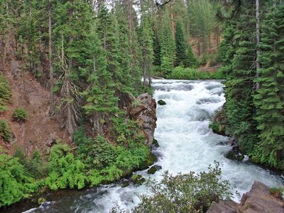
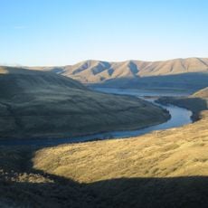
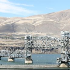
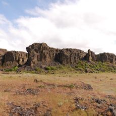
The Deschutes River is a major waterway in central Oregon that flows from the Cascade Range down to meet the Columbia River. It cuts through deep basalt canyons and is fed by natural springs that keep the water flow steady throughout the year.

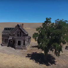
The river served Native populations for thousands of years before becoming a notable landmark for settlers moving westward in the 1800s. Its banks provided a natural corridor that guided early movement through this semi-arid landscape.

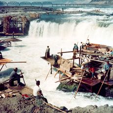
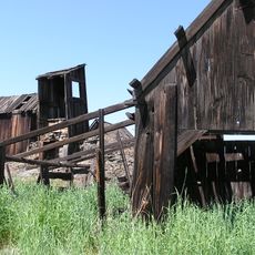
The river held deep importance for Native peoples who depended on its salmon runs and resources for survival. Today visitors can spot petroglyphs and ancient camp sites along the canyon that mark thousands of years of continuous use.

The river offers year-round activities like whitewater rafting, fishing, and camping, though conditions vary by season. Different sections require different skill levels and equipment, so choosing the right area for your ability matters.

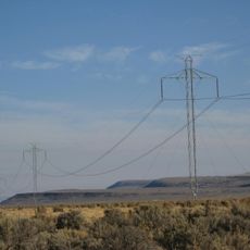
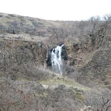
The water maintains an unusually steady flow throughout the year thanks to underground springs and the basalt canyon structure. This makes it one of the most reliable waterways in an otherwise dry part of the region.

The community of curious travelers

AroundUs brings together thousands of curated places, local tips, and hidden gems, enriched daily by 60,000 contributors worldwide.

Start exploring
Location
Location
Location
Location
GPS coordinates
45.63540,-120.91451
Latest update
December 19, 2025 22:57
Around this place
Maryhill Stonehenge
United States of America

Maryhill Stonehenge

10.7 km
Celilo Falls
United States of America

Celilo Falls

5.2 km
John Day Dam
United States of America

John Day Dam

19.4 km
Pacific DC Intertie
United States of America

Pacific DC Intertie

16.2 km
The Dalles Dam
United States of America

The Dalles Dam

17.2 km
Maryhill Museum of Art
United States of America

Maryhill Museum of Art

6.1 km
Celilo Converter Station
United States of America

Celilo Converter Station

16.1 km
Sam Hill Memorial Bridge
United States of America

Sam Hill Memorial Bridge

7.6 km
The Dalles Bridge
United States of America

The Dalles Bridge

17.7 km
The Dalles Mint
United States of America

The Dalles Mint

20.8 km
Maryhill State Park
United States of America

Maryhill State Park

8.6 km
Deschutes River State Recreation Area
United States of America

Deschutes River State Recreation Area

410 m
Oregon Trunk Rail Bridge
United States of America

Oregon Trunk Rail Bridge

5.5 km
Columbia Hills Historical State Park
United States of America

Columbia Hills Historical State Park

14.8 km
Charles E. Nelson House
United States of America

Charles E. Nelson House

13.5 km
Columbia Hills
United States of America

Columbia Hills

15.3 km
Granada Theater
United States of America

Granada Theater

21.2 km
Dr. J. A. Reuter House
United States of America

Dr. J. A. Reuter House

21.3 km
Indian Shaker Church and Gulick Homestead
United States of America

Indian Shaker Church and Gulick Homestead

17.3 km
The Dalles Civic Auditorium
United States of America

The Dalles Civic Auditorium

21.2 km
First Day Advent Christian Church
United States of America

First Day Advent Christian Church

9.8 km
The Dalles Carnegie Library
United States of America

The Dalles Carnegie Library

21.3 km
Joseph D. and Margaret Kelly House
United States of America

Joseph D. and Margaret Kelly House

20.9 km
U.S. Post Office
United States of America

U.S. Post Office

21.4 km
John and Murta Van Dellen House
United States of America

John and Murta Van Dellen House

21.4 km
Sharp Family Residential Ensemble
United States of America

Sharp Family Residential Ensemble

21.1 km
Fulton–Taylor House
United States of America

Fulton–Taylor House

21.4 km
National Neon Sign Museum
United States of America

National Neon Sign Museum

21.3 km
Show the full map
Reviews
Share your experience

No review yet

Discussions
Start a discussion...

No discussion yet

« Deschutes River - Major tributary river in central Oregon, US » is provided by Around Us (aroundus.com). Images and texts are derived from Wikimedia project under a Creative Commons license. You are allowed to copy, distribute, and modify copies of this page, under the conditions set by the license, as long as this note is clearly visible.

Discover hidden gems everywhere you go!

From secret cafés to breathtaking viewpoints, skip the crowded tourist spots and find places that match your style. Our app makes it easy with voice search, smart filtering, route optimization, and insider tips from travelers worldwide. Download now for the complete mobile experience.

Around Us App Screenshot

A unique approach to discovering new places

Le Figaro

All the places worth exploring

France Info

A tailor-made excursion in just a few clicks

20 Minutes

Around Us
Travel Guide & Maps
Download

Send to your phone

QR Code
1

Open the camera app on your mobile.

2

Point at the QR code with your camera. A notification will appear.

3

Tap the notification to open the link.