Chest opened
+${chestReward.xp} XP
Explorer
NOUVEAU ×${chestReward.collectible.quantity}
tapez pour fermer
Chest locked

Open chests in the app

Around Us is built for your phone — chests unlock when you walk, explore and capture nearby places.

Enable Location

We need your location to show you interesting places around you

Discover nearby places

Find interesting locations and hidden gems around you

Precise directions

Get accurate directions and distances to places

Your location is never shared with other users. It's only used when you tap the location button.

Log in to your account

Start exploring — it's free

Trusted by 72,886 travelers worldwide

Continue with Google
Continue with Apple
or

We will send you a code to connect

By continuing, you accept our Terms and Conditions and our Privacy Policy

Check your inbox

We've sent a pincode in your inbox. Please enter the code below.

Camp Polk
Discussion Reviews Photo
1.6k Popularity

Camp Polk, Protected area near Sisters, Oregon, United States.

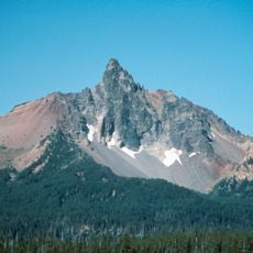
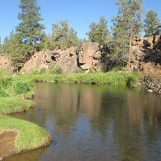
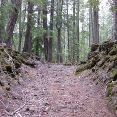
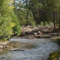
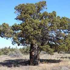
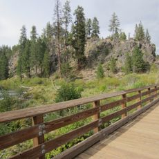
Camp Polk Meadow Preserve is a protected area near Sisters, Oregon, with open grasslands cut through by Whychus Creek. The site supports diverse plant and animal life within its natural meadow landscape.

The site began as a military installation in 1865 with soldiers stationed there to protect travelers on regional routes. It served as an important outpost during the era of westward movement and settlement.

The land shows traces of Native American presence and early European settlement through structures and features visible across the grounds. These remnants reflect how different peoples have lived on and shaped this area over time.

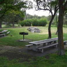
The area is accessible via marked trails, with parking available near the historic Hindman barn entrance. Walking paths make it easy to move through the grounds and see different parts of the preserve.

The Hindman barn, still standing on the original grounds, is one of the oldest known structures in Deschutes County. This building provides a window into early settlement architecture and serves as a landmark while exploring the site.

The community of curious travelers

AroundUs brings together thousands of curated places, local tips, and hidden gems, enriched daily by 60,000 contributors worldwide.

Start exploring
Location
GPS coordinates
44.31890,-121.51400
Latest update
December 14, 2025 13:03
Around this place
Black Butte
United States of America

Black Butte

13.3 km
Mount Washington
United States of America

Mount Washington

25.9 km
Petersen Rock Garden
United States of America

Petersen Rock Garden

23.9 km
Tumalo State Park
United States of America

Tumalo State Park

25.8 km
Belknap Crater
United States of America

Belknap Crater

26.5 km
Cline Falls State Scenic Viewpoint
United States of America

Cline Falls State Scenic Viewpoint

21.3 km
Oregon Route 242
United States of America

Oregon Route 242

27 km
Crooked River High Bridge
United States of America

Crooked River High Bridge

26.7 km
Blue Lake Crater
United States of America

Blue Lake Crater

23.1 km
Peter Skene Ogden State Scenic Viewpoint
United States of America

Peter Skene Ogden State Scenic Viewpoint

26.7 km
Elliott Corbett Memorial State Recreation Site
United States of America

Elliott Corbett Memorial State Recreation Site

23.1 km
Mount Washington Wilderness
United States of America

Mount Washington Wilderness

25.9 km
Crooked River Railroad Bridge
United States of America

Crooked River Railroad Bridge

26.6 km
Crooked River Gorge
United States of America

Crooked River Gorge

25 km
Santiam Wagon Road
United States of America

Santiam Wagon Road

28.9 km
Sisters State Park
United States of America

Sisters State Park

4 km
Skylight Cave
United States of America

Skylight Cave

16.4 km
Rex T. Barber Veterans Memorial Bridge
United States of America

Rex T. Barber Veterans Memorial Bridge

26.9 km
Black Crater
United States of America

Black Crater

19.6 km
Redmond–Bend Juniper State Scenic Corridor
United States of America

Redmond–Bend Juniper State Scenic Corridor

26.4 km
Milton Odem House
United States of America

Milton Odem House

27.1 km
New Redmond Hotel
United States of America

New Redmond Hotel

27.5 km
First Presbyterian Church of Redmond
United States of America

First Presbyterian Church of Redmond

27.5 km
Sisters High School
United States of America

Sisters High School

3.9 km
Rock O' the Range Bridge
United States of America

Rock O' the Range Bridge

28.4 km
Camp Sherman Community Hall
United States of America

Camp Sherman Community Hall

18 km
Collier Glacier
United States of America

Collier Glacier

27.6 km
Deschutes River Trail
United States of America

Deschutes River Trail

29.2 km
Show the full map
Reviews
Share your experience

No review yet

Discussions
Start a discussion...

No discussion yet

« Camp Polk - Protected area near Sisters, Oregon, United States » is provided by Around Us (aroundus.com). Images and texts are derived from Wikimedia project under a Creative Commons license. You are allowed to copy, distribute, and modify copies of this page, under the conditions set by the license, as long as this note is clearly visible.

Discover hidden gems everywhere you go!

From secret cafés to breathtaking viewpoints, skip the crowded tourist spots and find places that match your style. Our app makes it easy with voice search, smart filtering, route optimization, and insider tips from travelers worldwide. Download now for the complete mobile experience.

Around Us App Screenshot

A unique approach to discovering new places

Le Figaro

All the places worth exploring

France Info

A tailor-made excursion in just a few clicks

20 Minutes

Around Us
Travel Guide & Maps
Download

Send to your phone

QR Code
1

Open the camera app on your mobile.

2

Point at the QR code with your camera. A notification will appear.

3

Tap the notification to open the link.