Chest opened
+${chestReward.xp} XP
Explorer
NOUVEAU ×${chestReward.collectible.quantity}
tapez pour fermer
Chest locked

Open chests in the app

Around Us is built for your phone — chests unlock when you walk, explore and capture nearby places.

Enable Location

We need your location to show you interesting places around you

Discover nearby places

Find interesting locations and hidden gems around you

Precise directions

Get accurate directions and distances to places

Your location is never shared with other users. It's only used when you tap the location button.

Owens Lake

Log in to your account

Start exploring — it's free

Trusted by 72,889 travelers worldwide

Continue with Google
Continue with Apple
or

We will send you a code to connect

By continuing, you accept our Terms and Conditions and our Privacy Policy

Check your inbox

We've sent a pincode in your inbox. Please enter the code below.

Owens Lake
Discussion Reviews 2 Photos
70.2k Popularity

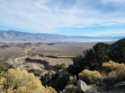
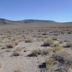
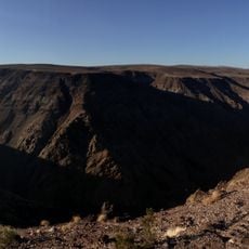
Owens Lake, Salt pan in Owens Valley, California, US

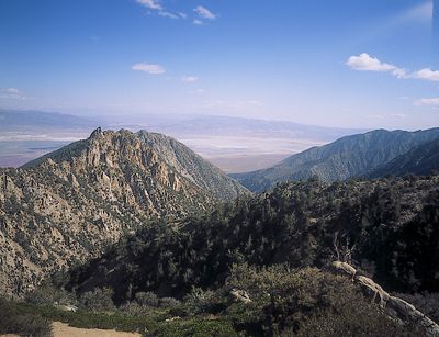
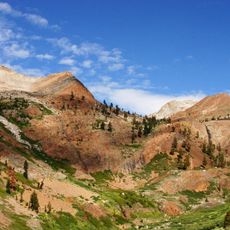
Owens Lake is a dry salt basin in Owens Valley between the Sierra Nevada and the Inyo Mountains in California. The surface covers roughly 108 square miles and sits at an elevation of about 3,550 feet (1,084 m).

The basin held water until 1913, when Los Angeles diverted the Owens River into an aqueduct and sent the water south. The draining triggered decades of conflict with farmers and ranchers and turned the region into a source of dust storms.

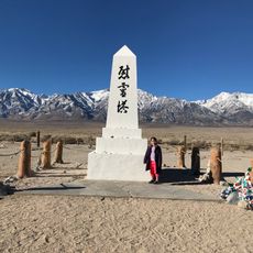
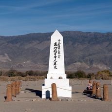
The Paiute called this place Pagoasa and harvested kutsavi, the pupae of alkali flies, drying them as a protein-rich food source for centuries. Today, occasional interpretive signs along access roads recall this tradition and the era when water still filled the basin.

The salt flat is best accessed in dry weather and may be partly flooded after rain or snowmelt. Visitors should bring drinking water, as there are no supply points in the area.

Halobacteria thrive in parts of the salt basin and tint the ground red or pink in places. These microorganisms survive in extreme salt concentration and create an unusual color pattern visible from the roadside.

The community of curious travelers

AroundUs brings together thousands of curated places, local tips, and hidden gems, enriched daily by 60,000 contributors worldwide.

Start exploring
Location
Elevation above the sea
1,084 m
GPS coordinates
36.43327,-117.95092
Latest update
December 13, 2025 17:47
Around this place
Cerro Gordo Mines
United States of America

Cerro Gordo Mines

18.2 km
Mount Whitney Trail
United States of America

Mount Whitney Trail

31.8 km
Mount Langley
United States of America

Mount Langley

27.7 km
Saline Valley salt tram
United States of America

Saline Valley salt tram

21.3 km
Smithsonian Institution Shelter
United States of America

Smithsonian Institution Shelter

34.6 km
Golden Trout Wilderness
United States of America

Golden Trout Wilderness

34.4 km
Mount Muir
United States of America

Mount Muir

33.8 km
Mount Russell
United States of America

Mount Russell

35.1 km
Darwin Falls Wilderness
United States of America

Darwin Falls Wilderness

33 km
Manzanar Children's Village
United States of America

Manzanar Children's Village

37.4 km
Olancha Peak
United States of America

Olancha Peak

23.9 km
Jordan Hot Springs
United States of America

Jordan Hot Springs

38.9 km
Sequoia-Kings Canyon
United States of America

Sequoia-Kings Canyon

31.3 km
Mount Mallory
United States of America

Mount Mallory

30.7 km
Mount LeConte
United States of America

Mount LeConte

29.4 km
Manzanar National Historic Site
United States of America

Manzanar National Historic Site

37.4 km
Mount McAdie
United States of America

Mount McAdie

32 km
Golden Trout Creek volcanic field
United States of America

Golden Trout Creek volcanic field

34.1 km
United States of America

Mount Irvine

31.1 km
Manzanar National Historic Site
United States of America

Manzanar National Historic Site

37.2 km
Museum of Western Film History
United States of America

Museum of Western Film History

21.1 km
Mount Guyot
United States of America

Mount Guyot

37.8 km
Lone Pine Film History Museum
United States of America

Lone Pine Film History Museum

21.1 km
Father Crowley Viewpoint
United States of America

Father Crowley Viewpoint

37.7 km
Eye of Alabama
United States of America

Eye of Alabama

25.2 km
Manzanar Visitor Center
United States of America

Manzanar Visitor Center

37.2 km
Soul Consoling Tower
United States of America

Soul Consoling Tower

37.6 km
Boot Arch
United States of America

Boot Arch

27.5 km
Show the full map
Reviews
Share your experience

No review yet

Discussions
Start a discussion...

No discussion yet

« Owens Lake - Salt pan in Owens Valley, California, US » is provided by Around Us (aroundus.com). Images and texts are derived from Wikimedia project under a Creative Commons license. You are allowed to copy, distribute, and modify copies of this page, under the conditions set by the license, as long as this note is clearly visible.

Discover hidden gems everywhere you go!

From secret cafés to breathtaking viewpoints, skip the crowded tourist spots and find places that match your style. Our app makes it easy with voice search, smart filtering, route optimization, and insider tips from travelers worldwide. Download now for the complete mobile experience.

Around Us App Screenshot

A unique approach to discovering new places

Le Figaro

All the places worth exploring

France Info

A tailor-made excursion in just a few clicks

20 Minutes

Around Us
Travel Guide & Maps
Download

Send to your phone

QR Code
1

Open the camera app on your mobile.

2

Point at the QR code with your camera. A notification will appear.

3

Tap the notification to open the link.