Chest opened
+${chestReward.xp} XP
Explorer
NOUVEAU ×${chestReward.collectible.quantity}
tapez pour fermer

See the monuments around you in AR Open chests in the app

Around Us is built for your phone — point your camera at the streets and discover the monuments and places around you in augmented reality. Around Us is built for your phone — chests unlock when you walk, explore and capture nearby places.

•

Enable Location

We need your location to show you interesting places around you

Discover nearby places

Find interesting locations and hidden gems around you

Precise directions

Get accurate directions and distances to places

Your location is never shared with other users. It's only used when you tap the location button.

Mount LeConte

Log in to your account

Start exploring — it's free

Trusted by 93,262 travelers worldwide

Continue with Google
Continue with Apple
or

We will send you a code to connect

By continuing, you accept our Terms and Conditions and our Privacy Policy

Check your inbox

We've sent a pincode in your inbox. Please enter the code below.

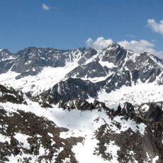
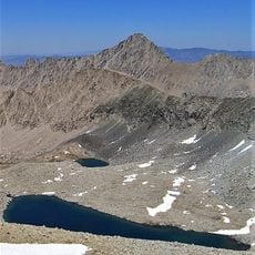
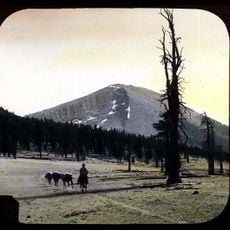
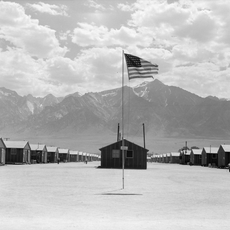
Mount LeConte, Mountain summit in Inyo County, California.

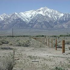
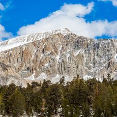
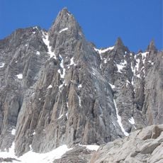
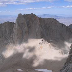
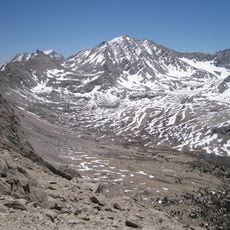
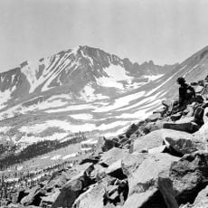
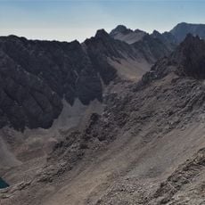
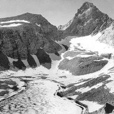
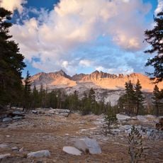
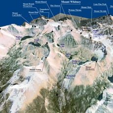
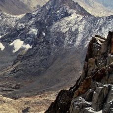
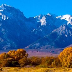
Mount LeConte is a mountain summit in the Sierra Nevada reaching 13,930 feet (4,250 meters). The peak displays steep ridges and granite rock formations typical of this high alpine terrain.

The peak took its name during geological surveys in the late 1800s as part of mapping expeditions through the Sierra Nevada. These surveys were part of broader efforts to document California's mountain regions.

The mountain carries the name of Joseph Le Conte, the first professor of geology and natural history at the University of California, given in 1895. Its crest also marks the county line between Inyo and Tulare counties, so a climber standing on the summit is on the boundary itself.

The mountain can be reached via several climbing routes from the eastern side, though each requires technical climbing skills and high-altitude experience. Weather can change rapidly at this elevation, so proper preparation is important.

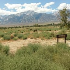
The Sierra crest along Mount LeConte forms the county line between Inyo and Tulare counties, so a climber standing on the summit can straddle two counties at once. The southwest slope drains to Rock Creek and the Kern River, while the north side feeds Meysan Creek and the east side Tuttle Creek, ending in Diaz Lake.

The community of curious travelers

AroundUs brings together thousands of curated places, local tips, and hidden gems, enriched daily by 93,262 contributors worldwide.

Start exploring
Location
Location
Location
Part of
Sierra Peaks Section Peaks List, Vagmarken Club Sierra Crest List
GPS coordinates
36.54030,-118.25134
Latest update
October 28, 2026 20:44
Reviews
Share your experience

No review yet

Discussions
Start a discussion...

No discussion yet

« Mount LeConte - Mountain summit in Inyo County, California » is provided by Around Us (aroundus.com). Images and texts are derived from Wikimedia project under a Creative Commons license. You are allowed to copy, distribute, and modify copies of this page, under the conditions set by the license, as long as this note is clearly visible.

Discover hidden gems everywhere you go!

From secret cafés to breathtaking viewpoints, skip the crowded tourist spots and find places that match your style. Our app makes it easy with voice search, smart filtering, route optimization, and insider tips from travelers worldwide. Download now for the complete mobile experience.
Around Us App Screenshot
❝

A unique approach to discovering new places❞

— Le Figaro

❝

All the places worth exploring❞

— France Info

❝

A tailor-made excursion in just a few clicks❞

— 20 Minutes

Around Us
Travel Guide & Maps
Download

Send to your phone

QR Code
1

Open the camera app on your mobile.

2

Point at the QR code with your camera. A notification will appear.

3

Tap the notification to open the link.