·

Enable Location

We need your location to show you interesting places around you

Discover nearby places

Find interesting locations and hidden gems around you

Precise directions

Get accurate directions and distances to places

Your location is never shared with other users. It's only used when you tap the location button.

Mount McAdie

Log in to your account

Start exploring — it's free

Trusted by 62,650 travelers worldwide

Continue with Google
Continue with Apple
or

We will send you a code to connect

By continuing, you accept our Terms and Conditions and our Privacy Policy

Check your inbox

We've sent a pincode in your inbox. Please enter the code below.

Mount McAdie

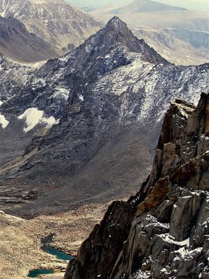
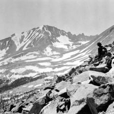
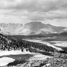
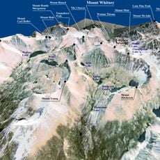
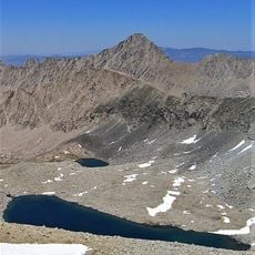
Mount McAdie, Mountain summit in Sierra Nevada, California, United States

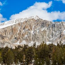
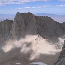
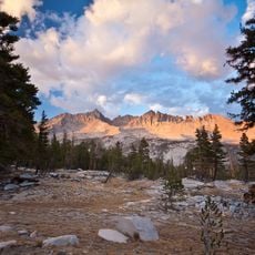
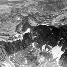
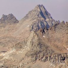
Mount McAdie is a summit in the Sierra Nevada featuring three distinct peaks along the main crest, with the northern peak reaching about 13,805 feet (4,206 meters). The mountain's multiple summits create a complex ridge structure that dominates this section of the range.

The mountain was named in 1905 by James E. Church to honor Alexander G. McAdie, a meteorologist with the U.S. Weather Bureau in San Francisco. This naming reflects the early 1900s practice of dedicating mountain peaks to scientists who studied weather and climate.

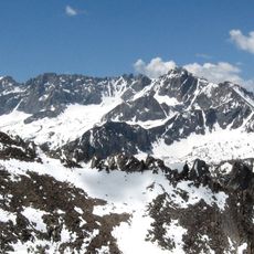
The mountain marks the boundary between Sequoia National Park and John Muir Wilderness, showing how different protected areas divide the landscape. Visitors standing here can see how the management and character of the two zones differ from this vantage point.

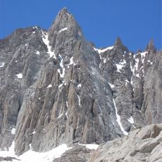
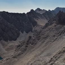
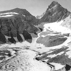
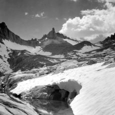
The standard climbing route accesses the summit through Arc Pass and requires rock scrambling at class 3 difficulty with careful movement between the separate peaks. Expect the terrain to be steep and exposed in sections, so solid footing and balance are essential throughout the approach.

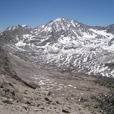
The mountain stands at the junction of Inyo and Tulare counties, creating an unusual administrative boundary line across the high country. From here visitors can spot Mount Whitney, one of the highest peaks in the contiguous United States, which rises nearby and is visible on clear days.

The community of curious travelers

AroundUs brings together thousands of curated places, local tips, and hidden gems, enriched daily by 60,000 contributors worldwide.

Start exploring
Location
Location
Location
Part of
Sierra Peaks Section Peaks List, Vagmarken Club Sierra Crest List
GPS coordinates
36.55179,-118.27629
Latest update
December 14, 2025 18:00
« Mount McAdie - Mountain summit in Sierra Nevada, California, United States » is provided by Around Us (aroundus.com). Images and texts are derived from Wikimedia project under a Creative Commons license. You are allowed to copy, distribute, and modify copies of this page, under the conditions set by the license, as long as this note is clearly visible.

Discover hidden gems everywhere you go!

From secret cafés to breathtaking viewpoints, skip the crowded tourist spots and find places that match your style. Our app makes it easy with voice search, smart filtering, route optimization, and insider tips from travelers worldwide. Download now for the complete mobile experience.

Around Us App Screenshot

A unique approach to discovering new places

Le Figaro

All the places worth exploring

France Info

A tailor-made excursion in just a few clicks

20 Minutes

Around Us
Travel Guide & Maps
Download

Send to your phone

QR Code
1

Open the camera app on your mobile.

2

Point at the QR code with your camera. A notification will appear.

3

Tap the notification to open the link.