Chest opened
+${chestReward.xp} XP
Explorer
NOUVEAU ×${chestReward.collectible.quantity}
tapez pour fermer
Chest locked

Open chests in the app

Around Us is built for your phone — chests unlock when you walk, explore and capture nearby places.

Enable Location

We need your location to show you interesting places around you

Discover nearby places

Find interesting locations and hidden gems around you

Precise directions

Get accurate directions and distances to places

Your location is never shared with other users. It's only used when you tap the location button.

Summerlin South

Log in to your account

Start exploring — it's free

Trusted by 72,887 travelers worldwide

Continue with Google
Continue with Apple
or

We will send you a code to connect

By continuing, you accept our Terms and Conditions and our Privacy Policy

Check your inbox

We've sent a pincode in your inbox. Please enter the code below.

Discussion Reviews 1 Photos
14.1k Popularity

Summerlin South, Census-designated place in western Las Vegas Valley, United States

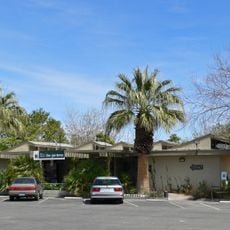
Summerlin South is a residential community in western Las Vegas Valley within Clark County. The area contains multiple neighborhoods with schools, shopping centers, and healthcare facilities serving the population.

The area began developing from land purchases in the 1950s and later took its name from a family connection to early Nevada business interests. This foundation led to the growth of residential communities.

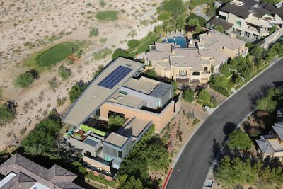
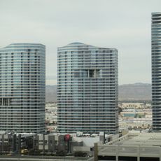
The population of 30,744 residents includes diverse households spread across multiple gated communities, with The Ridges being a notable residential section.

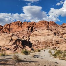
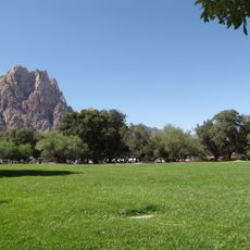
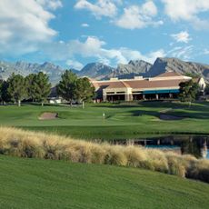
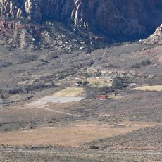
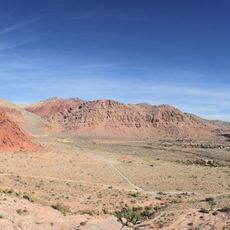
The area connects to the broader Las Vegas Valley through multiple transportation routes. Its location near Red Rock Canyon National Conservation Area provides easy access to outdoor recreation.

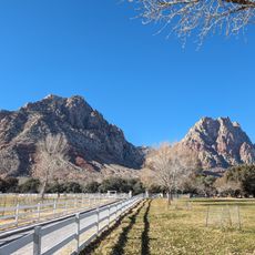
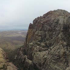
The area sits directly beside Red Rock Canyon with immediate access to hiking trails and natural landscapes. This is unusual because it remains simultaneously connected to major Las Vegas urban development.

The community of curious travelers

AroundUs brings together thousands of curated places, local tips, and hidden gems, enriched daily by 60,000 contributors worldwide.

Start exploring
Location
Elevation above the sea
585 m
Shares border with
Red Rock Canyon National Conservation Area
GPS coordinates
36.12639,-115.33278
Latest update
December 7, 2025 20:23
Around this place
Allegiant Stadium
United States of America

Allegiant Stadium

14 km
Vdara
United States of America

Vdara

14 km
Red Rock Canyon National Conservation Area
United States of America

Red Rock Canyon National Conservation Area

12.1 km
Bonnie Springs Ranch
United States of America

Bonnie Springs Ranch

13.2 km
Area15
United States of America

Area15

13.6 km
Wet'n'Wild Las Vegas
United States of America

Wet'n'Wild Las Vegas

8 km
Spring Mountain Ranch State Park
United States of America

Spring Mountain Ranch State Park

13 km
Springs Preserve
United States of America

Springs Preserve

13.7 km
Las Vegas Springs
United States of America

Las Vegas Springs

13.9 km
TPC at Summerlin
United States of America

TPC at Summerlin

7.7 km
Palms Place
United States of America

Palms Place

12.1 km
Arizona Charlie's Decatur
United States of America

Arizona Charlie's Decatur

12 km
Tivoli Village
United States of America

Tivoli Village

6.2 km
One Queensridge Place
United States of America

One Queensridge Place

5.6 km
The Martin
United States of America

The Martin

13.7 km
Nevada State Museum, Las Vegas
United States of America

Nevada State Museum, Las Vegas

13.8 km
The Gardens at the Las Vegas Springs Preserve
United States of America

The Gardens at the Las Vegas Springs Preserve

13.8 km
Sandstone Ranch
United States of America

Sandstone Ranch

13 km
Red Rock Lanes
United States of America

Red Rock Lanes

3.2 km
Hollywood Cars Museum
United States of America

Hollywood Cars Museum

14 km
Palms Casino Resort
United States of America

Palms Casino Resort

12.5 km
Siena Golf Club
United States of America

Siena Golf Club

2.8 km
Sonic drive in
United States of America

Sonic drive in

9.2 km
Siegfried & Roy's Secret Garden and Dolphin Habitat
United States of America

Siegfried & Roy's Secret Garden and Dolphin Habitat

14 km
Main Ranch House
United States of America

Main Ranch House

12.9 km
Faith Community Lutheran Church (Las Vegas)
United States of America

Faith Community Lutheran Church (Las Vegas)

612 m
Calico Basin
United States of America

Calico Basin

8.1 km
Juniper Canyon
United States of America

Juniper Canyon

13.9 km
Show the full map
Reviews
Share your experience

No review yet

Discussions
Start a discussion...

No discussion yet

« Summerlin South - Census-designated place in western Las Vegas Valley, United States » is provided by Around Us (aroundus.com). Images and texts are derived from Wikimedia project under a Creative Commons license. You are allowed to copy, distribute, and modify copies of this page, under the conditions set by the license, as long as this note is clearly visible.

Discover hidden gems everywhere you go!

From secret cafés to breathtaking viewpoints, skip the crowded tourist spots and find places that match your style. Our app makes it easy with voice search, smart filtering, route optimization, and insider tips from travelers worldwide. Download now for the complete mobile experience.

Around Us App Screenshot

A unique approach to discovering new places

Le Figaro

All the places worth exploring

France Info

A tailor-made excursion in just a few clicks

20 Minutes

Around Us
Travel Guide & Maps
Download

Send to your phone

QR Code
1

Open the camera app on your mobile.

2

Point at the QR code with your camera. A notification will appear.

3

Tap the notification to open the link.