Chest opened
+${chestReward.xp} XP
Explorer
NOUVEAU ×${chestReward.collectible.quantity}
tapez pour fermer
Chest locked

Open chests in the app

Around Us is built for your phone — chests unlock when you walk, explore and capture nearby places.

Enable Location

We need your location to show you interesting places around you

Discover nearby places

Find interesting locations and hidden gems around you

Precise directions

Get accurate directions and distances to places

Your location is never shared with other users. It's only used when you tap the location button.

Blue Diamond

Log in to your account

Start exploring — it's free

Trusted by 72,887 travelers worldwide

Continue with Google
Continue with Apple
or

We will send you a code to connect

By continuing, you accept our Terms and Conditions and our Privacy Policy

Check your inbox

We've sent a pincode in your inbox. Please enter the code below.

Discussion Reviews 1 Photos
16.2k Popularity

Blue Diamond, Census-designated place in Clark County, Nevada.

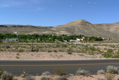
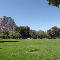
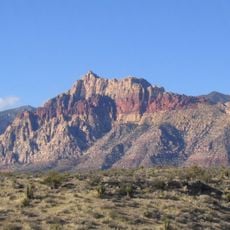
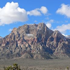
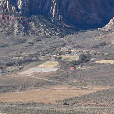
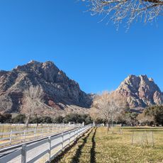
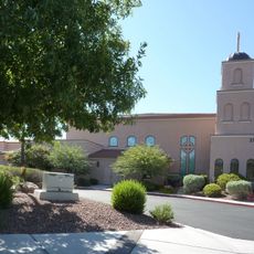
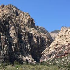
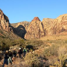
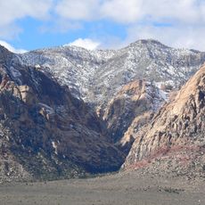
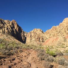
Blue Diamond is a small community in the Nevada desert west of Las Vegas. It consists of scattered homes, an elementary school, library, church, and a general store that serve the residents.

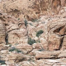
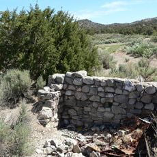
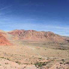
The site began as Cottonwood Spring, a watering place on the Old Spanish Trail. When the Blue Diamond Corporation started mining operations in 1923, it became the foundation for the permanent settlement.

The place takes its name from the mining company that shaped the settlement and its character. The community reflects this mining heritage through its layout and how residents connect to the land's industrial past.

The settlement is remote and accessible mainly by car, so plan accordingly if you are traveling from Las Vegas. Services are limited and designed for local residents rather than visitors, so it is best to prepare in advance.

One surprising feature is a private pool in this desert community, which is uncommon for such a remote location. The Blue Diamond Historical Society preserves photographs documenting the town's growth inside the 1942 mercantile building.

The community of curious travelers

AroundUs brings together thousands of curated places, local tips, and hidden gems, enriched daily by 60,000 contributors worldwide.

Start exploring
Location
Part of
Southern Nevada
GPS coordinates
36.04720,-115.40300
Latest update
December 7, 2025 19:27
Around this place
Allegiant Stadium
United States of America

Allegiant Stadium

20.4 km
Red Rock Canyon National Conservation Area
United States of America

Red Rock Canyon National Conservation Area

10.1 km
Michelob Ultra Arena
United States of America

Michelob Ultra Arena

20.7 km
Red Rock Canyon National Conservation Area
United States of America

Red Rock Canyon National Conservation Area

16.7 km
Bonnie Springs Ranch
United States of America

Bonnie Springs Ranch

4.8 km
Wet'n'Wild Las Vegas
United States of America

Wet'n'Wild Las Vegas

9.4 km
Spring Mountain Ranch State Park
United States of America

Spring Mountain Ranch State Park

5.5 km
TPC at Summerlin
United States of America

TPC at Summerlin

18.5 km
Palms Place
United States of America

Palms Place

19.8 km
Tivoli Village
United States of America

Tivoli Village

17 km
One Queensridge Place
United States of America

One Queensridge Place

16.5 km
Aztec Sandstone
United States of America

Aztec Sandstone

14.5 km
Potosi Mining District
United States of America

Potosi Mining District

15.1 km
Bridge Mountain
United States of America

Bridge Mountain

12.6 km
Mount Wilson
United States of America

Mount Wilson

8.9 km
Sandstone Ranch
United States of America

Sandstone Ranch

5.5 km
Hollywood Cars Museum
United States of America

Hollywood Cars Museum

20.6 km
Palms Casino Resort
United States of America

Palms Casino Resort

20.2 km
Magical Forest
United States of America

Magical Forest

19.3 km
Carroll Shelby Museum
United States of America

Carroll Shelby Museum

20.3 km
Siena Golf Club
United States of America

Siena Golf Club

9.7 km
Main Ranch House
United States of America

Main Ranch House

5.5 km
Faith Community Lutheran Church (Las Vegas)
United States of America

Faith Community Lutheran Church (Las Vegas)

11.2 km
Calico Basin
United States of America

Calico Basin

11.2 km
Icebox Canyon
United States of America

Icebox Canyon

13.6 km
Pine Creek Canyon
United States of America

Pine Creek Canyon

11.2 km
Oak Creek Canyon
United States of America

Oak Creek Canyon

9.9 km
Black Velvet Canyon
United States of America

Black Velvet Canyon

4.4 km
Show the full map
Reviews
Share your experience

No review yet

Discussions
Start a discussion...

No discussion yet

« Blue Diamond - Census-designated place in Clark County, Nevada » is provided by Around Us (aroundus.com). Images and texts are derived from Wikimedia project under a Creative Commons license. You are allowed to copy, distribute, and modify copies of this page, under the conditions set by the license, as long as this note is clearly visible.

Discover hidden gems everywhere you go!

From secret cafés to breathtaking viewpoints, skip the crowded tourist spots and find places that match your style. Our app makes it easy with voice search, smart filtering, route optimization, and insider tips from travelers worldwide. Download now for the complete mobile experience.

Around Us App Screenshot

A unique approach to discovering new places

Le Figaro

All the places worth exploring

France Info

A tailor-made excursion in just a few clicks

20 Minutes

Around Us
Travel Guide & Maps
Download

Send to your phone

QR Code
1

Open the camera app on your mobile.

2

Point at the QR code with your camera. A notification will appear.

3

Tap the notification to open the link.