Chest opened
+${chestReward.xp} XP
Explorer
NOUVEAU ×${chestReward.collectible.quantity}
tapez pour fermer
Chest locked

Open chests in the app

Around Us is built for your phone — chests unlock when you walk, explore and capture nearby places.

Enable Location

We need your location to show you interesting places around you

Discover nearby places

Find interesting locations and hidden gems around you

Precise directions

Get accurate directions and distances to places

Your location is never shared with other users. It's only used when you tap the location button.

Sedona Airport

Log in to your account

Start exploring — it's free

Trusted by 72,994 travelers worldwide

Continue with Google
Continue with Apple
or

We will send you a code to connect

By continuing, you accept our Terms and Conditions and our Privacy Policy

Check your inbox

We've sent a pincode in your inbox. Please enter the code below.

Sedona Airport
Discussion Reviews 1 Photos
16.8k Popularity

Sedona Airport, airport in Arizona

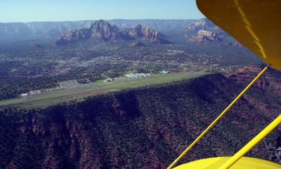
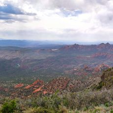
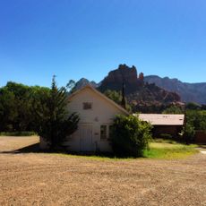
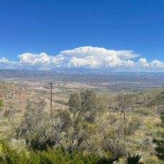
Sedona Airport is a small aerodrome perched on a high mesa above the city of Sedona. Its runway sits on an elevated plateau with clear views of the surrounding red rock landscape, accommodating small private aircraft and charter flights.

The aerodrome opened in 1955 and originally served private pilots and tourists exploring the region. An unpaved landing strip was replaced with a paved runway in 1957, making operations safer and more reliable.

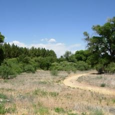
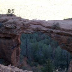
The airport reflects a respect for nature and personal space. Visitors arriving here are typically interested in outdoor activities, photography, and relaxation. The quiet surroundings foster a sense of connection to the landscape.

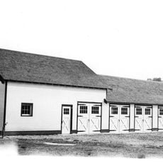
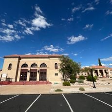
The aerodrome has limited facilities with fuel services, parking, and hangar space for small aircraft. Plan ahead to arrange private flights, and note that the terminal is modest but the road access from town is straightforward.

The aerodrome sits on a mesa with a distinctly narrow runway, which experienced pilots consider one of the most challenging landings in the country. The elevated position makes every approach visually memorable, with red rocks framing the landing path.

The community of curious travelers

AroundUs brings together thousands of curated places, local tips, and hidden gems, enriched daily by 60,000 contributors worldwide.

Start exploring
Location
Sedona City Limit
Operator
City of Sedona
Phone
GPS coordinates
34.84820,-111.79063
Latest update
February 17, 2026 01:40
Around this place
Oak Creek Canyon
United States of America

Oak Creek Canyon

9.2 km
Cathedral Rock
United States of America

Cathedral Rock

3.1 km
Slide Rock State Park
United States of America

Slide Rock State Park

9.2 km
Jerome Grand Hotel
United States of America

Jerome Grand Hotel

31.2 km
Red Rock State Park
United States of America

Red Rock State Park

5.1 km
Tuzigoot National Monument
United States of America

Tuzigoot National Monument

23.2 km
Bell Rock
United States of America

Bell Rock

5.8 km
Red Rock-Secret Mountain Wilderness
United States of America

Red Rock-Secret Mountain Wilderness

14.4 km
Dead Horse Ranch State Park
United States of America

Dead Horse Ranch State Park

22.9 km
Out of Africa Wildlife Park
United States of America

Out of Africa Wildlife Park

29 km
Jerome State Historic Park
United States of America

Jerome State Historic Park

31.1 km
Courthouse Butte
United States of America

Courthouse Butte

6.1 km
V-Bar-V Heritage Site
United States of America

V-Bar-V Heritage Site

21.8 km
Jerome Historic District
United States of America

Jerome Historic District

31.2 km
Sycamore Canyon Wilderness
United States of America

Sycamore Canyon Wilderness

23.8 km
Beaver Creek Ranger Station
United States of America

Beaver Creek Ranger Station

20.8 km
Sedona Ranger Station
United States of America

Sedona Ranger Station

2.8 km
Clarkdale Historic District
United States of America

Clarkdale Historic District

25.8 km
Jerome State Historical Mine Park Museum
United States of America

Jerome State Historical Mine Park Museum

31.1 km
Master Mechanic's House
United States of America

Master Mechanic's House

25 km
Willard House
United States of America

Willard House

24.3 km
Sedona Heritage Museum
United States of America

Sedona Heritage Museum

4.2 km
Tuzigoot Museum
United States of America

Tuzigoot Museum

23.2 km
Devil's Bridge, Sedona
United States of America

Devil's Bridge, Sedona

5.8 km
Clark Memorial Clubhouse
United States of America

Clark Memorial Clubhouse

25.7 km
Midgley Bridge
United States of America

Midgley Bridge

6 km
Douglas Mansion
United States of America

Douglas Mansion

31.1 km
Apache Maid Lookout
United States of America

Apache Maid Lookout

25.9 km
Show the full map
Reviews
Share your experience

No review yet

Discussions
Start a discussion...

No discussion yet

« Sedona Airport - airport in Arizona » is provided by Around Us (aroundus.com). Images and texts are derived from Wikimedia project under a Creative Commons license. You are allowed to copy, distribute, and modify copies of this page, under the conditions set by the license, as long as this note is clearly visible.

Discover hidden gems everywhere you go!

From secret cafés to breathtaking viewpoints, skip the crowded tourist spots and find places that match your style. Our app makes it easy with voice search, smart filtering, route optimization, and insider tips from travelers worldwide. Download now for the complete mobile experience.

Around Us App Screenshot

A unique approach to discovering new places

Le Figaro

All the places worth exploring

France Info

A tailor-made excursion in just a few clicks

20 Minutes

Around Us
Travel Guide & Maps
Download

Send to your phone

QR Code
1

Open the camera app on your mobile.

2

Point at the QR code with your camera. A notification will appear.

3

Tap the notification to open the link.