Chest opened
+${chestReward.xp} XP
Explorer
NOUVEAU ×${chestReward.collectible.quantity}
tapez pour fermer
Chest locked

Open chests in the app

Around Us is built for your phone — chests unlock when you walk, explore and capture nearby places.

Enable Location

We need your location to show you interesting places around you

Discover nearby places

Find interesting locations and hidden gems around you

Precise directions

Get accurate directions and distances to places

Your location is never shared with other users. It's only used when you tap the location button.

Log in to your account

Start exploring — it's free

Trusted by 72,884 travelers worldwide

Continue with Google
Continue with Apple
or

We will send you a code to connect

By continuing, you accept our Terms and Conditions and our Privacy Policy

Check your inbox

We've sent a pincode in your inbox. Please enter the code below.

Arizona Strip
Discussion Reviews Photo
22.5k Popularity

Arizona Strip, Remote territory in northern Arizona, United States.

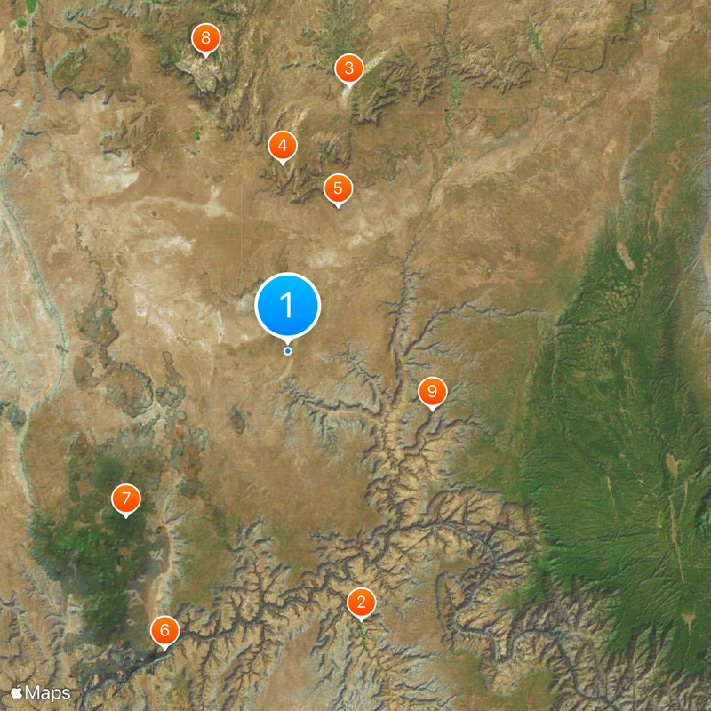
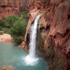
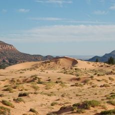
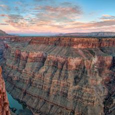
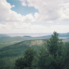
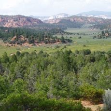
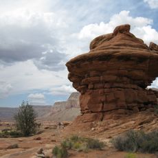
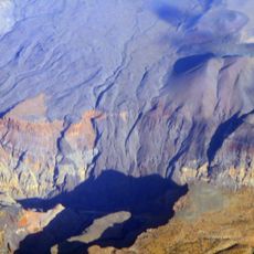
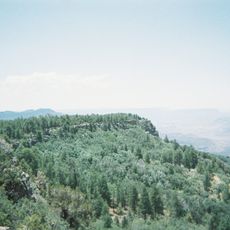
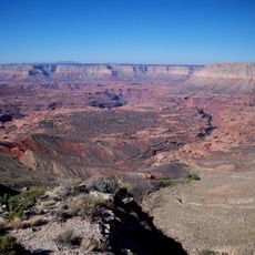
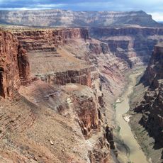
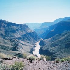
The Arizona Strip is a sparsely populated territory in northern Arizona that stretches between the Colorado River and the Utah state boundary. It features red-rock canyons, desert plains, and sagebrush landscapes typical of the high desert environment.

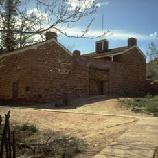
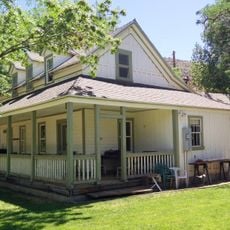
Mormon pioneers led by Jacob Hamblin established the first European settlements here in the mid-1800s and developed ranching operations. This early settlement pattern shaped the sparse population that remains throughout the region today.

Native American communities, particularly the Paiute and Navajo, have deep roots in this territory and continue their way of life here today. You can sense this presence as you travel through the region, especially near areas designated for tribal use.

Only three major roads cross this territory: Interstate 15, State Route 89A, and State Route 389, so plan your route ahead of time. Services like gas, food, and lodging are spread far apart, so prepare accordingly before heading out.

This vast area supports fewer than 10,000 residents, making it one of the least populated regions in the lower 48 states. This extreme remoteness keeps the landscape in a relatively untouched state that few visitors ever experience.

The community of curious travelers

AroundUs brings together thousands of curated places, local tips, and hidden gems, enriched daily by 60,000 contributors worldwide.

Start exploring
Location
GPS coordinates
36.65000,-112.83333
Latest update
December 20, 2025 16:01
Around this place
Havasu Falls
United States of America

Havasu Falls

45.6 km
Coral Pink Sand Dunes State Park
United States of America

Coral Pink Sand Dunes State Park

44.3 km
Vermilion Cliffs
United States of America

Vermilion Cliffs

30.7 km
Pipe Spring National Monument
United States of America

Pipe Spring National Monument

25.1 km
Toroweap Overlook
United States of America

Toroweap Overlook

52.5 km
Mount Trumbull Wilderness
United States of America

Mount Trumbull Wilderness

37.7 km
Canaan Mountain Wilderness
United States of America

Canaan Mountain Wilderness

49.9 km
Kanab Creek Wilderness
United States of America

Kanab Creek Wilderness

25.4 km
Lava Falls Trail
United States of America

Lava Falls Trail

53.1 km
Mount Logan Wilderness
United States of America

Mount Logan Wilderness

49.7 km
Big House
United States of America

Big House

29.7 km
Kanab Creek Trail
United States of America

Kanab Creek Trail

34 km
Tuckup Trail
United States of America

Tuckup Trail

50 km
North Bass Trail
United States of America

North Bass Trail

55.8 km
Jacob Lake Lookout Tower
United States of America

Jacob Lake Lookout Tower

55.6 km
Parry Lodge
United States of America

Parry Lodge

52.1 km
Kanab Lodge
United States of America

Kanab Lodge

51.7 km
Big Springs Lookout Tower
United States of America

Big Springs Lookout Tower

45 km
Brow Monument and Brow Monument Trail
United States of America

Brow Monument and Brow Monument Trail

39.4 km
Jacob Lake Ranger Station
United States of America

Jacob Lake Ranger Station

54.4 km
Big Springs Ranger Station
United States of America

Big Springs Ranger Station

43.5 km
Rider-Pugh House
United States of America

Rider-Pugh House

51.9 km
Bowman-Chamberlain House
United States of America

Bowman-Chamberlain House

51.9 km
Chuckwagon Cookout
United States of America

Chuckwagon Cookout

51.7 km
William Derby Johnson, Jr., House
United States of America

William Derby Johnson, Jr., House

51.9 km
Stewart-Woolley House
United States of America

Stewart-Woolley House

52.1 km
Dry Park Lookout
United States of America

Dry Park Lookout

57.5 km
Pipe Spring National Monument Visitor Center
United States of America

Pipe Spring National Monument Visitor Center

25.2 km
Show the full map
Reviews
Share your experience

No review yet

Discussions
Start a discussion...

No discussion yet

« Arizona Strip - Remote territory in northern Arizona, United States » is provided by Around Us (aroundus.com). Images and texts are derived from Wikimedia project under a Creative Commons license. You are allowed to copy, distribute, and modify copies of this page, under the conditions set by the license, as long as this note is clearly visible.

Discover hidden gems everywhere you go!

From secret cafés to breathtaking viewpoints, skip the crowded tourist spots and find places that match your style. Our app makes it easy with voice search, smart filtering, route optimization, and insider tips from travelers worldwide. Download now for the complete mobile experience.

Around Us App Screenshot

A unique approach to discovering new places

Le Figaro

All the places worth exploring

France Info

A tailor-made excursion in just a few clicks

20 Minutes

Around Us
Travel Guide & Maps
Download

Send to your phone

QR Code
1

Open the camera app on your mobile.

2

Point at the QR code with your camera. A notification will appear.

3

Tap the notification to open the link.