Chest opened
+${chestReward.xp} XP
Explorer
NOUVEAU ×${chestReward.collectible.quantity}
tapez pour fermer
Chest locked

Open chests in the app

Around Us is built for your phone — chests unlock when you walk, explore and capture nearby places.

Enable Location

We need your location to show you interesting places around you

Discover nearby places

Find interesting locations and hidden gems around you

Precise directions

Get accurate directions and distances to places

Your location is never shared with other users. It's only used when you tap the location button.

Naval Air Station Fallon

Log in to your account

Start exploring — it's free

Trusted by 73,052 travelers worldwide

Continue with Google
Continue with Apple
or

We will send you a code to connect

By continuing, you accept our Terms and Conditions and our Privacy Policy

Check your inbox

We've sent a pincode in your inbox. Please enter the code below.

Naval Air Station Fallon
Discussion Reviews 1 Photos
55.4k Popularity

Naval Air Station Fallon, Military training facility in Churchill County, United States

Naval Air Station Fallon is a military aerodrome in Churchill County, Nevada, used for training fighter pilots and air combat crews. The facility features a runway longer than 14,000 feet (4,300 meters) and supports operations across several weapon training zones.

The airfield started as an Army Air Corps station during the 1940s and later transferred to the Navy for use as a training center. Over the following decades, the site grew into one of the primary locations for tactical air operations instruction.

The installation supports 3,000 personnel through military exercises, integrating carrier air wings into realistic battle scenarios throughout the year.

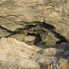
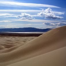
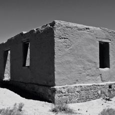
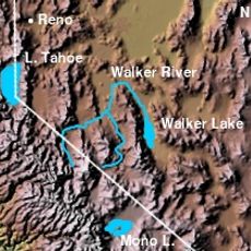
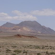
The installation sits about 60 miles (100 kilometers) east of Reno in a remote area with ample airspace for training flights. Civilian access is not permitted, as the site remains dedicated to military operations.

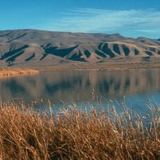
The region surrounding the base enjoys more than 300 days a year with clear skies, allowing for intensive use of the training ranges. The practice areas cover nearly 240,000 acres (97,000 hectares) of Nevada desert terrain.

The community of curious travelers

AroundUs brings together thousands of curated places, local tips, and hidden gems, enriched daily by 60,000 contributors worldwide.

Start exploring
Location
Elevation above the sea
1,199 m
GPS coordinates
39.42500,-118.70300
Latest update
December 14, 2025 17:22
Around this place
Lovelock Cave
United States of America

Lovelock Cave

61.1 km
Sand Mountain
United States of America

Sand Mountain

29.3 km
Fort Churchill State Historic Park
United States of America

Fort Churchill State Historic Park

51 km
Walker River
United States of America

Walker River

42.4 km
Lahontan State Recreation Area
United States of America

Lahontan State Recreation Area

35 km
Humboldt Cave
United States of America

Humboldt Cave

50.9 km
Stillwater National Wildlife Refuge
United States of America

Stillwater National Wildlife Refuge

29.8 km
Walker Lake State Recreation Area
United States of America

Walker Lake State Recreation Area

81.7 km
Fallon National Wildlife Refuge
United States of America

Fallon National Wildlife Refuge

37.2 km
Dini's Lucky Club
United States of America

Dini's Lucky Club

62.8 km
Cold Springs Pony Express Station Ruins
United States of America

Cold Springs Pony Express Station Ruins

73.1 km
Lyon County Courthouse
United States of America

Lyon County Courthouse

62.9 km
Salmon Creek Railroad
United States of America

Salmon Creek Railroad

10.7 km
Pershing County Courthouse
United States of America

Pershing County Courthouse

81.8 km
St. Paul's Episcopal Church
United States of America

St. Paul's Episcopal Church

82.3 km
Cold Springs Station Site
United States of America

Cold Springs Station Site

73.2 km
Oats Park Grammar School
United States of America

Oats Park Grammar School

7.7 km
Harmon School
United States of America

Harmon School

7.4 km
Holy Trinity Episcopal Church
United States of America

Holy Trinity Episcopal Church

8 km
Churchill County Courthouse
United States of America

Churchill County Courthouse

8.7 km
Fallon City Hall
United States of America

Fallon City Hall

8.4 km
Wadsworth Union Church
United States of America

Wadsworth Union Church

55.1 km
Robert L. Douglass House
United States of America

Robert L. Douglass House

8.3 km
The Cottage Schools
United States of America

The Cottage Schools

8 km
Parish House
United States of America

Parish House

82.3 km
Topog Peak
United States of America

Topog Peak

51.6 km
Ragged Top Mountain
United States of America

Ragged Top Mountain

69.1 km
Maine Street Historic District
United States of America

Maine Street Historic District

8.3 km
Show the full map
Reviews
Share your experience

No review yet

Discussions
Start a discussion...

No discussion yet

« Naval Air Station Fallon - Military training facility in Churchill County, United States » is provided by Around Us (aroundus.com). Images and texts are derived from Wikimedia project under a Creative Commons license. You are allowed to copy, distribute, and modify copies of this page, under the conditions set by the license, as long as this note is clearly visible.

Discover hidden gems everywhere you go!

From secret cafés to breathtaking viewpoints, skip the crowded tourist spots and find places that match your style. Our app makes it easy with voice search, smart filtering, route optimization, and insider tips from travelers worldwide. Download now for the complete mobile experience.

Around Us App Screenshot

A unique approach to discovering new places

Le Figaro

All the places worth exploring

France Info

A tailor-made excursion in just a few clicks

20 Minutes

Around Us
Travel Guide & Maps
Download

Send to your phone

QR Code
1

Open the camera app on your mobile.

2

Point at the QR code with your camera. A notification will appear.

3

Tap the notification to open the link.