Chest opened
+${chestReward.xp} XP
Explorer
NOUVEAU ×${chestReward.collectible.quantity}
tapez pour fermer
Chest locked

Open chests in the app

Around Us is built for your phone — chests unlock when you walk, explore and capture nearby places.

Enable Location

We need your location to show you interesting places around you

Discover nearby places

Find interesting locations and hidden gems around you

Precise directions

Get accurate directions and distances to places

Your location is never shared with other users. It's only used when you tap the location button.

Duck Valley Indian Reservation

Log in to your account

Start exploring — it's free

Trusted by 72,991 travelers worldwide

Continue with Google
Continue with Apple
or

We will send you a code to connect

By continuing, you accept our Terms and Conditions and our Privacy Policy

Check your inbox

We've sent a pincode in your inbox. Please enter the code below.

Duck Valley Indian Reservation
Discussion Reviews 1 Photos
14.7k Popularity

Duck Valley Indian Reservation, Native American reservation in Elko County and Owyhee County, United States.

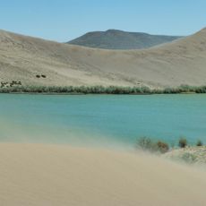
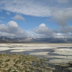
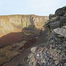
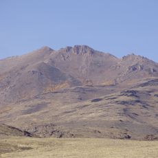
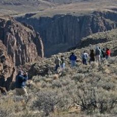
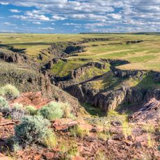
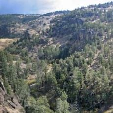
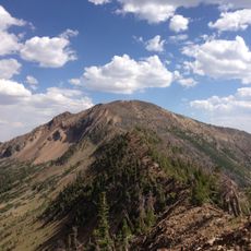
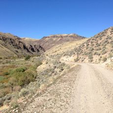
Duck Valley Indian Reservation is a tribal community straddling the Nevada-Idaho border in high desert terrain. The land spans several valleys where residents live in towns and scattered throughout rural areas.

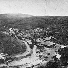
The reservation was established in 1877 through a presidential order to provide homeland for the Western Shoshone people. This founding marked a pivotal moment in the history of tribal lands in the western region.

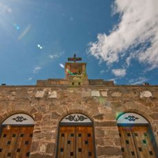
The Shoshone-Paiute peoples speak their own languages and maintain customs that shape daily life in the community. These practices are visible in local gatherings, crafts, and how residents stay connected to the land.

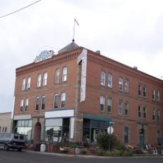
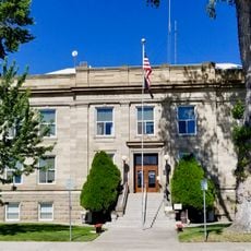
The closest major town is Elko, Nevada, located several miles away. The best way to explore the reservation is by car, as distances are considerable and public transportation is limited.

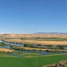
The reservation operates an established irrigation system that has made the land more productive for generations. This water management is an example of how the community has adapted the arid landscape for farming and ranching.

The community of curious travelers

AroundUs brings together thousands of curated places, local tips, and hidden gems, enriched daily by 60,000 contributors worldwide.

Start exploring
Location
Location
Elevation above the sea
5,321 ft
GPS coordinates
41.99750,-116.18400
Latest update
December 7, 2025 20:20
Around this place
Bruneau Dunes State Park
United States of America

Bruneau Dunes State Park

108.3 km
Jarbidge Wilderness
United States of America

Jarbidge Wilderness

76.3 km
Three Island Crossing State Park
United States of America

Three Island Crossing State Park

126.8 km
Northern Basin and Range ecoregion
United States of America

Northern Basin and Range ecoregion

130.1 km
Owyhee River Wilderness
United States of America

Owyhee River Wilderness

44 km
Fort McDermit
United States of America

Fort McDermit

119 km
De Lamar, Idaho
United States of America

De Lamar, Idaho

126.1 km
Our Lady, Queen of Heaven Church
United States of America

Our Lady, Queen of Heaven Church

117.4 km
Wild Horse State Recreation Area
United States of America

Wild Horse State Recreation Area

48.3 km
Granite Peak
United States of America

Granite Peak

122.2 km
Pole Creek Wilderness
United States of America

Pole Creek Wilderness

64.7 km
Bruneau – Jarbidge Rivers Wilderness
United States of America

Bruneau – Jarbidge Rivers Wilderness

63.9 km
Big Jacks Creek Wilderness
United States of America

Big Jacks Creek Wilderness

52.4 km
Bengoechea Hotel
United States of America

Bengoechea Hotel

132.3 km
Little Jacks Creek Wilderness
United States of America

Little Jacks Creek Wilderness

77.7 km
North Fork Owyhee Wilderness
United States of America

North Fork Owyhee Wilderness

88.9 km
Paradise Valley Ranger Station
United States of America

Paradise Valley Ranger Station

125.6 km
Elmore County Courthouse
United States of America

Elmore County Courthouse

132.6 km
United States of America

Gold Creek Ranger Station

50.3 km
Micca House
United States of America

Micca House

125.3 km
Marys River Peak
United States of America

Marys River Peak

73.2 km
Our Lady of Limerick Catholic Church
United States of America

Our Lady of Limerick Catholic Church

128.6 km
Gorby Opera Theater
United States of America

Gorby Opera Theater

129 km
Mountain Home Carnegie Library
United States of America

Mountain Home Carnegie Library

132.5 km
Bruneau Episcopal Church
United States of America

Bruneau Episcopal Church

103.3 km
Silver City Historic District
United States of America

Silver City Historic District

122.1 km
Bruneau Canyon
United States of America

Bruneau Canyon

95.6 km
Balanced Rock Park
United States of America

Balanced Rock Park

118 km
Show the full map
Reviews
Share your experience

No review yet

Discussions
Start a discussion...

No discussion yet

« Duck Valley Indian Reservation - Native American reservation in Elko County and Owyhee County, United States » is provided by Around Us (aroundus.com). Images and texts are derived from Wikimedia project under a Creative Commons license. You are allowed to copy, distribute, and modify copies of this page, under the conditions set by the license, as long as this note is clearly visible.

Discover hidden gems everywhere you go!

From secret cafés to breathtaking viewpoints, skip the crowded tourist spots and find places that match your style. Our app makes it easy with voice search, smart filtering, route optimization, and insider tips from travelers worldwide. Download now for the complete mobile experience.

Around Us App Screenshot

A unique approach to discovering new places

Le Figaro

All the places worth exploring

France Info

A tailor-made excursion in just a few clicks

20 Minutes

Around Us
Travel Guide & Maps
Download

Send to your phone

QR Code
1

Open the camera app on your mobile.

2

Point at the QR code with your camera. A notification will appear.

3

Tap the notification to open the link.