Enable Location

We need your location to show you interesting places around you

Discover nearby places

Find interesting locations and hidden gems around you

Precise directions

Get accurate directions and distances to places

Your location is never shared with other users. It's only used when you tap the location button.

De Lamar, Idaho

Log in to your account

Start exploring — it's free

Trusted by 62,869 travelers worldwide

Continue with Google
Continue with Apple
or

We will send you a code to connect

By continuing, you accept our Terms and Conditions and our Privacy Policy

Check your inbox

We've sent a pincode in your inbox. Please enter the code below.

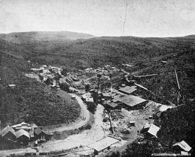
De Lamar, Idaho, human settlement in Owyhee County, Idaho, United States of America

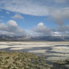
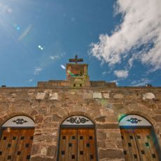
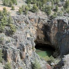
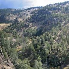
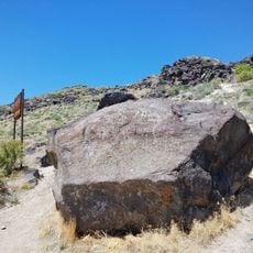
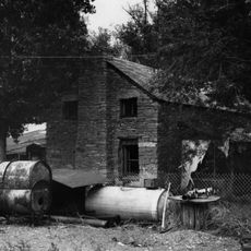
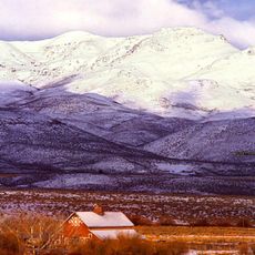
De Lamar is a mining settlement in Owyhee County, Idaho, now a ghost town situated at high elevation near Silver City. Only a handful of buildings remain standing across roughly 650 hectares of abandoned mines, old foundations, and ruins spread across the landscape.

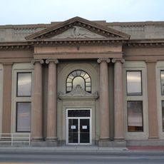
The settlement was established in the late 1880s when Joseph Raphael De Lamar, a former ship captain, discovered silver deposits and started mining operations. The mine produced significant wealth for a brief period before declining around 1890, leading to the town's gradual abandonment.

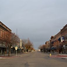
De Lamar grew as a mining community where families and workers built their lives together. Social gatherings such as dances, weddings, and weekly celebrations were central to daily life, creating a place where work in the mines and community bonds shaped how people spent their time.

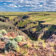
The site sits on federal land managed by the Bureau of Land Management and is accessible about 10 kilometers west of Silver City. Visitors should bring appropriate clothing for changing weather conditions and treat the old structures and land with respect.

A notable aspect is that the settlement operated a seasonal post office from 1917 to 1930, opening only during summer months. This reveals that some residents remained present in the site for decades after mining ceased, keeping a thread of habitation alive much longer than expected.

The community of curious travelers

AroundUs brings together thousands of curated places, local tips, and hidden gems, enriched daily by 60,000 contributors worldwide.

Start exploring
Location
GPS coordinates
43.02444,-116.83139
Latest update
February 9, 2026 08:23
Around this place
Jump Creek Falls
United States of America

Jump Creek Falls

51 km
Owyhee Reservoir
United States of America

Owyhee Reservoir

63.7 km
Morley Nelson Snake River Birds of Prey National Conservation Area
United States of America

Morley Nelson Snake River Birds of Prey National Conservation Area

58.8 km
Deer Flat National Wildlife Refuge
United States of America

Deer Flat National Wildlife Refuge

60 km
Northern Basin and Range ecoregion
United States of America

Northern Basin and Range ecoregion

14 km
Our Lady, Queen of Heaven Church
United States of America

Our Lady, Queen of Heaven Church

35.6 km
Succor Creek State Natural Area
United States of America

Succor Creek State Natural Area

55 km
Pole Creek Wilderness
United States of America

Pole Creek Wilderness

61.4 km
Little Jacks Creek Wilderness
United States of America

Little Jacks Creek Wilderness

61.3 km
North Fork Owyhee Wilderness
United States of America

North Fork Owyhee Wilderness

39.5 km
Lakeview Water Park
United States of America

Lakeview Water Park

66.5 km
Map Rock Petroglyphs Historic District
United States of America

Map Rock Petroglyphs Historic District

45.3 km
Nampa Historic District
United States of America

Nampa Historic District

65.5 km
Nampa Bowling
United States of America

Nampa Bowling

66.3 km
Farmers and Merchants Bank
United States of America

Farmers and Merchants Bank

65.6 km
Sheep Ranch Fortified House
United States of America

Sheep Ranch Fortified House

59.4 km
Owyhee County Courthouse
United States of America

Owyhee County Courthouse

31.3 km
Nampa Department Store
United States of America

Nampa Department Store

66.4 km
Nampa and Meridian Irrigation District Office
United States of America

Nampa and Meridian Irrigation District Office

65.4 km
Nampa Presbyterian Church
United States of America

Nampa Presbyterian Church

65.3 km
Jacob P. Lockman House
United States of America

Jacob P. Lockman House

65.9 km
Guffey Butte–Black Butte Archaeological District
United States of America

Guffey Butte–Black Butte Archaeological District

39.6 km
Nampa American Legion Chateau
United States of America

Nampa American Legion Chateau

65.3 km
H. Orton Wiley House
United States of America

H. Orton Wiley House

63.8 km
Noble Horse Barn
United States of America

Noble Horse Barn

22.4 km
Silver City Historic District
United States of America

Silver City Historic District

8 km
Nampa Train Depot
United States of America

Nampa Train Depot

65.6 km
Guffey Railroad Bridge
United States of America

Guffey Railroad Bridge

39.1 km
Show the full map
« De Lamar, Idaho - human settlement in Owyhee County, Idaho, United States of America » is provided by Around Us (aroundus.com). Images and texts are derived from Wikimedia project under a Creative Commons license. You are allowed to copy, distribute, and modify copies of this page, under the conditions set by the license, as long as this note is clearly visible.

Discover hidden gems everywhere you go!

From secret cafés to breathtaking viewpoints, skip the crowded tourist spots and find places that match your style. Our app makes it easy with voice search, smart filtering, route optimization, and insider tips from travelers worldwide. Download now for the complete mobile experience.

Around Us App Screenshot

A unique approach to discovering new places

Le Figaro

All the places worth exploring

France Info

A tailor-made excursion in just a few clicks

20 Minutes

Around Us
Travel Guide & Maps
Download

Send to your phone

QR Code
1

Open the camera app on your mobile.

2

Point at the QR code with your camera. A notification will appear.

3

Tap the notification to open the link.