Chest opened
+${chestReward.xp} XP
Explorer
NOUVEAU ×${chestReward.collectible.quantity}
tapez pour fermer
Chest locked

Open chests in the app

Around Us is built for your phone — chests unlock when you walk, explore and capture nearby places.

Enable Location

We need your location to show you interesting places around you

Discover nearby places

Find interesting locations and hidden gems around you

Precise directions

Get accurate directions and distances to places

Your location is never shared with other users. It's only used when you tap the location button.

Log in to your account

Start exploring — it's free

Trusted by 72,880 travelers worldwide

Continue with Google
Continue with Apple
or

We will send you a code to connect

By continuing, you accept our Terms and Conditions and our Privacy Policy

Check your inbox

We've sent a pincode in your inbox. Please enter the code below.

Treasure Hill
Discussion Reviews Photo
1.4k Popularity

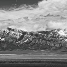
Treasure Hill, Historical silver mining site in White Pine County, Nevada.

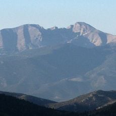
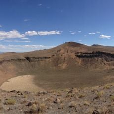
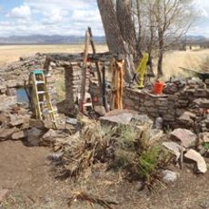
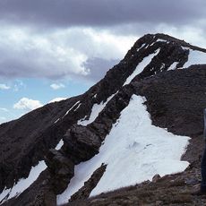
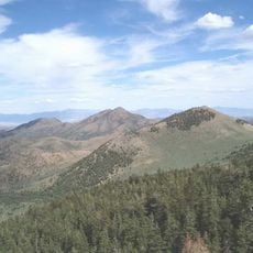
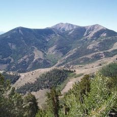
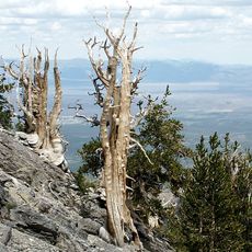
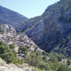
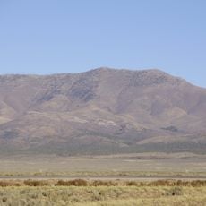
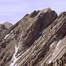
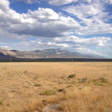
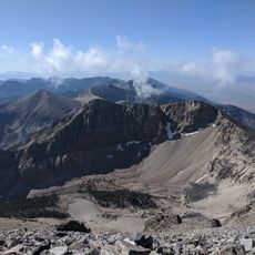
Treasure Hill is a former mining district near the White Pine Range in eastern Nevada's desert landscape, situated at an elevation of about 9,200 feet. The terrain contains scattered remnants of mining operations, collapsed structures, and traces of two ghost towns that formed during the silver boom.

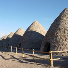
Silver veins were discovered here in 1868, drawing thousands of prospectors and entrepreneurs to the area within months. Mining activity ramped up quickly, making this one of Nevada's most productive silver-producing regions within a decade.

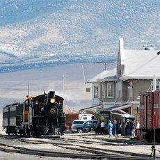
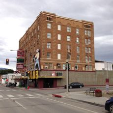
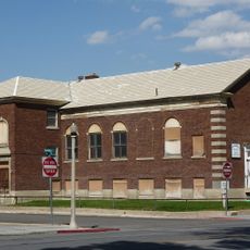
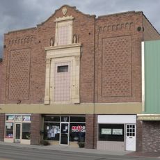
The site developed as a center for silver mining, where workers established trading posts and small communities to support extraction operations. These settlements reflect how daily life revolved entirely around the demands of mining in a remote mountain location.

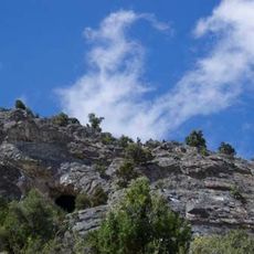
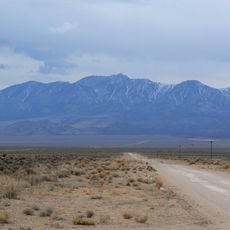
The site lies within Humboldt National Forest in an isolated location, so visitors should bring plenty of water and supplies. Road access can be challenging depending on the season, and there are no facilities on site, so it helps to plan ahead.

The Eberhardt Mine contained an unusual mixture of silver ore combined with quartz, calcite, and manganese oxide, setting it apart from other mines in the region. This distinctive mineral composition made it a rare occurrence that caught the attention of geologists and mining experts.

The community of curious travelers

AroundUs brings together thousands of curated places, local tips, and hidden gems, enriched daily by 60,000 contributors worldwide.

Start exploring
Location
GPS coordinates
39.22720,-115.48000
Latest update
December 14, 2025 17:03
Around this place
Ely State Prison
United States of America

Ely State Prison

49.9 km
Wheeler Peak
United States of America

Wheeler Peak

104.3 km
Ward Charcoal Ovens State Historic Park
United States of America

Ward Charcoal Ovens State Historic Park

58.6 km
Nevada Northern Railway Museum
United States of America

Nevada Northern Railway Museum

52.9 km
Hotel Nevada and Gambling Hall
United States of America

Hotel Nevada and Gambling Hall

50.7 km
Wheeler Peak Glacier
United States of America

Wheeler Peak Glacier

104.2 km
Cave Lake State Park
United States of America

Cave Lake State Park

65.5 km
Lunar Crater National Natural Landmark
United States of America

Lunar Crater National Natural Landmark

106.9 km
Fort Ruby
United States of America

Fort Ruby

93.7 km
North Schell Peak
United States of America

North Schell Peak

78.6 km
Red Mountain Wilderness
United States of America

Red Mountain Wilderness

37.4 km
High Schells Wilderness
United States of America

High Schells Wilderness

76.9 km
Goshute Canyon Wilderness
United States of America

Goshute Canyon Wilderness

103.1 km
Currant Mountain Wilderness
United States of America

Currant Mountain Wilderness

35.4 km
South Egan Range Wilderness
United States of America

South Egan Range Wilderness

76.5 km
Diamond Peak
United States of America

Diamond Peak

49.4 km
Central Theatre
United States of America

Central Theatre

51.6 km
Currant Mountain
United States of America

Currant Mountain

35.6 km
Ely L.D.S. Stake Tabernacle
United States of America

Ely L.D.S. Stake Tabernacle

51.1 km
Capital Theatre
United States of America

Capital Theatre

50.6 km
Troy Peak
United States of America

Troy Peak

101.1 km
White Pine County Courthouse
United States of America

White Pine County Courthouse

51.1 km
Eureka Historic District
United States of America

Eureka Historic District

52.5 km
Lund Grade School
United States of America

Lund Grade School

57.8 km
Bahsahwahbee
United States of America

Bahsahwahbee

89.4 km
Pyramid Peak
United States of America

Pyramid Peak

107 km
Baker Peak
United States of America

Baker Peak

104.5 km
Nevada Northern Railway East Ely Yards and Shops
United States of America

Nevada Northern Railway East Ely Yards and Shops

52.8 km
Show the full map
Reviews
Share your experience

No review yet

Discussions
Start a discussion...

No discussion yet

« Treasure Hill - Historical silver mining site in White Pine County, Nevada » is provided by Around Us (aroundus.com). Images and texts are derived from Wikimedia project under a Creative Commons license. You are allowed to copy, distribute, and modify copies of this page, under the conditions set by the license, as long as this note is clearly visible.

Discover hidden gems everywhere you go!

From secret cafés to breathtaking viewpoints, skip the crowded tourist spots and find places that match your style. Our app makes it easy with voice search, smart filtering, route optimization, and insider tips from travelers worldwide. Download now for the complete mobile experience.

Around Us App Screenshot

A unique approach to discovering new places

Le Figaro

All the places worth exploring

France Info

A tailor-made excursion in just a few clicks

20 Minutes

Around Us
Travel Guide & Maps
Download

Send to your phone

QR Code
1

Open the camera app on your mobile.

2

Point at the QR code with your camera. A notification will appear.

3

Tap the notification to open the link.