Chest opened
+${chestReward.xp} XP
Explorer
NOUVEAU ×${chestReward.collectible.quantity}
tapez pour fermer
Chest locked

Open chests in the app

Around Us is built for your phone — chests unlock when you walk, explore and capture nearby places.

Enable Location

We need your location to show you interesting places around you

Discover nearby places

Find interesting locations and hidden gems around you

Precise directions

Get accurate directions and distances to places

Your location is never shared with other users. It's only used when you tap the location button.

Heber-Overgaard

Log in to your account

Start exploring — it's free

Trusted by 72,877 travelers worldwide

Continue with Google
Continue with Apple
or

We will send you a code to connect

By continuing, you accept our Terms and Conditions and our Privacy Policy

Check your inbox

We've sent a pincode in your inbox. Please enter the code below.

Discussion Reviews 1 Photos
600+ Popularity

Heber-Overgaard, Mountain residential area in Navajo County, Arizona.

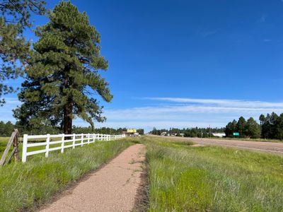
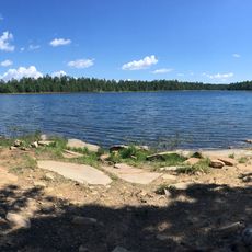
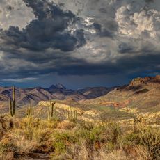
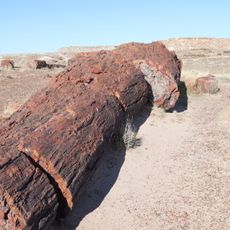
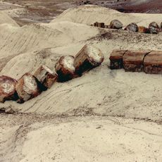
Heber-Overgaard is a residential community situated on the Mogollon Rim at approximately 6,627 feet (2,015 m) elevation in Navajo County, Arizona. The location sits within the Apache-Sitgreaves National Forest region and experiences cold winters with moderate summers.

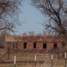
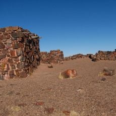
The settlement began in 1883 when Mormon pioneers founded Heber, while Overgaard developed later in 1936 around a local sawmill operation. The two communities eventually merged into a single unified place.

The community maintains ties to Native American traditions and Western heritage that show up in local celebrations and gatherings. These influences shape how residents connect with their surroundings and each other.

The area provides access to outdoor activities such as hiking trails, fishing spots, and camping throughout the surrounding forest. Visitors should come prepared for cold weather, especially during winter months.

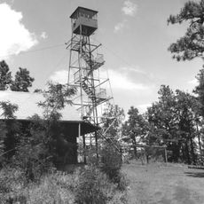
The area suffered severe destruction from the Rodeo-Chediski Fire in 2002, which damaged hundreds of structures across the region. This event became a defining moment that led to strong community rebuilding efforts.

The community of curious travelers

AroundUs brings together thousands of curated places, local tips, and hidden gems, enriched daily by 60,000 contributors worldwide.

Start exploring
Location
Inception
1883
GPS coordinates
34.41306,-110.56444
Latest update
December 14, 2025 20:27
Around this place
Standin' on the Corner Park
United States of America

Standin' on the Corner Park

69 km
Wigwam Motel
United States of America

Wigwam Motel

65.4 km
Chevelon Creek Bridge
United States of America

Chevelon Creek Bridge

56.9 km
Blue Ridge Reservoir
United States of America

Blue Ridge Reservoir

60.5 km
Willow Springs Lake
United States of America

Willow Springs Lake

30.7 km
Homolovi State Park
United States of America

Homolovi State Park

68.4 km
Snowflake Arizona Temple
United States of America

Snowflake Arizona Temple

42.8 km
La Posada Historic District
United States of America

La Posada Historic District

68.8 km
Brigham City
United States of America

Brigham City

70.9 km
Agate House Pueblo
United States of America

Agate House Pueblo

77.8 km
Arizona Rancho
United States of America

Arizona Rancho

65.5 km
Sierra Ancha Wilderness
United States of America

Sierra Ancha Wilderness

71.9 km
Cedar Canyon Bridge
United States of America

Cedar Canyon Bridge

51.2 km
Lake Mountain Lookout Complex
United States of America

Lake Mountain Lookout Complex

78.5 km
Lorenzo Hubbell Trading Post and Warehouse
United States of America

Lorenzo Hubbell Trading Post and Warehouse

69.3 km
Corduroy Creek Bridge
United States of America

Corduroy Creek Bridge

51 km
Pleasant Valley Ranger Station
United States of America

Pleasant Valley Ranger Station

48 km
White Mountain Family Fun Park
United States of America

White Mountain Family Fun Park

57.8 km
Los Burros Ranger Station
United States of America

Los Burros Ranger Station

79.5 km
Rainbow Forest Museum
United States of America

Rainbow Forest Museum

78.1 km
Rainbow Forest
United States of America

Rainbow Forest

77.1 km
Giant Logs Trail
United States of America

Giant Logs Trail

78.1 km
Show Low Historical Society
United States of America

Show Low Historical Society

51.7 km
Aztec Peak Lookout
United States of America

Aztec Peak Lookout

74 km
Giant Logs
United States of America

Giant Logs

78.2 km
Moqui Lookout
United States of America

Moqui Lookout

58 km
Obed Road Bridge
United States of America

Obed Road Bridge

62.8 km
Rainbow Forest Complex
United States of America

Rainbow Forest Complex

78.1 km
Show the full map
Reviews
Share your experience

No review yet

Discussions
Start a discussion...

No discussion yet

« Heber-Overgaard - Mountain residential area in Navajo County, Arizona » is provided by Around Us (aroundus.com). Images and texts are derived from Wikimedia project under a Creative Commons license. You are allowed to copy, distribute, and modify copies of this page, under the conditions set by the license, as long as this note is clearly visible.

Discover hidden gems everywhere you go!

From secret cafés to breathtaking viewpoints, skip the crowded tourist spots and find places that match your style. Our app makes it easy with voice search, smart filtering, route optimization, and insider tips from travelers worldwide. Download now for the complete mobile experience.

Around Us App Screenshot

A unique approach to discovering new places

Le Figaro

All the places worth exploring

France Info

A tailor-made excursion in just a few clicks

20 Minutes

Around Us
Travel Guide & Maps
Download

Send to your phone

QR Code
1

Open the camera app on your mobile.

2

Point at the QR code with your camera. A notification will appear.

3

Tap the notification to open the link.