Chest opened
+${chestReward.xp} XP
Explorer
NOUVEAU ×${chestReward.collectible.quantity}
tapez pour fermer
Chest locked

Open chests in the app

Around Us is built for your phone — chests unlock when you walk, explore and capture nearby places.

Enable Location

We need your location to show you interesting places around you

Discover nearby places

Find interesting locations and hidden gems around you

Precise directions

Get accurate directions and distances to places

Your location is never shared with other users. It's only used when you tap the location button.

Moriarty

Log in to your account

Start exploring — it's free

Trusted by 72,882 travelers worldwide

Continue with Google
Continue with Apple
or

We will send you a code to connect

By continuing, you accept our Terms and Conditions and our Privacy Policy

Check your inbox

We've sent a pincode in your inbox. Please enter the code below.

Discussion Reviews 1 Photos
17.2k Popularity

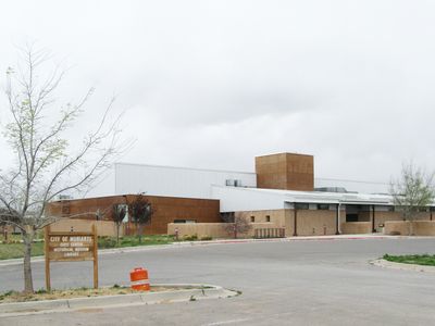
Moriarty, city in Torrance County, New Mexico, United States

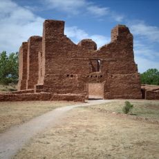
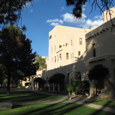
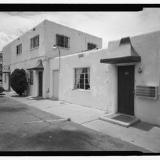
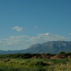
Moriarty is a small city in Torrance County, New Mexico, situated on the east side of the Sandia Range. The town features older buildings and quiet streets that reflect its role as a historic stop for travelers passing through this rural region.

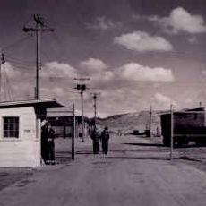
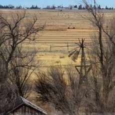
A railway line was built through Moriarty in the early 1900s, bringing new settlers and economic growth to the region. Route 66, one of the country's main roads created in the 1920s, later connected different parts of America and shaped the town's role as a traveler's stop.

The town takes its name from the Moriarty family, Irish ranchers who settled here permanently in the early days. This connection to both real settlers and a famous fictional character gives the place a distinctive identity that locals and visitors notice.

Moriarty sits on major routes and serves as a practical stop for travelers driving through New Mexico. The town offers modern lodging and dining options where visitors can rest and enjoy local food before continuing their journey.

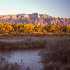
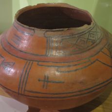
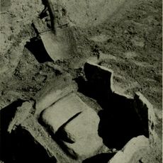
The area surrounding the town has archaeological sites showing some of America's oldest tools made by early inhabitants thousands of years ago. This gives the region one of the deepest human timelines in North America, visible in the landscape today.

The community of curious travelers

AroundUs brings together thousands of curated places, local tips, and hidden gems, enriched daily by 60,000 contributors worldwide.

Start exploring
Location
Elevation above the sea
1,896 m
GPS coordinates
34.99972,-106.04667
Latest update
February 17, 2026 01:00
Around this place
Sandia Mountains
United States of America

Sandia Mountains

43.5 km
Sandia Peak Tramway
United States of America

Sandia Peak Tramway

44.8 km
Sandia Base
United States of America

Sandia Base

46.1 km
La Luz Trail
United States of America

La Luz Trail

44.9 km
Sandia Cave
United States of America

Sandia Cave

43.3 km
Congregation Albert
United States of America

Congregation Albert

49.6 km
United States of America

Tijeras Canyon

32.3 km
Albuquerque New Mexico Temple
United States of America

Albuquerque New Mexico Temple

47.4 km
San Lazaro archaeological site
United States of America

San Lazaro archaeological site

40.7 km
Bank of the West Tower
United States of America

Bank of the West Tower

49.9 km
Quarai
United States of America

Quarai

50.4 km
Solar Building
United States of America

Solar Building

50.1 km
Hinkle Family Fun Center
United States of America

Hinkle Family Fun Center

42.6 km
National Solar Thermal Test Facility
United States of America

National Solar Thermal Test Facility

42.4 km
Wildlife West Nature Park
United States of America

Wildlife West Nature Park

16.4 km
Manzano Wilderness
United States of America

Manzano Wilderness

49.3 km
Space Development and Test Wing
United States of America

Space Development and Test Wing

50.7 km
Moriarty Eclipse Windmill
United States of America

Moriarty Eclipse Windmill

3.2 km
Tewa Lodge
United States of America

Tewa Lodge

49.6 km
Tonque Pueblo
United States of America

Tonque Pueblo

47.2 km
United States of America

Hoffmantown Baptist Church

47.6 km
Tinkertown Museum
United States of America

Tinkertown Museum

34.8 km
Albuquerque Veterans Administration Medical Center
United States of America

Albuquerque Veterans Administration Medical Center

49.4 km
Luna Lodge
United States of America

Luna Lodge

46.2 km
American Vaudeville Museum
United States of America

American Vaudeville Museum

20.5 km
San Antonito Church and Cemetery
United States of America

San Antonito Church and Cemetery

32.9 km
La Puerta Lodge
United States of America

La Puerta Lodge

45.7 km
Northeast Albuquerque
United States of America

Northeast Albuquerque

43.3 km
Show the full map
Reviews
Share your experience

No review yet

Discussions
Start a discussion...

No discussion yet

« Moriarty - city in Torrance County, New Mexico, United States » is provided by Around Us (aroundus.com). Images and texts are derived from Wikimedia project under a Creative Commons license. You are allowed to copy, distribute, and modify copies of this page, under the conditions set by the license, as long as this note is clearly visible.

Discover hidden gems everywhere you go!

From secret cafés to breathtaking viewpoints, skip the crowded tourist spots and find places that match your style. Our app makes it easy with voice search, smart filtering, route optimization, and insider tips from travelers worldwide. Download now for the complete mobile experience.

Around Us App Screenshot

A unique approach to discovering new places

Le Figaro

All the places worth exploring

France Info

A tailor-made excursion in just a few clicks

20 Minutes

Around Us
Travel Guide & Maps
Download

Send to your phone

QR Code
1

Open the camera app on your mobile.

2

Point at the QR code with your camera. A notification will appear.

3

Tap the notification to open the link.