Interstate 25, Pan-American Freeway segment in New Mexico and Colorado.
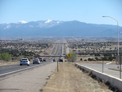
Interstate 25 is a major north-south highway stretching across 1,060 miles (1,700 km) through New Mexico, Colorado, and Wyoming. The road passes through mountain valleys and high plains, serving as a primary route connecting major cities in the region.
Construction started in 1948 and the first section opened in 1950 as one of Colorado's earliest Interstate highways. Over time it grew into a vital transportation link connecting three states across the western United States.
The road follows ancient trading pathways that connected different regions for centuries. People today drive the same north-south route that merchants and settlers once traveled on foot and by wagon.
Most sections have four lanes, with extra lanes in the northern area to reduce traffic jams. Winter driving often requires snow chains or caution, especially in higher elevation areas.
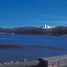
The pass along this route reaches 2,400 meters (7,800 feet) elevation and closes frequently in winter when snow arrives. This makes it one of the most challenging stretches for drivers during cold months.
Location: New Mexico
Location: Colorado
Location: Wyoming
GPS coordinates: 39.06418,-104.85558
Latest update: December 6, 2025 21:25
Garden of the Gods
20.8 km
United States Air Force Academy Cadet Chapel
6.9 km
Falcon Stadium
7.6 km
Cave of the Winds
22 km
Glen Eyrie
19.4 km
Flying W Ranch
15.3 km
Rampart Reservoir
13.6 km
United States Air Force Academy Cemetery
5.6 km
United States Air Force Academy, Cadet Area
6.9 km
Rocky Mountain Dinosaur Resource Center
18.6 km
Santa's Workshop
20.6 km
North Pole Colorado
20.7 km
Colorado Renaissance Festival
18.8 km
Blodgett Peak
12.5 km
Rock Ledge Ranch Historic Site
21.3 km
Tri-Lakes, Colorado
4.2 km
Western Museum of Mining & Industry
4.7 km
Eastholme
21 km
Black Forest School
14.5 km
Taylor Memorial Chapel
13.5 km
Fort Collins Municipal Railway No. 22
22.1 km
J.G. Evans Barn
14.2 km
Bridge over Fountain Creek
22.4 km
Inez Johnson Lewis School
3.3 km
Cottonwood Creek Bridge
15.6 km
Spring Valley School
12.3 km
The Country Club at Woodmoor
4.9 km
Banning Lewis Ranch Vista Water Park
22.2 kmVisited this place? Tap the stars to rate it and share your experience / photos with the community! Try now! You can cancel it anytime.
Discover hidden gems everywhere you go!
From secret cafés to breathtaking viewpoints, skip the crowded tourist spots and find places that match your style. Our app makes it easy with voice search, smart filtering, route optimization, and insider tips from travelers worldwide. Download now for the complete mobile experience.
A unique approach to discovering new places❞
— Le Figaro
All the places worth exploring❞
— France Info
A tailor-made excursion in just a few clicks❞
— 20 Minutes