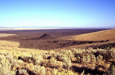
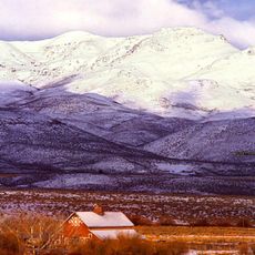
Jordan Craters, Volcanic field in Malheur County, Oregon, United States.
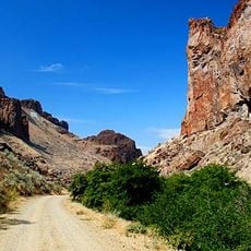
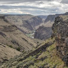
The area encompasses a 27-square-mile (70-square-kilometer) lava field marked by deep cavities, tubes, caves, and the central Coffeepot Crater formation. Basalt columns, cinder fields, and solidified lava flows shape the landscape. The surface displays various volcanic structures including lava bombs and collapsed tube systems that reveal both explosive and effusive eruption phases.
Radiocarbon dating of charred wood in sediment cores confirms eruptions occurred approximately 3,200 years ago during the Bronze Age period. Geologists identified multiple eruption phases producing different lava types and deposits. The Bureau of Land Management has administered the area for decades as a protected geological site while supporting scientific investigations into regional volcanic history.
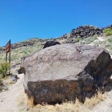
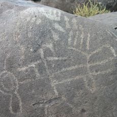
Rock art found nearby provides evidence that indigenous groups inhabited this region and may have observed volcanic activity firsthand. Today the lava field serves geological research purposes and attracts visitors interested in volcanic landscapes and prehistoric human settlement evidence. The remote setting has helped preserve both archaeological and geological features from modern disturbance.
Access requires driving 8 miles (13 kilometers) north on Highway 95, followed by several turns on gravel and dirt roads to reach the parking area. Late spring through early fall offers the best visiting conditions when road conditions are favorable. Visitors should bring water, sun protection, and sturdy footwear, as facilities are absent and terrain is uneven.
The geological structures resemble lunar surfaces due to minimal soil development and sparse vegetation across the basalt field. NASA scientists use the site for comparative planetary geology studies. Some lava tubes extend hundreds of feet in length, forming underground corridors with constant temperatures that shelter bats and other cave-dwelling species.
The community of curious travelers
AroundUs brings together thousands of curated places, local tips, and hidden gems, enriched daily by 60,000 contributors worldwide.