Umatilla National Wildlife Refuge, National wildlife refuge on Columbia River, United States.
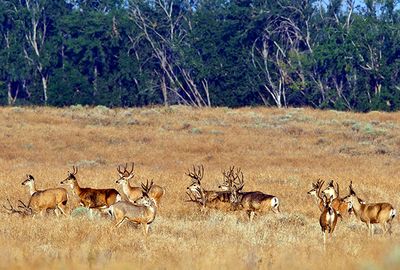
The Umatilla National Wildlife Refuge is a protected area along the Columbia River spanning about 24,000 acres across Oregon and Washington. It contains a mix of open water, marshland, wetlands, cropland, islands, and shrub-covered upland areas that provide varied habitats for wildlife.
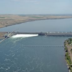
The refuge was established in 1969 to offset habitat losses caused by construction of the John Day Dam. It was created as a direct response to the ecological impacts of this major infrastructure project.
The refuge functions as an educational center where visitors learn about wildlife conservation through observation programs and guided nature activities.
The refuge is open from sunrise to sunset, with certain areas subject to seasonal closures. Visitors should prepare for wet and open conditions and bring appropriate gear for wildlife viewing.
The refuge sits within the Pacific Flyway, a major migration route for thousands of wild geese and other waterfowl. This geographic position makes it a critical stopover point during winter months when birds travel from north to south.
The community of curious travelers
AroundUs brings together thousands of curated places, local tips, and hidden gems, enriched daily by 60,000 contributors worldwide.