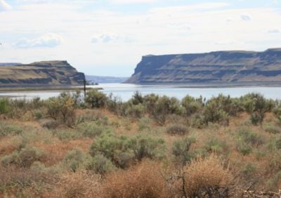
Wallula Gap, Water gap and National Natural Landmark in Columbia Basin, Washington, United States.
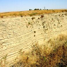
Wallula Gap is a water gap and National Natural Landmark in the Columbia Basin region of Washington, where steep basalt cliffs rise on both sides of the Columbia River, forming a natural corridor through the landscape. The formation extends for several kilometers and clearly shows the power of volcanic activity and erosion that shaped this valley.
This gorge formed during the last Ice Age when massive glacial floods surged through volcanic rock formations, creating this distinctive geological structure. The extreme power of these prehistoric floods left lasting marks on the landscape that remain visible today.
Native American tribes established settlements near Wallula Gap, utilizing the Columbia River's resources and the natural passage for transportation and trade.
The best viewing points are located along Route 730, where you can clearly see the basalt cliffs and the river flowing below. The area is accessible year-round, with the clearest views on dry days.
During prehistoric floods, water flowed through this gap at a rate of approximately 166 cubic kilometers per day. This enormous volume exceeded at that time the daily water flow of all current rivers on Earth combined.
The community of curious travelers
AroundUs brings together thousands of curated places, local tips, and hidden gems, enriched daily by 60,000 contributors worldwide.