Chest opened
+${chestReward.xp} XP
Explorer
NOUVEAU ×${chestReward.collectible.quantity}
tapez pour fermer
Chest locked

Open chests in the app

Around Us is built for your phone — chests unlock when you walk, explore and capture nearby places.

Enable Location

We need your location to show you interesting places around you

Discover nearby places

Find interesting locations and hidden gems around you

Precise directions

Get accurate directions and distances to places

Your location is never shared with other users. It's only used when you tap the location button.

Chinese Wall

Log in to your account

Start exploring — it's free

Trusted by 72,891 travelers worldwide

Continue with Google
Continue with Apple
or

We will send you a code to connect

By continuing, you accept our Terms and Conditions and our Privacy Policy

Check your inbox

We've sent a pincode in your inbox. Please enter the code below.

Chinese Wall
Discussion Reviews 1 Photos
10.7k Popularity

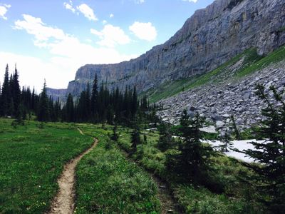
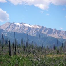
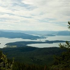
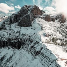
Chinese Wall, Limestone escarpment in Bob Marshall Wilderness, Montana.

The Chinese Wall is a limestone escarpment extending roughly thirteen miles along the Continental Divide with a steep eastern face rising about 1,000 feet from below. The western slope descends more gradually, creating a contrast between the two sides of the formation.

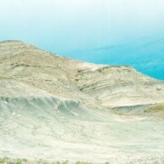
The limestone formation contains pre-Cambrian marine fossils from an ancient inland sea that deposited organic material millions of years ago. These layers reveal that the region was once submerged beneath a vast ocean.

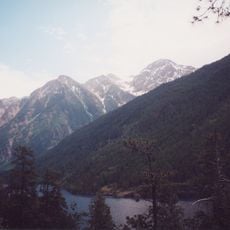
The Continental Divide Trail passes beneath this geological formation, making it a significant destination for long-distance hikers traversing remote wilderness. The route attracts adventurers from around the world seeking to experience the raw landscape on foot.

Reaching this formation requires a multi-day backpacking trip through backcountry terrain and remote mountain passes. Visitors need sturdy gear and strong hiking experience since the location sits in a remote wilderness area without services or facilities.

The escarpment functions as a natural water divide directing runoff in opposite directions across two different ocean systems. Rainfall on the eastern face ultimately reaches the Atlantic Ocean while precipitation on the western slope flows toward the Pacific.

The community of curious travelers

AroundUs brings together thousands of curated places, local tips, and hidden gems, enriched daily by 60,000 contributors worldwide.

Start exploring
Location
GPS coordinates
47.65600,-113.12800
Latest update
December 10, 2025 15:52
Around this place
Bob Marshall Wilderness
United States of America

Bob Marshall Wilderness

18.5 km
Two Medicine Formation
United States of America

Two Medicine Formation

77.5 km
Marias Pass
United States of America

Marias Pass

75.6 km
Great Bear Wilderness
United States of America

Great Bear Wilderness

68.1 km
Izaak Walton Inn
United States of America

Izaak Walton Inn

78.1 km
Scapegoat Wilderness
United States of America

Scapegoat Wilderness

67 km
McDonald Peak
United States of America

McDonald Peak

66.8 km
Gibson Dam
United States of America

Gibson Dam

28.2 km
Ninepipe National Wildlife Refuge
United States of America

Ninepipe National Wildlife Refuge

78.2 km
Placid Lake State Park
United States of America

Placid Lake State Park

66.1 km
Pablo National Wildlife Refuge
United States of America

Pablo National Wildlife Refuge

77.5 km
Swan River National Wildlife Refuge
United States of America

Swan River National Wildlife Refuge

60.7 km
Gibson Reservoir
United States of America

Gibson Reservoir

28.2 km
Dearborn River High Bridge
United States of America

Dearborn River High Bridge

69.5 km
Finley Point State Park
United States of America

Finley Point State Park

72.3 km
Yellow Bay State Park
United States of America

Yellow Bay State Park

72 km
Summit Mountain
United States of America

Summit Mountain

79.7 km
Scenic Bridge
United States of America

Scenic Bridge

78.6 km
United States of America

Sheep Mountain

80.5 km
Walton Ranger Station Historic District
United States of America

Walton Ranger Station Historic District

77.3 km
Don E. Olsson House and Garage
United States of America

Don E. Olsson House and Garage

74.4 km
Miracle of America Museum and Pioneer Village
United States of America

Miracle of America Museum and Pioneer Village

74.1 km
Lower Park Creek Patrol Cabin
United States of America

Lower Park Creek Patrol Cabin

81.8 km
Polson Feed Mill
United States of America

Polson Feed Mill

77.6 km
Silver King Ranch
United States of America

Silver King Ranch

77.8 km
Teton County Courthouse
United States of America

Teton County Courthouse

73 km
Gable Peaks
United States of America

Gable Peaks

42.9 km
Fielding Snowshoe Patrol Cabin
United States of America

Fielding Snowshoe Patrol Cabin

74.3 km
Show the full map
Reviews
Share your experience

No review yet

Discussions
Start a discussion...

No discussion yet

« Chinese Wall - Limestone escarpment in Bob Marshall Wilderness, Montana » is provided by Around Us (aroundus.com). Images and texts are derived from Wikimedia project under a Creative Commons license. You are allowed to copy, distribute, and modify copies of this page, under the conditions set by the license, as long as this note is clearly visible.

Discover hidden gems everywhere you go!

From secret cafés to breathtaking viewpoints, skip the crowded tourist spots and find places that match your style. Our app makes it easy with voice search, smart filtering, route optimization, and insider tips from travelers worldwide. Download now for the complete mobile experience.

Around Us App Screenshot

A unique approach to discovering new places

Le Figaro

All the places worth exploring

France Info

A tailor-made excursion in just a few clicks

20 Minutes

Around Us
Travel Guide & Maps
Download

Send to your phone

QR Code
1

Open the camera app on your mobile.

2

Point at the QR code with your camera. A notification will appear.

3

Tap the notification to open the link.