Chest opened
+${chestReward.xp} XP
Explorer
NOUVEAU ×${chestReward.collectible.quantity}
tapez pour fermer
Chest locked

Open chests in the app

Around Us is built for your phone — chests unlock when you walk, explore and capture nearby places.

Enable Location

We need your location to show you interesting places around you

Discover nearby places

Find interesting locations and hidden gems around you

Precise directions

Get accurate directions and distances to places

Your location is never shared with other users. It's only used when you tap the location button.

Log in to your account

Start exploring — it's free

Trusted by 72,890 travelers worldwide

Continue with Google
Continue with Apple
or

We will send you a code to connect

By continuing, you accept our Terms and Conditions and our Privacy Policy

Check your inbox

We've sent a pincode in your inbox. Please enter the code below.

Hell Roaring Creek
Discussion Reviews Photo
8.9k Popularity

Hell Roaring Creek, Stream in Beaverhead County, Montana, United States.

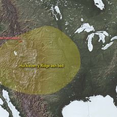
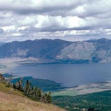
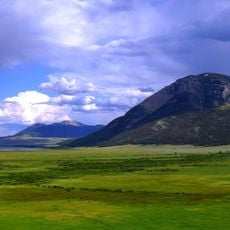
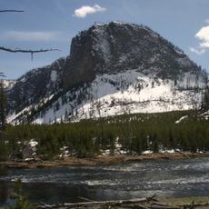
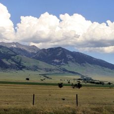
Hell Roaring Creek is a mountain stream in Beaverhead County, in southern Montana, that flows through a remote and largely undeveloped landscape before reaching the Red Rock River. It originates at Brower's Spring, a source recognized as the farthest headwater of the entire Missouri River system.

The creek gained attention in the early 19th century when explorers pushing into the American West began mapping the upper reaches of the Missouri River system. Its source at Brower's Spring was eventually identified as the most distant point of that vast river network.

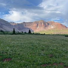
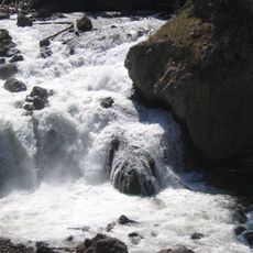
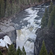
The creek's name was given by early settlers who passed through this remote corner of Montana and wanted to capture the rough sound the water makes as it tumbles through the terrain. Today, anyone standing near the banks can immediately understand why that name stuck.

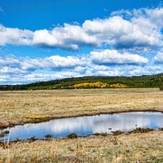
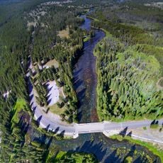
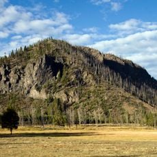
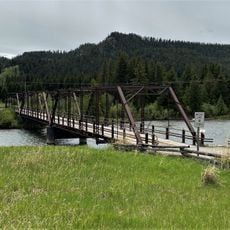
The creek sits in a remote high-elevation area reached by roads through Beaverhead County, so conditions can change quickly depending on the season. Visitors should come prepared for rough terrain and limited facilities, as the surrounding land is largely undeveloped.

A short ethnographic film made in 2010 recorded a shepherdess crossing the water with her flock at dawn, capturing a working practice that has changed little over generations. The footage shows how herders still move through this land the same way people did long before maps were drawn of it.

The community of curious travelers

AroundUs brings together thousands of curated places, local tips, and hidden gems, enriched daily by 60,000 contributors worldwide.

Start exploring
GPS coordinates
44.61683,-111.55227
Latest update
March 3, 2026 10:13
Around this place
Huckleberry Ridge Tuff
United States of America

Huckleberry Ridge Tuff

36.5 km
Island Park Caldera
United States of America

Island Park Caldera

36.5 km
Hebgen Lake
United States of America

Hebgen Lake

32.4 km
Henry's Fork Caldera
United States of America

Henry's Fork Caldera

36.5 km
Mesa Falls Tuff
United States of America

Mesa Falls Tuff

36.5 km
Henrys Lake
United States of America

Henrys Lake

12 km
Upper Mesa Falls
United States of America

Upper Mesa Falls

50.9 km
Big Springs
United States of America

Big Springs

26.9 km
Firehole Falls
United States of America

Firehole Falls

54.6 km
Grizzly & Wolf Discovery Center
United States of America

Grizzly & Wolf Discovery Center

36.2 km
Hebgen Dam
United States of America

Hebgen Dam

32.4 km
Red Rock Lakes National Wildlife Refuge
United States of America

Red Rock Lakes National Wildlife Refuge

18.3 km
Mount Haynes
United States of America

Mount Haynes

48.1 km
Lower Mesa Falls
United States of America

Lower Mesa Falls

53.3 km
Hilgard Peak
United States of America

Hilgard Peak

34.2 km
Eagle's Store
United States of America

Eagle's Store

36.3 km
Camas Meadows Battle Sites
United States of America

Camas Meadows Battle Sites

37.5 km
National Park Mountain
United States of America

National Park Mountain

53.8 km
Queen's Laundry Bath House
United States of America

Queen's Laundry Bath House

54.4 km
United States of America

Mount Jackson

49.5 km
Johnny Sack Cabin
United States of America

Johnny Sack Cabin

26.9 km
Bishop Mountain Lookout
United States of America

Bishop Mountain Lookout

31.6 km
Lonesomehurst Cabin
United States of America

Lonesomehurst Cabin

29.6 km
Hutchins Bridge
United States of America

Hutchins Bridge

30.3 km
West Yellowstone Oregon Shortline Terminus Historic District
United States of America

West Yellowstone Oregon Shortline Terminus Historic District

35.9 km
Mather Plaque in Yellowstone National Park
United States of America

Mather Plaque in Yellowstone National Park

54.7 km
Union Pacific Dining Lodge
United States of America

Union Pacific Dining Lodge

35.9 km
West Yellowstone Public Library
United States of America

West Yellowstone Public Library

36 km
Show the full map
Reviews
Share your experience

No review yet

Discussions
Start a discussion...

No discussion yet

« Hell Roaring Creek - Stream in Beaverhead County, Montana, United States » is provided by Around Us (aroundus.com). Images and texts are derived from Wikimedia project under a Creative Commons license. You are allowed to copy, distribute, and modify copies of this page, under the conditions set by the license, as long as this note is clearly visible.

Discover hidden gems everywhere you go!

From secret cafés to breathtaking viewpoints, skip the crowded tourist spots and find places that match your style. Our app makes it easy with voice search, smart filtering, route optimization, and insider tips from travelers worldwide. Download now for the complete mobile experience.

Around Us App Screenshot

A unique approach to discovering new places

Le Figaro

All the places worth exploring

France Info

A tailor-made excursion in just a few clicks

20 Minutes

Around Us
Travel Guide & Maps
Download

Send to your phone

QR Code
1

Open the camera app on your mobile.

2

Point at the QR code with your camera. A notification will appear.

3

Tap the notification to open the link.