Amanã Sustainable Development Reserve, Sustainable development reserve in Amazonas, Brazil.
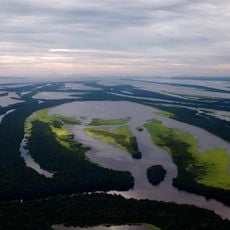
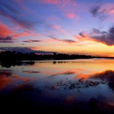
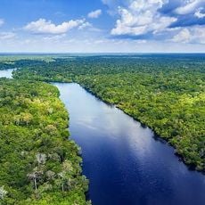
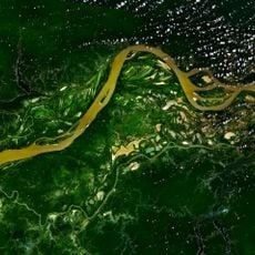
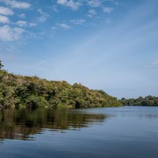
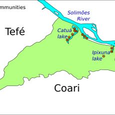
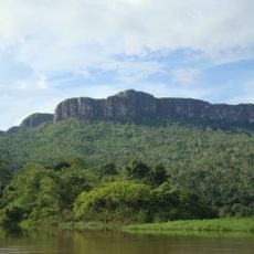
Amanã Sustainable Development Reserve is a vast forest area with rivers, lakes, and seasonally flooded zones in western Amazonas. The reserve is home to more than a hundred communities scattered across multiple locations.
The reserve was established in 1998 and is part of a larger conservation complex. This complex received UNESCO World Heritage designation in 2000.
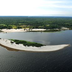
Local communities practice traditional lifeways that reflect their deep connection to the forest and water systems. Fishing, hunting, and forest management are woven into daily routines and shape how residents interact with their surroundings.
Access is through the city of Tefé, which serves as the main entry point and is located to the west. A visit requires planning and local guidance to navigate the water systems and forest conditions safely.
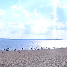
The area contains a large lake that ranks among the biggest natural lakes in the Amazon region. This lake is notable for its size and importance to the local communities.
Location: Amazonas
Inception: 1998
Part of: Jaú National Park, Amanã Sustainable Development Reserve and Demonstration Area of Mamirauá Sustainable Development Reserve
GPS coordinates: -2.40300,-64.44700
Latest update: December 14, 2025 16:44
Pico da Neblina
396.7 km
Praia de Ponta Negra
488.7 km
Piedra del Cocuy
483.9 km
Pico da Neblina National Park
345.8 km
Pico 31 de Março
397.1 km
Anavilhanas National Park
392.2 km
Jaú National Park
205.2 km
Serranía La Neblina National Park
412.9 km
Piedra del Cocuy Natural Monument
483.9 km
Amazon River
432.2 km
Mamirauá Sustainable Development Reserve
138.1 km
Cachoeira do El Dorado
385 km
Central Amazon Conservation Complex
271.4 km
Moon Beach
488.7 km
Morro dos Seis Lagos Biological Reserve
392.7 km
Central Amazon Ecological Corridor
399.7 km
Serra do Aracá State Park
457.7 km
Forte de São José de Marabitanas
467.8 km
Rio Negro Left Bank Environmental Protection Area
442.9 km
Tefé National Forest
136.6 km
Cué-cué/Marabitanas Indigenous Territory
451.8 km
Lower Rio Negro Mosaic
388.3 km
Catuá-Ipixuna Extractive Reserve
165.4 km
Auatí-Paraná Extractive Reserve
248.6 km
Lago do Capanã Grande Extractive Reserve
428.3 km
Reserva Extrativista do Rio Unini
333.4 km
Sierra Unturan Natural Monument
475.5 km
Cerros Tapirapecó y Tamacuari Natural Monument
413.9 kmVisited this place? Tap the stars to rate it and share your experience / photos with the community! Try now! You can cancel it anytime.
Discover hidden gems everywhere you go!
From secret cafés to breathtaking viewpoints, skip the crowded tourist spots and find places that match your style. Our app makes it easy with voice search, smart filtering, route optimization, and insider tips from travelers worldwide. Download now for the complete mobile experience.
A unique approach to discovering new places❞
— Le Figaro
All the places worth exploring❞
— France Info
A tailor-made excursion in just a few clicks❞
— 20 Minutes