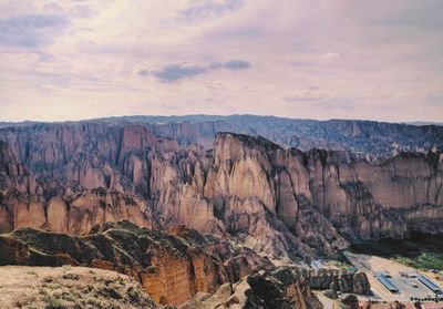
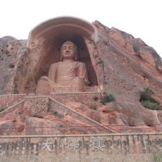
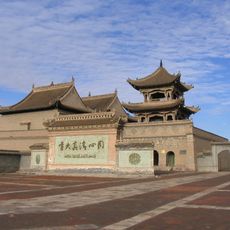
Huanghe Shilin National Geopark, National geopark in Jingtai County, China.
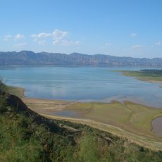
Huanghe Shilin National Geopark is a protected geological site in Jingtai County, Gansu Province, known for its dense clusters of stone columns, natural rock arches, and layers of colored mineral deposits. The formations were shaped by erosion and sediment from the Yellow River, revealing a wide range of rock types stacked in visible layers.
The rock formations were carved over millions of years by the Yellow River, which slowly wore away softer sediment and left behind the harder stone cores. The area received its national geopark status in 2004, which marked the start of organized protection and visitor access.
The name Shilin means "stone forest" in Chinese, and that description fits well with what you see when walking between the tall rock columns. Along the paths, you can sometimes spot inscriptions and small engravings left by visitors over many years.
The park has wooden walkways and viewing platforms that make the main areas reachable, but some paths are steep and uneven. Solid footwear is a good idea, and arriving early in the day helps avoid the busiest periods.
Although the park sits far from any coast, some of the rock layers contain fossil deposits from a time when this region was covered by water. These marine traces are visible in the exposed stone and point to a past that looks nothing like the dry landscape you see today.
The community of curious travelers
AroundUs brings together thousands of curated places, local tips, and hidden gems, enriched daily by 60,000 contributors worldwide.