Topography of Terror, Military museum in Kreuzberg, Germany
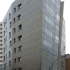
Topography of Terror is a documentation center on Niederkirchnerstrasse in Kreuzberg, built on the site of the Gestapo headquarters. Its long, single-story rectangular building has a facade of light grey vertical panels and frosted glass set in thin white frames. A recessed glass entryway with dark metal framing sits at ground level, and a concrete parapet wall with louvered vents runs diagonally in front, with grey gravel between wall and building.
The site housed command centers of the Gestapo, SS leadership, and Reich Security Main Office from 1933, organizing persecution and deportations from this location. After the war, the destroyed buildings lay vacant for decades until a provisional exhibition opened in 1987 and the current center was completed in 2010.
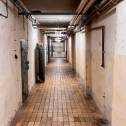
The name refers to the systematic mapping and persecution carried out by Nazi security organizations headquartered at this location. Visitors today can walk past information panels along the basement ruins that explain how interrogations and deportations originated from this address.
The documentation center stands at Niederkirchnerstraße 8, between the Gropius Bau and the preserved 200-meter stretch of the Berlin Wall. The open-air exhibition is set in a trench beneath the Wall along Niederkirchnerstraße, while the indoor permanent exhibition occupies the 800-cubic-meter hall. The site is bordered by Wilhelmstraße to the east and lies about a kilometer south of the Brandenburg Gate.
The 200-metre stretch of Berlin Wall along Niederkirchnerstraße is the longest surviving section of the outer wall; the longer East Side Gallery belonged to the inner wall and was not visible from West Berlin. The open-air exhibition is set in the trench directly beneath it.
The community of curious travelers
AroundUs brings together thousands of curated places, local tips, and hidden gems, enriched daily by 92,681 contributors worldwide.