Eschkopf, Mountain summit in Rhineland-Palatinate, Germany
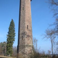
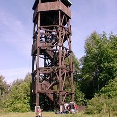
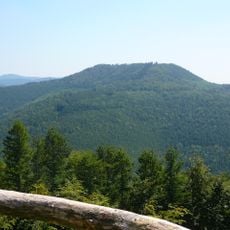
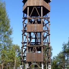
Eschkopf is a 608.3 m high hill in the Palatine Forest, the northernmost of four peaks exceeding 600 m in the Frankenweide massif. Its plateau-like summit holds a 20 m observation tower built in 1902, reached by 98 steps, and about 1 km northeast stands a radar tower of Deutsche Flugsicherung at 585.3 m.
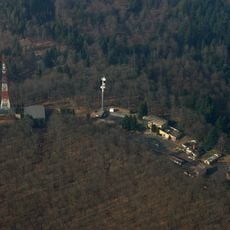
The Eschkopf is the northernmost of four peaks over 600 m in the Frankenweide, the central massif of the Palatine Forest; the Palatine Watershed between the Rhine and Moselle runs over its summit. Its 20 m tower was built in 1902 for surveying and now serves as an observation tower with 98 steps. About 1 km northeast, at 585.3 m, stands the tower of the Pfälzer Wald secondary radar facility of Deutsche Flugsicherung.
The Eschkopf lies on the main Palatine Watershed, so rain falling on its slopes drains either to the Rhine or, via the Blies, Saar and Mosel, to the Rhine's own mouth. The European long-distance path E8 and the Franken-Hessen-Kurpfalz trail pass just south of the summit, and the 98-step tower gives walkers a view from the Donnersberg to the Kalmit and into Alsace.
The Eschkopfturm, built in 1902, has 98 steps to its viewing platform. The B 48 passes just north and east of the summit and reaches 549.5 m on the north flank. A bus stop at the Iggelbach junction is served twice on Sundays and public holidays in summer from Neustadt an der Weinstraße. The E8 and Franken-Hessen-Kurpfalz long-distance trails run a little south of the top.
The 20-metre Eschkopf Tower was built in 1902 for surveying and has 98 steps; from its platform the view runs from the Donnersberg in the north over the Kalmit in the east to Alsace in the south. About 1 km northeast, at 585.3 m, stands the tower of the Pfälzer Wald secondary radar facility of Deutsche Flugsicherung.
The community of curious travelers
AroundUs brings together thousands of curated places, local tips, and hidden gems, enriched daily by 94,638 contributors worldwide.