Arrondissement of Saint-Dié-des-Vosges
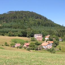
Arrondissement of Saint-Dié-des-Vosges, arrondissement of France
Location: Vosges
Capital city: Saint-Dié-des-Vosges
Shares border with: arrondissement of Lunéville, arrondissement of Molsheim, arrondissement of Sélestat-Erstein, arrondissement of Colmar-Ribeauvillé, arrondissement of Thann-Guebwiller, arrondissement of Épinal
GPS coordinates: 48.28330,6.95000
Latest update: March 10, 2025 17:38
Lac de Pierre-Percée
20.6 km
Mont Donon
30 km
Route des Crêtes
24.4 km
Hohneck
27.8 km
Ballons des Vosges Regional Natural Park
22.9 km
Fraispertuis City
17 km
Murbach Abbey
43 km
Château de Saulxures
39.8 km
Lac Noir
21.9 km
Lac de Kruth-Wildenstein
36.5 km
Saint-Dié Cathedral
625 m
Camp celtique de la Bure
4.9 km
Sentier des Roches
26.2 km
Petit Ballon
36.1 km
Timber Drop
17 km
Linge Memorial
26.3 km
Abbaye de Moyenmoutier
10.9 km
Climont
18.6 km
Champ de Roches
18.3 km
Saint Mont
37.4 km
Senones Abbey
12.5 km
Abbaye Notre-Dame d'Autrey
19.5 km
Saut du Bouchot
33.6 km
Musée Pierre-Noël de Saint-Dié-des-Vosges
616 m
Château de Salm
23.5 km
Église Saint-Léger, ancienne abbatiale de Murbach
42.9 km
Le Tanet
23.5 km
Cascade de la Pissoire
30.1 kmVisited this place? Tap the stars to rate it and share your experience / photos with the community! Try now! You can cancel it anytime.
Discover hidden gems everywhere you go!
From secret cafés to breathtaking viewpoints, skip the crowded tourist spots and find places that match your style. Our app makes it easy with voice search, smart filtering, route optimization, and insider tips from travelers worldwide. Download now for the complete mobile experience.
A unique approach to discovering new places❞
— Le Figaro
All the places worth exploring❞
— France Info
A tailor-made excursion in just a few clicks❞
— 20 Minutes