Roche de la Muzelle

Log in to your account

AroundUs is a community-driven map of interesting places, built by curious explorers like you. It grows with every review, story, and photo you share.
Connect to save your favorite spots, contribute locations, and create personalized routes.
Continue with Google
Continue with Apple
Continue with X
Continue with Facebook
Continue with email
By continuing, you accept our Terms and Conditions and our Privacy Policy
Create an account

Roche de la Muzelle

Add to collection
Map
Suggest a change
Share

Roche de la Muzelle, Mountain summit in Isère, France

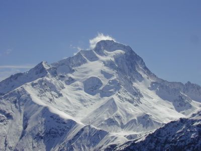
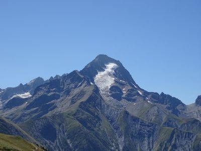
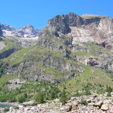
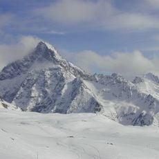
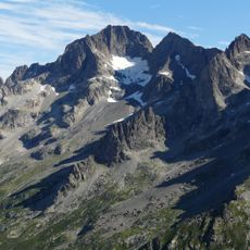
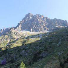
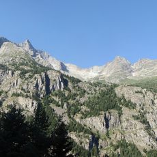
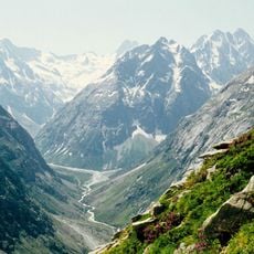
Roche de la Muzelle is a peak in the Massif des Écrins mountain range that reaches roughly 3,465 meters above sea level. The ascent passes through grassy terrain before reaching glacier-covered sections near the summit, with expansive views across the surrounding mountains and valleys.

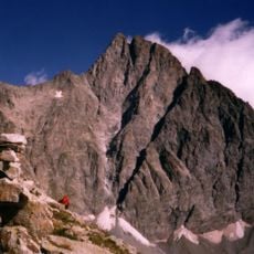
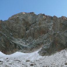
The mountain was first climbed in 1875 by English climbers accompanied by experienced guides from the Swiss Alps. The northeast ridge route became a popular path for mountaineers in the following decades.

The mountain serves as a symbol of French alpinism, with its northeast ridge route established by mountaineers Bouvier and Clerc in 1928.

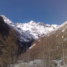
Start your climb from a mountain refuge at roughly 2,115 meters elevation, ascending through grassy slopes before reaching glacier terrain. The best climbing season runs from summer through early fall when glacier conditions are more stable and safer for travel.

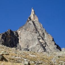
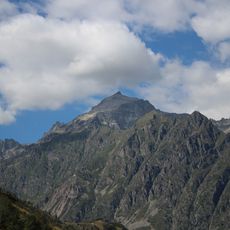
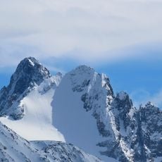
The summit has a distinctive pyramid-shaped silhouette that stands out clearly from the surrounding mountains. A permanent glacier covers the northern face, creating an striking visual feature visible from many vantage points in the region.

Location: Isère

Elevation above the sea: 3,465 m

GPS coordinates: 44.93067,6.10613

Latest update: December 14, 2025 11:05

Photos
Reviews

Visited this place? Tap the stars to rate it and share your experience / photos with the community! Try now! You can cancel it anytime.

« Roche de la Muzelle - Mountain summit in Isère, France » is provided by Around Us (aroundus.com). Images and texts are derived from Wikimedia project under a Creative Commons license. You are allowed to copy, distribute, and modify copies of this page, under the conditions set by the license, as long as this note is clearly visible.

Discover hidden gems everywhere you go!

From secret cafés to breathtaking viewpoints, skip the crowded tourist spots and find places that match your style. Our app makes it easy with voice search, smart filtering, route optimization, and insider tips from travelers worldwide. Download now for the complete mobile experience.

Around Us App Screenshot

A unique approach to discovering new places

Le Figaro

All the places worth exploring

France Info

A tailor-made excursion in just a few clicks

20 Minutes