Enable Location

We need your location to show you interesting places around you

Discover nearby places

Find interesting locations and hidden gems around you

Precise directions

Get accurate directions and distances to places

Your location is never shared with other users. It's only used when you tap the location button.

Pointe du Fréjus

Log in to your account

Start exploring — it's free

Trusted by 63,162 travelers worldwide

Continue with Google
Continue with Apple
or

We will send you a code to connect

By continuing, you accept our Terms and Conditions and our Privacy Policy

Check your inbox

We've sent a pincode in your inbox. Please enter the code below.

Pointe du Fréjus
Discussion Reviews 2 Photos
1.9k Popularity

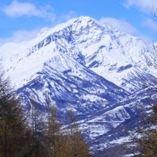
Pointe du Fréjus, Mountain summit in Cottian Alps, France-Italy border.

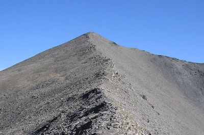
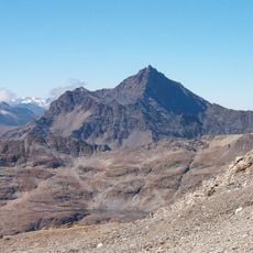
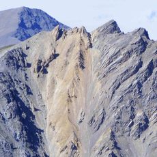
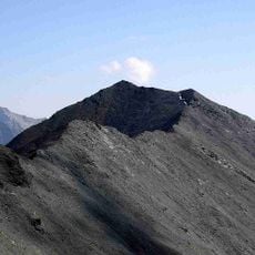
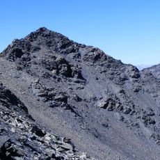
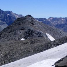
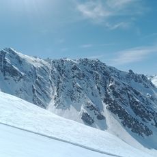
Pointe du Fréjus is a mountain summit in the Cottian Alps at 2936 meters elevation that marks the border between Modane, France and Bardonecchia, Italy. The peak features distinct slopes on each side with alpine meadows and rocky terrain characteristic of high mountain areas.

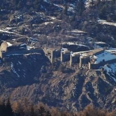
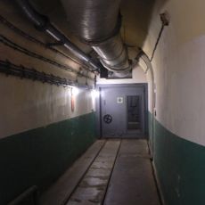
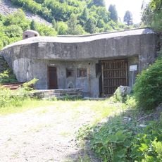
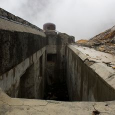
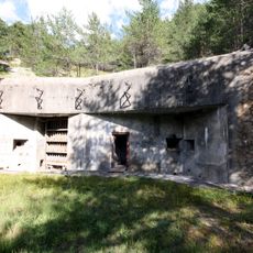
The mountain pass near the summit became a military frontier zone during World War II between French and Italian forces. Abandoned barracks and fortifications from that period still stand as reminders of the area's strategic importance.

The summit carries two names reflecting its border location: Pointe du Fréjus on the French side and Monte Frejus on the Italian side. Visitors experience this dual identity through the different routes and landscapes that characterize each approach.

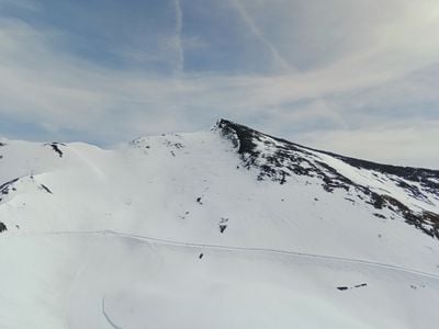
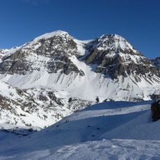
The French side near Modane allows vehicle access on unpaved roads for those with suitable vehicles, while hiking is also possible. The Italian approach from Bardonecchia offers only hiking trails, so visitors should plan for a full hiking day with proper equipment.

Near the summit sits a small alpine lake called Petit lac du Frejus, topped by a cross marking this international border point. The cross is visible from far away on clear days and serves as a landmark for climbers approaching from either side.

The community of curious travelers

AroundUs brings together thousands of curated places, local tips, and hidden gems, enriched daily by 60,000 contributors worldwide.

Start exploring
Location
Location
Elevation above the sea
2,936 m
Part of
France–Italy border
GPS coordinates
45.14032,6.68043
Latest update
December 14, 2025 11:00
Reviews
Share your experience

No review yet

Discussions
Start a discussion...

No discussion yet

« Pointe du Fréjus - Mountain summit in Cottian Alps, France-Italy border » is provided by Around Us (aroundus.com). Images and texts are derived from Wikimedia project under a Creative Commons license. You are allowed to copy, distribute, and modify copies of this page, under the conditions set by the license, as long as this note is clearly visible.

Discover hidden gems everywhere you go!

From secret cafés to breathtaking viewpoints, skip the crowded tourist spots and find places that match your style. Our app makes it easy with voice search, smart filtering, route optimization, and insider tips from travelers worldwide. Download now for the complete mobile experience.

Around Us App Screenshot

A unique approach to discovering new places

Le Figaro

All the places worth exploring

France Info

A tailor-made excursion in just a few clicks

20 Minutes

Around Us
Travel Guide & Maps
Download

Send to your phone

QR Code
1

Open the camera app on your mobile.

2

Point at the QR code with your camera. A notification will appear.

3

Tap the notification to open the link.