Chest opened
+${chestReward.xp} XP
Explorer
NOUVEAU ×${chestReward.collectible.quantity}
tapez pour fermer

See the monuments around you in AR Open chests in the app

Around Us is built for your phone — point your camera at the streets and discover the monuments and places around you in augmented reality. Around Us is built for your phone — chests unlock when you walk, explore and capture nearby places.

•

Enable Location

We need your location to show you interesting places around you

Discover nearby places

Find interesting locations and hidden gems around you

Precise directions

Get accurate directions and distances to places

Your location is never shared with other users. It's only used when you tap the location button.

Kippure

Log in to your account

Start exploring — it's free

Trusted by 94,441 travelers worldwide

Continue with Google
Continue with Apple
or

We will send you a code to connect

By continuing, you accept our Terms and Conditions and our Privacy Policy

Check your inbox

We've sent a pincode in your inbox. Please enter the code below.

Kippure

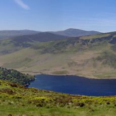
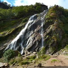
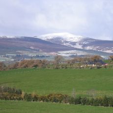
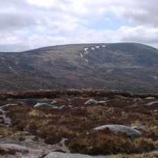
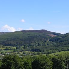
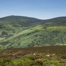
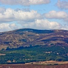
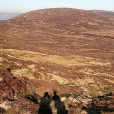
Kippure, Mountain summit in County Wicklow, Ireland.

Kippure is a 757-metre summit on the Dublin–Wicklow county border, the highest point of County Dublin and the 56th-highest peak in Ireland on the Arderin scale. Its massif forms the head of Glencree to the east and Glenasmole to the north, and two corrie lakes, Lough Bray Upper and Lough Bray Lower, lie on its north-east flank. A 127-metre television and radio mast stands on the summit.

A television transmitter was built on the summit in the late 1950s and began broadcasting in December 1961, making this the first television transmission site in Ireland. The transmitter station has remained a landmark on the mountain ever since.

The mountain's name derives from Irish Gaelic 'Cipiúr' and serves as a geographical boundary between County Dublin and County Wicklow.

The summit is reached by a path off the R115, the Military Road, on the route to the Sally Gap. The access road to the transmitter was built in 1959. The mountain is exposed, and the Liffey Head Bog on its slopes is the source of the River Liffey.

Kippure's summit holds a 127-metre television and radio mast, built after the Board of Works laid an access road in 1959 and Pye Ltd began installation. Test transmissions in summer 1961 showed slides of Ireland, a test card and music by Count John McCormack. Telefís Éireann opened from here on 31 December 1961, the first of its five main transmitters.

The community of curious travelers

AroundUs brings together thousands of curated places, local tips, and hidden gems, enriched daily by 94,441 contributors worldwide.

Start exploring
GPS coordinates
53.17814,-6.33188
Latest update
October 24, 2026 13:39
Reviews
Share your experience

No review yet

Discussions
Start a discussion...

No discussion yet

« Kippure - Mountain summit in County Wicklow, Ireland » is provided by Around Us (aroundus.com). Images and texts are derived from Wikimedia project under a Creative Commons license. You are allowed to copy, distribute, and modify copies of this page, under the conditions set by the license, as long as this note is clearly visible.

Discover hidden gems everywhere you go!

From secret cafés to breathtaking viewpoints, skip the crowded tourist spots and find places that match your style. Our app makes it easy with voice search, smart filtering, route optimization, and insider tips from travelers worldwide. Download now for the complete mobile experience.
Around Us App Screenshot
❝

A unique approach to discovering new places❞

— Le Figaro

❝

All the places worth exploring❞

— France Info

❝

A tailor-made excursion in just a few clicks❞

— 20 Minutes

Around Us
Travel Guide & Maps
Download

Send to your phone

QR Code
1

Open the camera app on your mobile.

2

Point at the QR code with your camera. A notification will appear.

3

Tap the notification to open the link.