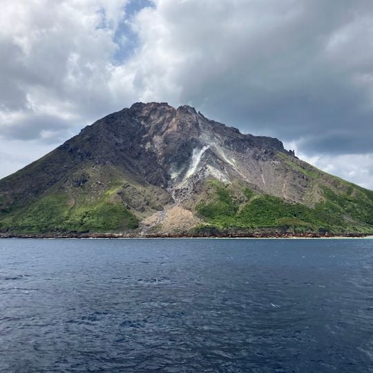
Kikai Caldera, Submerged caldera in Osumi Strait, Japan
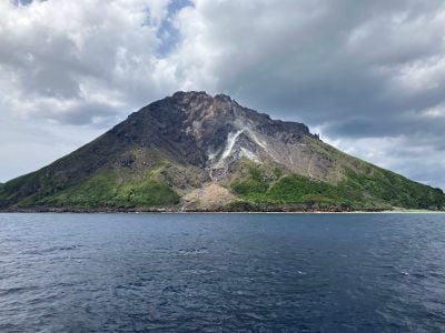
Kikai Caldera is a mostly submerged caldera in the Ōsumi Strait, about 50 km south of the Satsuma Peninsula. Its rim is formed by Satsuma Iōjima and Takeshima, the only parts above sea level. The caldera is roughly 20 km across and has a twin structure: an outer caldera and an inner one formed about 7,300 years ago. The seafloor inside lies 400–500 m deep.
The depression formed through a massive eruption around 7,300 years ago that covered much of southern Japan with volcanic ash. This eruption ranks among the largest events of the Holocene and permanently altered the landscape of the surrounding regions.
The name comes from Kikaigashima, the "island of the demon world" of old legends, not from today's Kikai Island far to the south. Geologist Matsumoto Tadakazu, who surveyed these islands in the early Showa years, named the structure Kikai Volcano after that legendary island and proposed the term Kikai Caldera to the academic world in 1943. In September 2015 the area was certified as the Mishima Village–Kikai Caldera Geopark, one of Japan's national geoparks.
The submerged structure is not directly accessible to visitors, but Satsuma Iōjima island offers a vantage point over the active volcanic fields within the larger formation. Boat trips to the area depend on weather conditions and current volcanic activity, which local authorities assess.
A large dome of solidified lava rises in the center of the submerged depression and continuously releases hot gas clouds documented through underwater robot studies. This ongoing degassing shows that magma remains present deep beneath the ocean floor.
The community of curious travelers
AroundUs brings together thousands of curated places, local tips, and hidden gems, enriched daily by 92,514 contributors worldwide.