Chest opened
+${chestReward.xp} XP
Explorer
NOUVEAU ×${chestReward.collectible.quantity}
tapez pour fermer
Chest locked

Open chests in the app

Around Us is built for your phone — chests unlock when you walk, explore and capture nearby places.

Enable Location

We need your location to show you interesting places around you

Discover nearby places

Find interesting locations and hidden gems around you

Precise directions

Get accurate directions and distances to places

Your location is never shared with other users. It's only used when you tap the location button.

Mount Tate

Log in to your account

Start exploring — it's free

Trusted by 72,888 travelers worldwide

Continue with Google
Continue with Apple
or

We will send you a code to connect

By continuing, you accept our Terms and Conditions and our Privacy Policy

Check your inbox

We've sent a pincode in your inbox. Please enter the code below.

Mount Tate
Discussion Reviews 3 Photos
96.4k Popularity

Mount Tate, Sacred mountain in Toyama Prefecture, Japan.

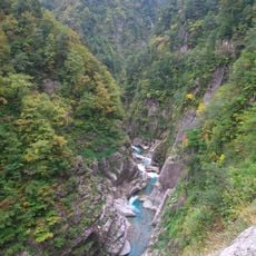
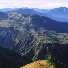
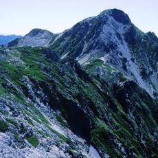
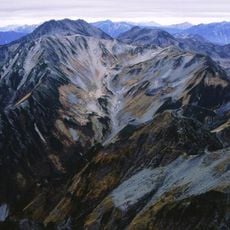
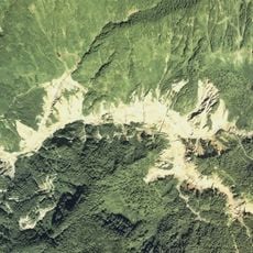
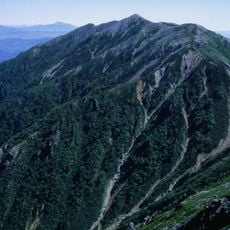
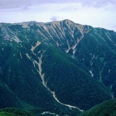
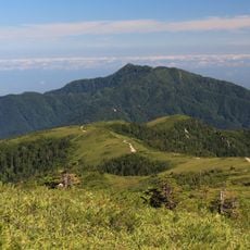
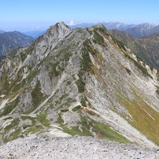
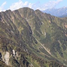
Mount Tate is a sacred mountain in Toyama Prefecture that rises to 3015 meters and consists of three distinct peaks forming a long ridge line in the Hida Mountains. The steep rock faces and deep valleys are laced with snowfields that remain visible on the northern slopes well into summer.

Saeki no Ariyori completed the first documented ascent in the 8th century and made the mountain an important destination for Buddhist ascetics. Over the following centuries this place became a major pilgrimage center with trails and shrines built along the entire route.

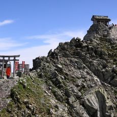
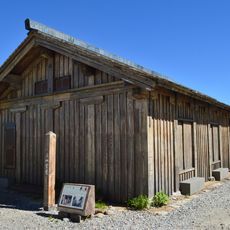
The name Tate means standing upright in Japanese and has been revered as a sacred place for centuries. Hikers notice the Oyama Shrine at the summit and smaller prayer altars along the trails where pilgrims leave offerings and pray for safe return.

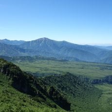
The Tateyama Kurobe Alpine Route provides access from April to November and starts from either Toyama Station or Ogizawa Station. In dry weather the trails are easy to walk but hikers should bring warm clothing and sturdy footwear as temperatures at altitude can remain cool even in summer.

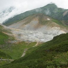
Japanese scientists have identified several glaciers here formed by exceptional snow accumulation on the Murodo Plateau at 2450 meters. These ice formations lie hidden beneath the surface and are revealed through special radar surveys.

The community of curious travelers

AroundUs brings together thousands of curated places, local tips, and hidden gems, enriched daily by 60,000 contributors worldwide.

Start exploring
Location
Elevation above the sea
3,015 m
Part of
Three Holy Mountains, 100 Famous Japanese Mountains, New 100 Famous Japanese Mountains, Hana no Hyaku Meizan, 100 Famous First Order Triangulation Station Mountains, 富山の百山
GPS coordinates
36.57583,137.61972
Latest update
December 12, 2025 23:40
Reviews
Share your experience

No review yet

Discussions
Start a discussion...

No discussion yet

« Mount Tate - Sacred mountain in Toyama Prefecture, Japan » is provided by Around Us (aroundus.com). Images and texts are derived from Wikimedia project under a Creative Commons license. You are allowed to copy, distribute, and modify copies of this page, under the conditions set by the license, as long as this note is clearly visible.

Discover hidden gems everywhere you go!

From secret cafés to breathtaking viewpoints, skip the crowded tourist spots and find places that match your style. Our app makes it easy with voice search, smart filtering, route optimization, and insider tips from travelers worldwide. Download now for the complete mobile experience.

Around Us App Screenshot

A unique approach to discovering new places

Le Figaro

All the places worth exploring

France Info

A tailor-made excursion in just a few clicks

20 Minutes

Around Us
Travel Guide & Maps
Download

Send to your phone

QR Code
1

Open the camera app on your mobile.

2

Point at the QR code with your camera. A notification will appear.

3

Tap the notification to open the link.