Chest opened
+${chestReward.xp} XP
Explorer
NOUVEAU ×${chestReward.collectible.quantity}
tapez pour fermer
Chest locked

Open chests in the app

Around Us is built for your phone — chests unlock when you walk, explore and capture nearby places.

Enable Location

We need your location to show you interesting places around you

Discover nearby places

Find interesting locations and hidden gems around you

Precise directions

Get accurate directions and distances to places

Your location is never shared with other users. It's only used when you tap the location button.

South Aral Sea

Log in to your account

Start exploring — it's free

Trusted by 72,994 travelers worldwide

Continue with Google
Continue with Apple
or

We will send you a code to connect

By continuing, you accept our Terms and Conditions and our Privacy Policy

Check your inbox

We've sent a pincode in your inbox. Please enter the code below.

South Aral Sea
Discussion Reviews 2 Photos
35k Popularity

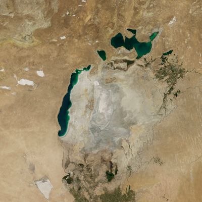
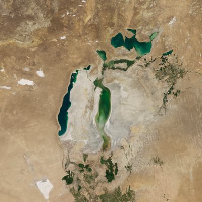
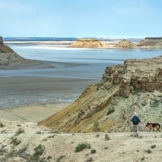
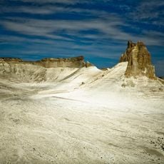
South Aral Sea, Former lake between Kazakhstan and Uzbekistan

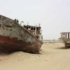
The South Aral Sea is a former water body that once lay across Aktobe, Kyzylorda, and Karakalpakstan, marking the border between Kazakhstan and Uzbekistan. What remains is a flat, barren landscape of exposed seabed, ghostly shorelines, and the scattered remnants of villages that once thrived along its waters.

Soviet irrigation schemes starting in the 1960s diverted the Amu Darya and Syr Darya rivers to grow cotton, setting the sea on a path of steady decline. Over the next decades this process accelerated, transforming a thriving body of water into a dry basin that reshaped the lives of millions in the region.

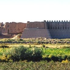
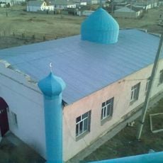
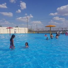
The people living here, Kazakhs and Uzbeks, once built their lives around fishing and trade on these waters, seeing their practices disappear as the lake shrank. Today you can still sense this lost connection in the small settlements that dot the former shoreline.

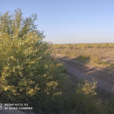
The best time to visit is between April and September when weather conditions are dry and temperatures are more comfortable. You can reach the former shoreline from Aralsk in Kazakhstan or Muynak in Uzbekistan, and sturdy footwear plus plenty of water are essential for crossing the barren landscape.

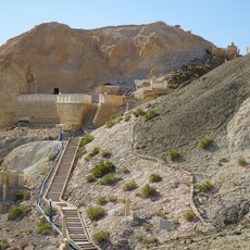
The eastern basin of the dried seabed transformed into the Aralkum Desert, a new landscape that satellite imagery has tracked since the shrinkage began. This shift shows how rapidly human activity and natural processes can reshape an entire ecosystem.

The community of curious travelers

AroundUs brings together thousands of curated places, local tips, and hidden gems, enriched daily by 60,000 contributors worldwide.

Start exploring
Location
Location
Location
GPS coordinates
45.00000,58.50000
Latest update
December 19, 2025 22:21
Reviews
Share your experience

No review yet

Discussions
Start a discussion...

No discussion yet

« South Aral Sea - Former lake between Kazakhstan and Uzbekistan » is provided by Around Us (aroundus.com). Images and texts are derived from Wikimedia project under a Creative Commons license. You are allowed to copy, distribute, and modify copies of this page, under the conditions set by the license, as long as this note is clearly visible.

Discover hidden gems everywhere you go!

From secret cafés to breathtaking viewpoints, skip the crowded tourist spots and find places that match your style. Our app makes it easy with voice search, smart filtering, route optimization, and insider tips from travelers worldwide. Download now for the complete mobile experience.

Around Us App Screenshot

A unique approach to discovering new places

Le Figaro

All the places worth exploring

France Info

A tailor-made excursion in just a few clicks

20 Minutes

Around Us
Travel Guide & Maps
Download

Send to your phone

QR Code
1

Open the camera app on your mobile.

2

Point at the QR code with your camera. A notification will appear.

3

Tap the notification to open the link.