Enable Location

We need your location to show you interesting places around you

Discover nearby places

Find interesting locations and hidden gems around you

Precise directions

Get accurate directions and distances to places

Your location is never shared with other users. It's only used when you tap the location button.

La Rumorosa

Log in to your account

Save your favorite places
Create custom travel routes
Rate and review places
Access the full interactive map
Continue with Google
Continue with Apple
Continue with email
By continuing, you accept our Terms and Conditions and our Privacy Policy
Create an account
Add to collection
Map
Suggest a change
Share

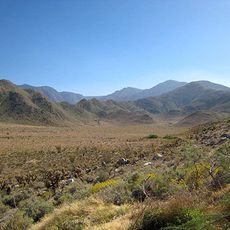
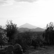
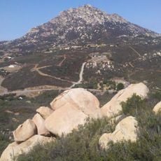
La Rumorosa, Mountain town in Tecate, Mexico

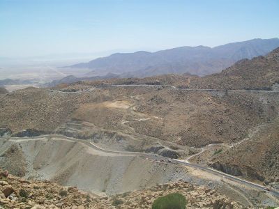
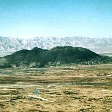
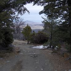
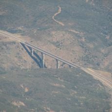
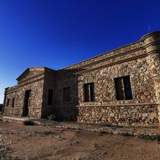
La Rumorosa is a mountain settlement in Baja California's Sierra de Juárez range, sitting at roughly 1,250 meters (4,100 feet) elevation on rocky terrain. The town functions as a waypoint along Federal Highway 2D, which connects Mexicali with Tecate through the mountain pass.

A road was built through the Sierra de Juárez in 1917, creating the first direct land route between Tijuana and central Mexico without crossing into the United States. This connection later enabled the settlement to develop as a key stopping point along this important passage.

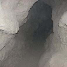
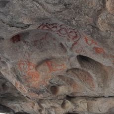
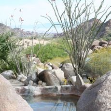
The El Vallecito archaeological site preserves cave paintings created by indigenous peoples in earlier centuries, with figures like the Rooted Man visible on rock surfaces. These artworks reveal how people once understood and represented their world in this mountain region.

The settlement is located directly on Federal Highway 2D and provides travelers with gas stations, shops, and food options. Winter conditions can make the mountain pass slippery, so vehicles with good traction are advisable for safe passage.

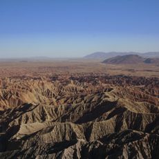
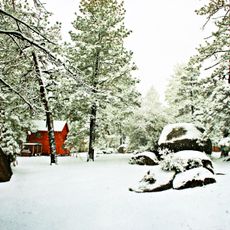
Winter snow accumulates noticeably at this high elevation, creating an alpine environment in what is otherwise a desert region. This phenomenon catches many visitors by surprise, as they do not expect such weather conditions in Baja California.

Location: Tecate

GPS coordinates: 32.52340,-116.05940

Latest update: December 14, 2025 20:22

Photos
Around this place
Show the full map
Reviews

Visited this place? Tap the stars to rate it and share your experience / photos with the community! Try now! You can cancel it anytime.

« La Rumorosa - Mountain town in Tecate, Mexico » is provided by Around Us (aroundus.com). Images and texts are derived from Wikimedia project under a Creative Commons license. You are allowed to copy, distribute, and modify copies of this page, under the conditions set by the license, as long as this note is clearly visible.

Discover hidden gems everywhere you go!

From secret cafés to breathtaking viewpoints, skip the crowded tourist spots and find places that match your style. Our app makes it easy with voice search, smart filtering, route optimization, and insider tips from travelers worldwide. Download now for the complete mobile experience.

Around Us App Screenshot

A unique approach to discovering new places

Le Figaro

All the places worth exploring

France Info

A tailor-made excursion in just a few clicks

20 Minutes