Baltoro Glacier, Glacier in Gilgit-Baltistan, Pakistan.
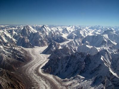
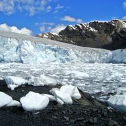
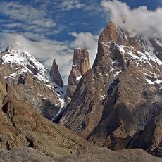
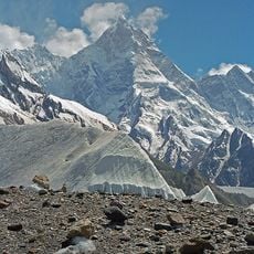
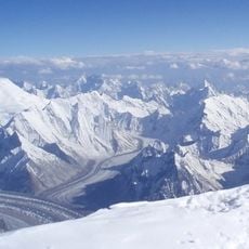
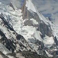
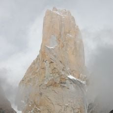
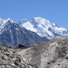
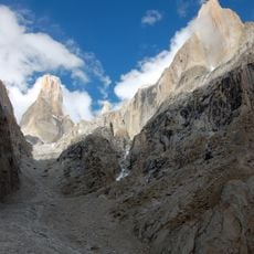
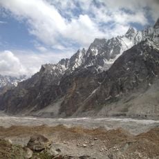
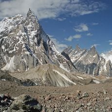
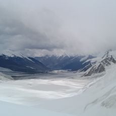
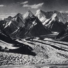
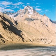
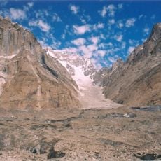
Baltoro Glacier is a glacier in Gilgit-Baltistan, Pakistan, extending more than 60 kilometers through the Karakoram mountains. The ice sheet runs between steep rock walls and forms one of the longest glacier highways outside the polar regions, surrounded by tall peaks and side valleys.
Since the early 20th century the glacier valley has served as the main access route for climbers heading toward the highest peaks in the region. European expeditions first mapped the route in the early 1900s, laying the groundwork for later summit attempts.
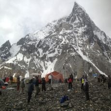
The local population names the glacier after old mountain traditions in their language, and to this day experienced porters from nearby villages accompany expeditions across the ice. These guides know the changing conditions from decades of experience and pass their knowledge of safe routes within their families.
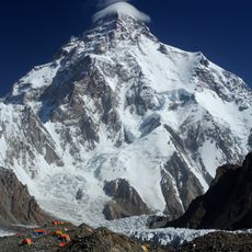
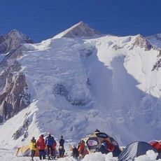
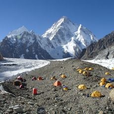
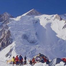
Travelers need official permission from Pakistani authorities and should plan their expedition for the months between June and September when temperatures make crossing the ice easier. The trek across the glacier takes several days and requires equipment for extreme altitudes.
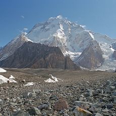
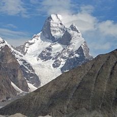
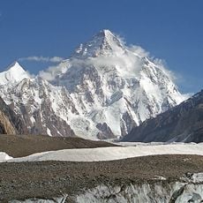
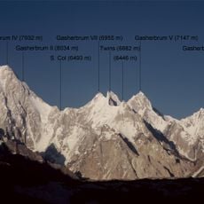
At the junction with the Godwin-Austen Glacier a natural plaza called Concordia forms, where the highest concentration of peaks above 7000 meters shapes the landscape. This spot is often described as an amphitheater of ice and rock, with mountains rising in a wide circle around the flat glacier surface.
Location: Gilgit-Baltistan
GPS coordinates: 35.73639,76.38083
Latest update: December 5, 2025 22:23
Glaciers represent some of the most remarkable natural formations on Earth. These ice masses form over centuries through the compression of snow and move slowly through valleys and across mountain slopes. They shape landscapes from the Patagonian Andes to Arctic regions and store approximately 70 percent of the world's freshwater. The Perito Moreno Glacier in Argentina covers 250 square kilometers and ranks among the few glaciers currently not retreating. The Jostedalsbreen in Norway forms the largest ice mass on mainland Europe at 487 square kilometers. The Vatnajökull in Iceland covers eight percent of the country's land area and conceals several active volcanoes beneath its ice cap. These glaciers serve science as climate archives and demonstrate through their changes the effects of rising temperatures. Many glaciers worldwide continuously lose mass, which has consequences for water supply and sea levels.
K2
20.2 km
Broad Peak
18.8 km
Trango Towers
16.4 km
Gasherbrum II
24.7 km
Masherbrum
12.3 km
Godwin-Austen Glacier
14.2 km
Chogolisa
22.2 km
Concordia
13.1 km
Muztagh Tower
10.4 km
Central Karakoram National Park
20.4 km
Gasherbrum III
23.7 km
Laila Peak
16.1 km
Trango Tower
17.6 km
Broad Peak Central
19.1 km
Skil Brum
13.4 km
Gasherbrum V
21.1 km
Great Trango Tower
16.4 km
Gasherbrum VI
22.9 km
Trango Glacier
23.5 km
Gondogoro Glacier
16.8 km
Biarchedi
6.8 km
Sarpo Laggo Glacier
20.2 km
Praqpa Kangri
11.5 km
Gasherbrum VII
19.9 km
Gasherbrum II East
26 km
Paiju Peak
24 km
Marble Peak
10.3 km
Biale
14.9 kmReviews
Visited this place? Tap the stars to rate it and share your experience / photos with the community! Try now! You can cancel it anytime.
Discover hidden gems everywhere you go!
From secret cafés to breathtaking viewpoints, skip the crowded tourist spots and find places that match your style. Our app makes it easy with voice search, smart filtering, route optimization, and insider tips from travelers worldwide. Download now for the complete mobile experience.
A unique approach to discovering new places❞
— Le Figaro
All the places worth exploring❞
— France Info
A tailor-made excursion in just a few clicks❞
— 20 Minutes