Enable Location

We need your location to show you interesting places around you

Discover nearby places

Find interesting locations and hidden gems around you

Precise directions

Get accurate directions and distances to places

Your location is never shared with other users. It's only used when you tap the location button.

Kanjut Sar

Log in to your account

Start exploring — it's free

Trusted by 65,825 travelers worldwide

Continue with Google
Continue with Apple
or

We will send you a code to connect

By continuing, you accept our Terms and Conditions and our Privacy Policy

Check your inbox

We've sent a pincode in your inbox. Please enter the code below.

Kanjut Sar
Discussion Reviews 1 Photos
4.6k Popularity

Kanjut Sar, Mountain summit in Gilgit-Baltistan, Pakistan

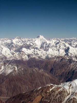
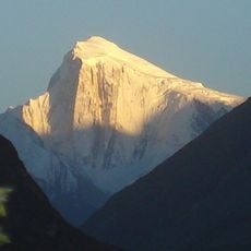
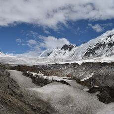
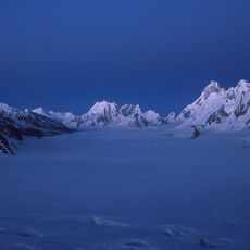
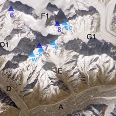
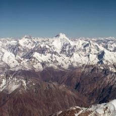
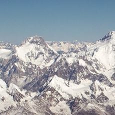
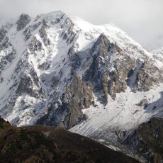
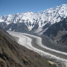
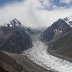
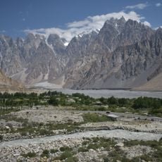
Kanjut Sar is a mountain peak in the Karakoram range, located on the border between Pakistan and China, rising to 7,760 meters (25,460 feet). Its upper slopes are covered in permanent snow and ice, with steep rock faces dropping sharply on all sides.

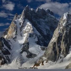
The first ascent was completed in 1959 by Italian climber Camillo Pellissier, as part of an expedition led by Guido Monzino. Since then, only a handful of teams have attempted the peak, making it one of the least-visited high summits in the Karakoram.

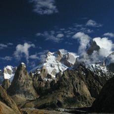
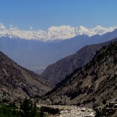
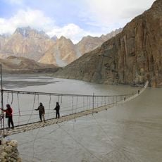
The name comes from the Wakhi language and refers to a peak overlooking the Hunza region. For local people, this mountain is part of the landscape that shapes their routes and connections through the high valleys.

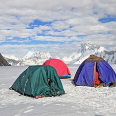
Climbing attempts are generally possible from May through August, when weather windows open up at high altitude, though conditions can shift quickly. A professional guide and proper acclimatization over several days are needed before any attempt on the upper mountain.

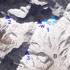
People from the nearby village of Shimshal often confuse this peak with the neighboring Yukshin Gardan Sar, partly because both summits look similar when seen from the valleys below. This local naming confusion shows how mountain communities develop their own geography, separate from what appears on official maps.

The community of curious travelers

AroundUs brings together thousands of curated places, local tips, and hidden gems, enriched daily by 60,000 contributors worldwide.

Start exploring
Location
Elevation above the sea
7,760 m
GPS coordinates
36.20517,75.41610
Latest update
March 3, 2026 08:12
Reviews
Share your experience

No review yet

Discussions
Start a discussion...

No discussion yet

« Kanjut Sar - Mountain summit in Gilgit-Baltistan, Pakistan » is provided by Around Us (aroundus.com). Images and texts are derived from Wikimedia project under a Creative Commons license. You are allowed to copy, distribute, and modify copies of this page, under the conditions set by the license, as long as this note is clearly visible.

Discover hidden gems everywhere you go!

From secret cafés to breathtaking viewpoints, skip the crowded tourist spots and find places that match your style. Our app makes it easy with voice search, smart filtering, route optimization, and insider tips from travelers worldwide. Download now for the complete mobile experience.

Around Us App Screenshot

A unique approach to discovering new places

Le Figaro

All the places worth exploring

France Info

A tailor-made excursion in just a few clicks

20 Minutes

Around Us
Travel Guide & Maps
Download

Send to your phone

QR Code
1

Open the camera app on your mobile.

2

Point at the QR code with your camera. A notification will appear.

3

Tap the notification to open the link.