
Zharai, summit in Pakistan
Location: Balochistan
Elevation above the sea: 2,657 m
GPS coordinates: 30.67639,67.68083
Latest update: March 9, 2025 16:38

Mehrgarh
142.1 km
Quaid-e-Azam Residency
33.2 km
Shrine of the Cloak
215.3 km
Kandahar Bilingual Rock Inscription
218.8 km
Camp Rhino
303.1 km
Mundigak
246.5 km
Takht-e-Sulaiman
242.3 km
Tarnak Farms
197.1 km
Gomal Zam Dam
262.3 km
Ghazni Minarets
329.2 km
Kalat Kali Temple
211.8 km
Citadel of Ghazni
327.4 km
Pirak
138.1 km
Ziarat Juniper Forest
31.4 km
Tomb of Ahmad Shah Durrani
215.3 km
Palace of Sultan Mas'ud III
329.8 km
Main Operating Base Price
323.3 km
Chil Zena
218.8 km
Quetta Cantonment
79 km
Mosque of the Hair of the Prophet
214.8 km
Forward Operating Base Arian
322.2 km
Quetta Fort
82.7 km
Karezat
280.3 km
Forward Operating Base Zeebrugge
309.8 km
Khalid Abad
289.2 km
Qalat City Fort
175.8 km
Mausoleum of Baba Wali
221.7 km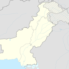
Kāla Pāni (tubud nga init)
229.9 kmReviews
Visited this place? Tap the stars to rate it and share your experience / photos with the community! Try now! You can cancel it anytime.
Discover hidden gems everywhere you go!
From secret cafés to breathtaking viewpoints, skip the crowded tourist spots and find places that match your style. Our app makes it easy with voice search, smart filtering, route optimization, and insider tips from travelers worldwide. Download now for the complete mobile experience.

A unique approach to discovering new places❞
— Le Figaro
All the places worth exploring❞
— France Info
A tailor-made excursion in just a few clicks❞
— 20 Minutes