
Dāru Khāk, summit in Pakistan
Location: Balochistan
Elevation above the sea: 2,486 m
GPS coordinates: 30.57000,67.63000
Latest update: March 14, 2025 01:58

Mehrgarh
130.1 km
Quaid-e-Azam Residency
23.1 km
Shrine of the Cloak
217.3 km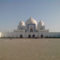
Bhutto family mausoleum
327.4 km
Kandahar Bilingual Rock Inscription
220.6 km
Camp Rhino
297.8 km
Mundigak
249.4 km
Takht-e-Sulaiman
252.3 km
Tarnak Farms
198.5 km
Gomal Zam Dam
273.4 km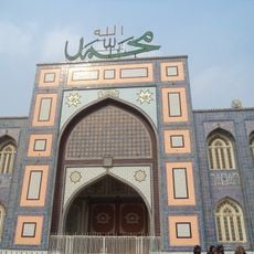
Bhong Mosque
325.5 km
Kalat Kali Temple
199.1 km
Pirak
127.1 km
Ziarat Juniper Forest
21.5 km
Tomb of Ahmad Shah Durrani
217.3 km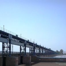
Panjnad
330.8 km
Main Operating Base Price
323.9 km
Chil Zena
220.6 km
Band E Sardeh Dam
317.7 km
Quetta Cantonment
68 km
Mosque of the Hair of the Prophet
216.8 km
Quetta Fort
71.8 km
Lashkar Gah Mosque
330.9 km
Karezat
269.2 km
Forward Operating Base Zeebrugge
311.9 km
Forward Operating Base Arnhem
331.1 km
Khalid Abad
291.2 km
Qalat City Fort
184.8 kmReviews
Visited this place? Tap the stars to rate it and share your experience / photos with the community! Try now! You can cancel it anytime.
Discover hidden gems everywhere you go!
From secret cafés to breathtaking viewpoints, skip the crowded tourist spots and find places that match your style. Our app makes it easy with voice search, smart filtering, route optimization, and insider tips from travelers worldwide. Download now for the complete mobile experience.

A unique approach to discovering new places❞
— Le Figaro
All the places worth exploring❞
— France Info
A tailor-made excursion in just a few clicks❞
— 20 Minutes