Chest opened
+${chestReward.xp} XP
Explorer
NOUVEAU ×${chestReward.collectible.quantity}
tapez pour fermer
Chest locked

Open chests in the app

Around Us is built for your phone — chests unlock when you walk, explore and capture nearby places.

Enable Location

We need your location to show you interesting places around you

Discover nearby places

Find interesting locations and hidden gems around you

Precise directions

Get accurate directions and distances to places

Your location is never shared with other users. It's only used when you tap the location button.

Raychikhinsk

Log in to your account

Start exploring — it's free

Trusted by 72,874 travelers worldwide

Continue with Google
Continue with Apple
or

We will send you a code to connect

By continuing, you accept our Terms and Conditions and our Privacy Policy

Check your inbox

We've sent a pincode in your inbox. Please enter the code below.

Raychikhinsk
Discussion Reviews 1 Photos
16.7k Popularity

Raychikhinsk, human settlement in Amur Oblast, Khabarovsk Krai, Russia

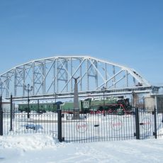
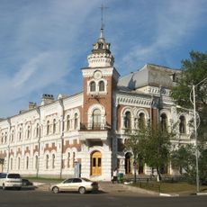
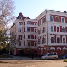
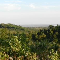
Raychikhinsk is a town in Amur Oblast, in Russia's Far East, that grew up around coal mining. It is laid out on flat ground with residential neighborhoods, industrial zones, and a mix of Soviet-era buildings alongside newer construction.

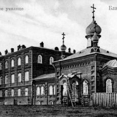
The settlement was first recorded in 1932 and received official town status in 1944. Its growth was driven by coal mining, which had begun in the surrounding valleys in the early 20th century.

The name of the town comes from the Raychikha River, which was itself named after a man called Raev who drowned in it. Daily life here revolves around work shifts and family routines, and neighbors tend to know each other well.

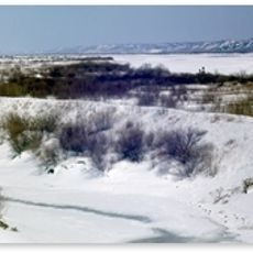
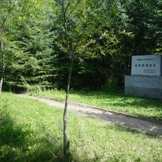
The town is not set up for tourists, but shops, markets, and basic eateries are easy to find and follow a steady daily schedule. The flat land around the town, with forests and open fields nearby, makes it easy to go for walks outside the built area.

In 2013, part of the town's territory was separated to form a new, independent settlement called Zelveino. This kind of administrative split is rare for a town of this size and shows how local boundaries can shift in response to demographic changes.

The community of curious travelers

AroundUs brings together thousands of curated places, local tips, and hidden gems, enriched daily by 60,000 contributors worldwide.

Start exploring
Location
Inception
1932
Elevation above the sea
200 m
GPS coordinates
49.80000,129.40000
Latest update
March 3, 2026 08:20
Around this place
China

Blagoveshchensk–Heihe Bridge

136.3 km
Khabarovsk Bridge
Russian Federation

Khabarovsk Bridge

431.1 km
Tongjiang-Nizhneleninskoye railway bridge
China

Tongjiang-Nizhneleninskoye railway bridge

316.5 km
Bastak Nature Reserve
Russian Federation

Bastak Nature Reserve

286 km
Triumphal arch in Blagoveshchensk
Russian Federation

Triumphal arch in Blagoveshchensk

143.6 km
Khingan Nature Reserve
Russian Federation

Khingan Nature Reserve

115.5 km
Bureinsky Ridge
Russian Federation

Bureinsky Ridge

389.8 km
Volochaevsky Memorial
Russian Federation

Volochaevsky Memorial

395.6 km
Мост через Амурскую протоку
Russian Federation

Мост через Амурскую протоку

430 km
Bureya Reservoir
Russian Federation

Bureya Reservoir

83.6 km
Nora Nature Reserve
Russian Federation

Nora Nature Reserve

307.1 km
Музей Амурского моста
Russian Federation

Музей Амурского моста

431.8 km
Wudalianchi Geological Park
China

Wudalianchi Geological Park

259.4 km
Road bridge over Zeya in Blagoveshchensk
Russian Federation

Road bridge over Zeya in Blagoveshchensk

141 km
Amur Oblast Local Museum
Russian Federation

Amur Oblast Local Museum

143.5 km
Blagoveshchensk State Pedagogical University
Russian Federation

Blagoveshchensk State Pedagogical University

142.3 km
Aihui History Museum
China

Aihui History Museum

138.2 km
Annunciation Cathedral
Russian Federation

Annunciation Cathedral

144.3 km
Beit T'shuva
Russian Federation

Beit T'shuva

281.3 km
Russian Federation

Памятник Муравьёву-Амурскому

143.3 km
Russian Federation

Музей истории пенсий

278.7 km
Aihui New City vestiges
China

Aihui New City vestiges

138.6 km
Victory Square
Russian Federation

Victory Square

279.9 km
Amur Stadium
Russian Federation

Amur Stadium

145.1 km
Cathedral of the Annunciation of the Blessed Virgin Mary
Russian Federation

Cathedral of the Annunciation of the Blessed Virgin Mary

144.3 km
Благовещенский заказник
Russian Federation

Благовещенский заказник

148.1 km
Церковь иконы Божией Матери «Всех скорбящих Радость»
Russian Federation

Церковь иконы Божией Матери «Всех скорбящих Радость»

141.3 km
Sifengshan Shuiku
China

Sifengshan Shuiku

346.7 km
Show the full map
Reviews
Share your experience

No review yet

Discussions
Start a discussion...

No discussion yet

« Raychikhinsk - human settlement in Amur Oblast, Khabarovsk Krai, Russia » is provided by Around Us (aroundus.com). Images and texts are derived from Wikimedia project under a Creative Commons license. You are allowed to copy, distribute, and modify copies of this page, under the conditions set by the license, as long as this note is clearly visible.

Discover hidden gems everywhere you go!

From secret cafés to breathtaking viewpoints, skip the crowded tourist spots and find places that match your style. Our app makes it easy with voice search, smart filtering, route optimization, and insider tips from travelers worldwide. Download now for the complete mobile experience.

Around Us App Screenshot

A unique approach to discovering new places

Le Figaro

All the places worth exploring

France Info

A tailor-made excursion in just a few clicks

20 Minutes

Around Us
Travel Guide & Maps
Download

Send to your phone

QR Code
1

Open the camera app on your mobile.

2

Point at the QR code with your camera. A notification will appear.

3

Tap the notification to open the link.