Chest opened
+${chestReward.xp} XP
Explorer
NOUVEAU ×${chestReward.collectible.quantity}
tapez pour fermer
Chest locked

Open chests in the app

Around Us is built for your phone — chests unlock when you walk, explore and capture nearby places.

Enable Location

We need your location to show you interesting places around you

Discover nearby places

Find interesting locations and hidden gems around you

Precise directions

Get accurate directions and distances to places

Your location is never shared with other users. It's only used when you tap the location button.

Stanovoy Range

Log in to your account

Start exploring — it's free

Trusted by 72,887 travelers worldwide

Continue with Google
Continue with Apple
or

We will send you a code to connect

By continuing, you accept our Terms and Conditions and our Privacy Policy

Check your inbox

We've sent a pincode in your inbox. Please enter the code below.

Stanovoy Range
Discussion Reviews 1 Photos
14.6k Popularity

Stanovoy Range, Mountain range in Sakha and Amur Oblast, Russia

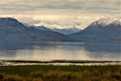
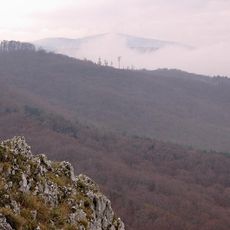
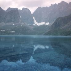
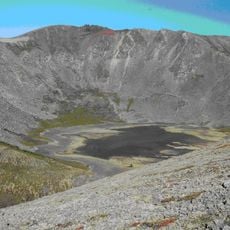
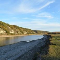
Stanovoy Range is a mountain chain in Sakha and Amur Oblast that stretches roughly 720 kilometers from east to west. The peaks are made of shale, gneiss, and granite, creating a rugged landscape that divides the region geographically.

The range served as a border between Russian and Chinese territories from 1689 to 1858 under the Treaty of Nerchinsk. After this period, its role as a political boundary ended, though its geographical importance remained unchanged.

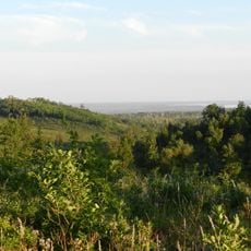
Indigenous Evenk people refer to this range, along with Dzhugdzhur and Yablonoi mountains, as the central foundation of their traditional lands.

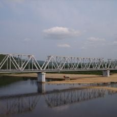
The Amur-Yakutsk highway crosses through the mountains, linking Sakha Republic with the Trans-Siberian Railway network. This road remains the primary passage for travelers heading through this remote area.

The range forms a natural watershed divide, separating river systems that flow toward the Arctic Ocean from those heading to the Pacific. This geographical split has shaped the region's ecosystems and animal migration patterns for millennia.

The community of curious travelers

AroundUs brings together thousands of curated places, local tips, and hidden gems, enriched daily by 60,000 contributors worldwide.

Start exploring
Location
Location
Location
Elevation above the sea
2,482 m
Made from material
shale, gneiss, granite
GPS coordinates
55.53260,125.92380
Latest update
December 7, 2025 20:20
Around this place
Chara Sands
Russian Federation

Chara Sands

502.8 km
Zeya Dam
Russian Federation

Zeya Dam

215.4 km
Highland of Aldan
Russian Federation

Highland of Aldan

232.3 km
Olyokma Nature Reserve
Russian Federation

Olyokma Nature Reserve

412.2 km
Zeya Nature Reserve
Russian Federation

Zeya Nature Reserve

198 km
Vitim Nature Reserve
Russian Federation

Vitim Nature Reserve

591.5 km
Nora Nature Reserve
Russian Federation

Nora Nature Reserve

442 km
Lake Bolshoye Toko
Russian Federation

Lake Bolshoye Toko

315.9 km
Pik BAM
Russian Federation

Pik BAM

537.4 km
Kodar National Park
Russian Federation

Kodar National Park

537.6 km
Russian Federation

Сиреневый Камень

519.8 km
Russian Federation

Aku Volcano

533.3 km
Udokan Plateau
Russian Federation

Udokan Plateau

515.2 km
Buotama
Russian Federation

Buotama

589.1 km
Tokinsko-Stanovoy National Park
Russian Federation

Tokinsko-Stanovoy National Park

262.9 km
Памятник воинам-землякам, погибшим в годы Великой Отечественной войны (Томмот)
Russian Federation

Памятник воинам-землякам, погибшим в годы Великой Отечественной войны (Томмот)

383.7 km
Благовещенский заказник
Russian Federation

Благовещенский заказник

570.2 km
Мемориал Славы (Нерюнгри)
Russian Federation

Мемориал Славы (Нерюнгри)

146.8 km
Ягодний (Амурська область)
Russian Federation

Ягодний (Амурська область)

305.2 km
牛耳河镇
China

牛耳河镇

522.5 km
Orthodox church of the New Martyrs and Confessors of Russia in Aldan
Russian Federation

Orthodox church of the New Martyrs and Confessors of Russia in Aldan

344.6 km
Road bridge over Aldan River in Tommot
Russian Federation

Road bridge over Aldan River in Tommot

382.7 km
Gora Burgalenzha
Russian Federation

Gora Burgalenzha

410.4 km
Railway bridge through Amga river in Verkhnyaya Amga
Russian Federation

Railway bridge through Amga river in Verkhnyaya Amga

463.7 km
Railway bridge through Aldan river in Tommot
Russian Federation

Railway bridge through Aldan river in Tommot

382.9 km
Gora Yuzhnyy Krest
Russian Federation

Gora Yuzhnyy Krest

412.5 km
Road bridge over Amga River in Verkhnyaya Amga
Russian Federation

Road bridge over Amga River in Verkhnyaya Amga

463.6 km
Rail bridge over Ulu river
Russian Federation

Rail bridge over Ulu river

539.7 km
Show the full map
Reviews
Share your experience

No review yet

Discussions
Start a discussion...

No discussion yet

« Stanovoy Range - Mountain range in Sakha and Amur Oblast, Russia » is provided by Around Us (aroundus.com). Images and texts are derived from Wikimedia project under a Creative Commons license. You are allowed to copy, distribute, and modify copies of this page, under the conditions set by the license, as long as this note is clearly visible.

Discover hidden gems everywhere you go!

From secret cafés to breathtaking viewpoints, skip the crowded tourist spots and find places that match your style. Our app makes it easy with voice search, smart filtering, route optimization, and insider tips from travelers worldwide. Download now for the complete mobile experience.

Around Us App Screenshot

A unique approach to discovering new places

Le Figaro

All the places worth exploring

France Info

A tailor-made excursion in just a few clicks

20 Minutes

Around Us
Travel Guide & Maps
Download

Send to your phone

QR Code
1

Open the camera app on your mobile.

2

Point at the QR code with your camera. A notification will appear.

3

Tap the notification to open the link.