Skår, Residential district in Gothenburg Municipality, Sweden
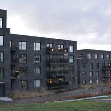
Skår is a district and primary area in the Centrum district of Gothenburg Municipality, covering 244 hectares. Its buildings are mainly villas and terraced houses in functionalist style, and the district extends into the Delsjö area. Skårsskolan, a primary school for years F–6, is located here.
Skår was named after the old farm Skårs Östergård, whose main building dates from the 18th century. The area was incorporated into Gothenburg in 1922, and a 1933 town plan by Uno Åhrén guided construction from 1937 to 1947 on land partly belonging to the Jakobsdal estate. The terraced houses on Sankt Sigfridsgatan were added in the mid-1940s.
The name Skår comes from the Old Swedish word skōr, meaning a cut or notch in the ground, probably referring to the steep drop in the rock east-northeast of Skårs gård. The name appears in 1496 as Skor, then Skå(å)rr in 1565 and Skåhr in 1679. The district also holds Göteborgs pepparkaksbageri.
The best way to find this location is by using a GPS device or digital map application with its coordinates. Modern navigation tools will guide you to the precise spot and show you the surrounding area.
Skår was counted by Statistics Sweden as a separate small locality (småort) until 1995, covering the area east of the Delsjö golf course. The name itself appears in 1496 as Skor, from the Old Swedish skōr, a notch or cut in the ground, probably the steep drop in the rock northeast of Östergården.
The community of curious travelers
AroundUs brings together thousands of curated places, local tips, and hidden gems, enriched daily by 94,490 contributors worldwide.