Enable Location

We need your location to show you interesting places around you

Discover nearby places

Find interesting locations and hidden gems around you

Precise directions

Get accurate directions and distances to places

Your location is never shared with other users. It's only used when you tap the location button.

Cuyahoga Valley National Park

Log in to your account

Start exploring — it's free

Trusted by 63,397 travelers worldwide

Continue with Google
Continue with Apple
or

We will send you a code to connect

By continuing, you accept our Terms and Conditions and our Privacy Policy

Check your inbox

We've sent a pincode in your inbox. Please enter the code below.

Discussion Reviews 4 Photos
88.8k Popularity

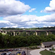
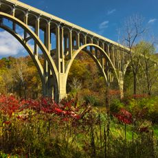
Cuyahoga Valley National Park, National park between Cleveland and Akron, United States

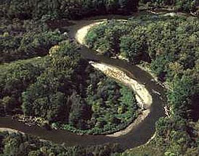
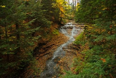
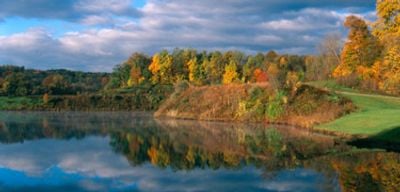
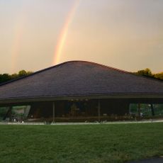
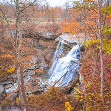
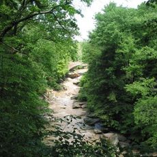
Cuyahoga Valley National Park is a national park in Summit and Cuyahoga counties in Ohio between Cleveland and Akron and covers forests, meadows, and wetlands along the Cuyahoga River. Waterfalls in the park like Brandywine Falls drop over sandstone layers and attract visitors who enjoy views of the cascades from wooden platforms.

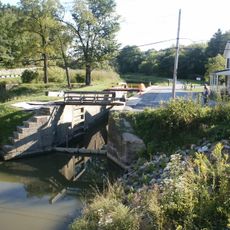
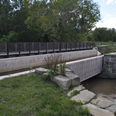
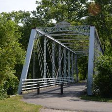
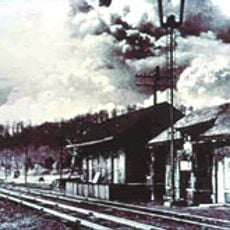
The Ohio and Erie Canal was built in the 1820s and brought commerce and settlements into the valley before railroads diminished its importance. The region was protected as a National Recreation Area in 1974 and gained national park status in 2000.

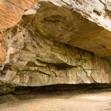
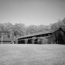
The Ledges form a natural formation that locals use for climbing and photography, while Winterhurst Manor serves as a venue for weddings and concerts. The Towpath Trail follows the former canal and lets visitors walk in the tracks where horses once pulled freight boats.

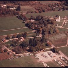
Visitor centers in Boston Mills and Peninsula offer maps and information about trails and activities throughout the valley. In winter some trails may become impassable with snow, while fall and spring provide milder weather for hiking and biking.

Beavers live in the park and build dams that create wetlands attracting waterfowl and amphibians. The Cuyahoga Scenic Railroad offers train rides through the valley and combines historic rail travel with nature observation.

The community of curious travelers

AroundUs brings together thousands of curated places, local tips, and hidden gems, enriched daily by 60,000 contributors worldwide.

Start exploring
Location
Location
Inception
October 11, 2000
Operator
National Park Service
Address
Ohio, USA
Phone
GPS coordinates
41.24167,-81.54972
Latest update
December 13, 2025 15:51
Around this place
Blossom Music Center
United States of America

Blossom Music Center

5.7 km
Ohio and Erie Canal
United States of America

Ohio and Erie Canal

13.3 km
Stan Hywet Hall and Gardens
United States of America

Stan Hywet Hall and Gardens

13.7 km
United States of America

Cathedral of Tomorrow

11.1 km
Hale Farm and Village
United States of America

Hale Farm and Village

6.5 km
Valley View Bridge
United States of America

Valley View Bridge

19.9 km
Brandywine Falls
United States of America

Brandywine Falls

4 km
Mary Campbell Cave
United States of America

Mary Campbell Cave

13.8 km
Boston Mills Historic District
United States of America

Boston Mills Historic District

2.7 km
Dr. Robert Smith House
United States of America

Dr. Robert Smith House

16.2 km
United States of America

Tinkers Creek

14.6 km
All-America Bridge
United States of America

All-America Bridge

16.7 km
Tinkers Creek Aqueduct
United States of America

Tinkers Creek Aqueduct

14.6 km
Fun 'n' Stuff
United States of America

Fun 'n' Stuff

7.7 km
Brecksville-Northfield High Level Bridge
United States of America

Brecksville-Northfield High Level Bridge

9.4 km
Brecksville Reservation
United States of America

Brecksville Reservation

9.2 km
Jaite Mill Historic District
United States of America

Jaite Mill Historic District

4.9 km
Virginia Kendall State Park Historic District
United States of America

Virginia Kendall State Park Historic District

3.6 km
Station Road Bridge
United States of America

Station Road Bridge

9.2 km
Jim Brown House
United States of America

Jim Brown House

7.1 km
Everett Historic District
United States of America

Everett Historic District

4.6 km
Independence Slab
United States of America

Independence Slab

17.4 km
United States of America

Packard-Doubler House

13.4 km
Edmund Gleason Farm
United States of America

Edmund Gleason Farm

14.9 km
Bedford Baptist Church
United States of America

Bedford Baptist Church

16.6 km
Valley Railway Historic District
United States of America

Valley Railway Historic District

2.4 km
Independence Presbyterian Church
United States of America

Independence Presbyterian Church

17.4 km
St. Joseph Convent and Academy Complex
United States of America

St. Joseph Convent and Academy Complex

20.3 km
Show the full map
Reviews
Share your experience

No review yet

Discussions
Start a discussion...

No discussion yet

« Cuyahoga Valley National Park - National park between Cleveland and Akron, United States » is provided by Around Us (aroundus.com). Images and texts are derived from Wikimedia project under a Creative Commons license. You are allowed to copy, distribute, and modify copies of this page, under the conditions set by the license, as long as this note is clearly visible.

Discover hidden gems everywhere you go!

From secret cafés to breathtaking viewpoints, skip the crowded tourist spots and find places that match your style. Our app makes it easy with voice search, smart filtering, route optimization, and insider tips from travelers worldwide. Download now for the complete mobile experience.

Around Us App Screenshot

A unique approach to discovering new places

Le Figaro

All the places worth exploring

France Info

A tailor-made excursion in just a few clicks

20 Minutes

Around Us
Travel Guide & Maps
Download

Send to your phone

QR Code
1

Open the camera app on your mobile.

2

Point at the QR code with your camera. A notification will appear.

3

Tap the notification to open the link.