Enable Location

We need your location to show you interesting places around you

Discover nearby places

Find interesting locations and hidden gems around you

Precise directions

Get accurate directions and distances to places

Your location is never shared with other users. It's only used when you tap the location button.

Delta County

Log in to your account

Start exploring — it's free

Trusted by 62,179 travelers worldwide

Continue with Google
Continue with Apple
or

We will send you a code to connect

By continuing, you accept our Terms and Conditions and our Privacy Policy

Check your inbox

We've sent a pincode in your inbox. Please enter the code below.

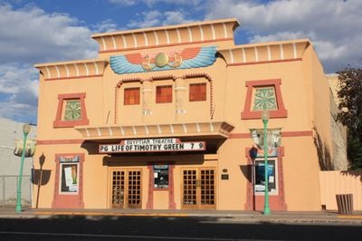
Delta County, Administrative county in western Colorado, US.

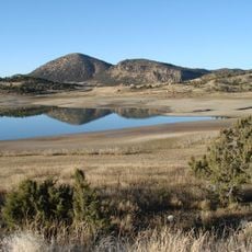
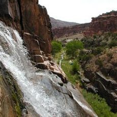
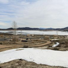
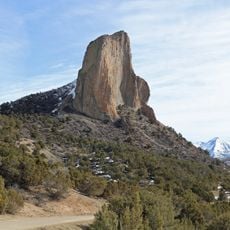
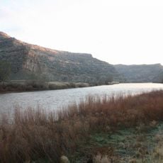
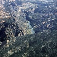
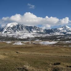
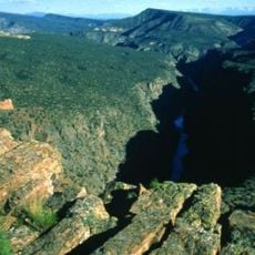
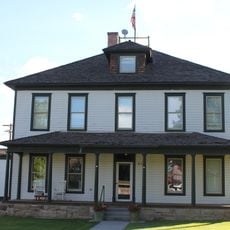
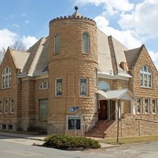
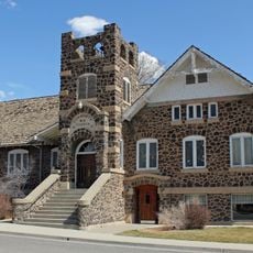
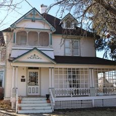
Delta County spreads across western Colorado between the Grand Mesa, West Elk Mountains, and Uncompahgre Plateau. The landscape includes river valleys, mountain foothills, and open farmland where orchards and small towns dot the terrain.

Colorado established this county in 1883, naming it after the fertile delta where the Uncompahgre River flows into the Gunnison River. The creation reflected early settlement efforts and the area's importance for farming and resource development.

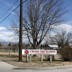
Fruit orchards and vineyards shape the countryside throughout the county, reflecting farming traditions passed down through generations. Walking through these agricultural areas gives visitors a sense of the region's working landscape and how people have used the land.

The region mixes mountain terrain and valley areas, so travel conditions vary depending on which direction you explore. Having a car makes it easier to move between the different landscapes and smaller towns scattered across the county.

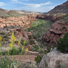
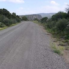
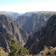
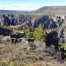
Parts of five national protected areas lie within the county, including Dominguez Canyon Wilderness and sections of Grand Mesa National Forest. These preserved spaces offer visitors access to wild landscapes that remain largely untouched.

The community of curious travelers

AroundUs brings together thousands of curated places, local tips, and hidden gems, enriched daily by 60,000 contributors worldwide.

Start exploring
Location
Inception
February 11, 1883
Capital city
Delta
Shares border with
Mesa County, Gunnison County, Montrose County
GPS coordinates
38.86000,-107.86000
Latest update
December 7, 2025 19:26
Around this place
Crawford State Park
United States of America

Crawford State Park

29.9 km
Dominguez Canyon Wilderness
United States of America

Dominguez Canyon Wilderness

49.8 km
Vega State Park
United States of America

Vega State Park

41 km
Needle Rock Natural Area
United States of America

Needle Rock Natural Area

30.9 km
James M. Robb – Colorado River State Park
United States of America

James M. Robb – Colorado River State Park

56.5 km
Gunnison Gorge National Conservation Area
United States of America

Gunnison Gorge National Conservation Area

18.4 km
Egyptian Theatre
United States of America

Egyptian Theatre

22.5 km
Mount Lamborn
United States of America

Mount Lamborn

29.9 km
Gunnison Gorge Wilderness
United States of America

Gunnison Gorge Wilderness

22.3 km
Land's End Observatory
United States of America

Land's End Observatory

36.4 km
Dominguez-Escalante National Conservation Area
United States of America

Dominguez-Escalante National Conservation Area

47.5 km
Methodist Episcopal Church of Montrose
United States of America

Methodist Episcopal Church of Montrose

42.3 km
Cross Orchards Historic Site
United States of America

Cross Orchards Historic Site

59.8 km
North Rim Road, Black Canyon of the Gunnison National Park
United States of America

North Rim Road, Black Canyon of the Gunnison National Park

35.2 km
Clifton Community Center and Church
United States of America

Clifton Community Center and Church

57.1 km
IOOF Hall
United States of America

IOOF Hall

60.9 km
First Methodist Episcopal Church of Delta
United States of America

First Methodist Episcopal Church of Delta

22.5 km
Montrose Masonic Temple, Lodge No. 63
United States of America

Montrose Masonic Temple, Lodge No. 63

42.2 km
First Presbyterian Church of Eckert
United States of America

First Presbyterian Church of Eckert

10.2 km
U.S. Bureau of Reclamation Project Office Building
United States of America

U.S. Bureau of Reclamation Project Office Building

41.7 km
Paonia First Christian Church
United States of America

Paonia First Christian Church

23.1 km
Hotchkiss Methodist Episcopal Church
United States of America

Hotchkiss Methodist Episcopal Church

14 km
North Rim Road
United States of America

North Rim Road

36.8 km
Garnethurst
United States of America

Garnethurst

22.1 km
Painted Wall
United States of America

Painted Wall

33.1 km
Black Canyon of the Gunnison
United States of America

Black Canyon of the Gunnison

8.8 km
South Rim Visitor Center
United States of America

South Rim Visitor Center

37.1 km
Gunnison Point
United States of America

Gunnison Point

37.1 km
Show the full map
« Delta County - Administrative county in western Colorado, US » is provided by Around Us (aroundus.com). Images and texts are derived from Wikimedia project under a Creative Commons license. You are allowed to copy, distribute, and modify copies of this page, under the conditions set by the license, as long as this note is clearly visible.

Discover hidden gems everywhere you go!

From secret cafés to breathtaking viewpoints, skip the crowded tourist spots and find places that match your style. Our app makes it easy with voice search, smart filtering, route optimization, and insider tips from travelers worldwide. Download now for the complete mobile experience.

Around Us App Screenshot

A unique approach to discovering new places

Le Figaro

All the places worth exploring

France Info

A tailor-made excursion in just a few clicks

20 Minutes

Around Us
Travel Guide & Maps
Download

Send to your phone

QR Code
1

Open the camera app on your mobile.

2

Point at the QR code with your camera. A notification will appear.

3

Tap the notification to open the link.