Enable Location

We need your location to show you interesting places around you

Discover nearby places

Find interesting locations and hidden gems around you

Precise directions

Get accurate directions and distances to places

Your location is never shared with other users. It's only used when you tap the location button.

Hampton

Log in to your account

Start exploring — it's free

Trusted by 61,983 travelers worldwide

Continue with Google
Continue with Apple
or

We will send you a code to connect

By continuing, you accept our Terms and Conditions and our Privacy Policy

Check your inbox

We've sent a pincode in your inbox. Please enter the code below.

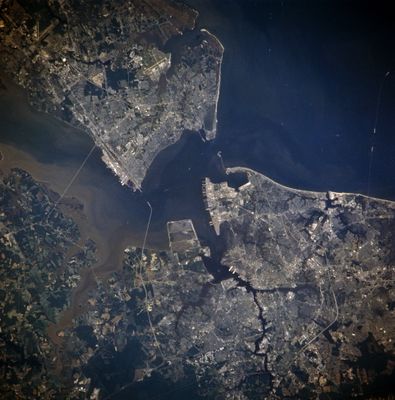
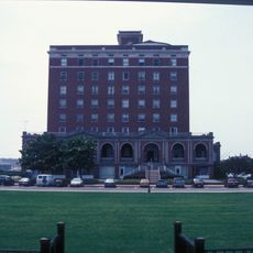
Hampton, Independent city in Chesapeake Bay, United States

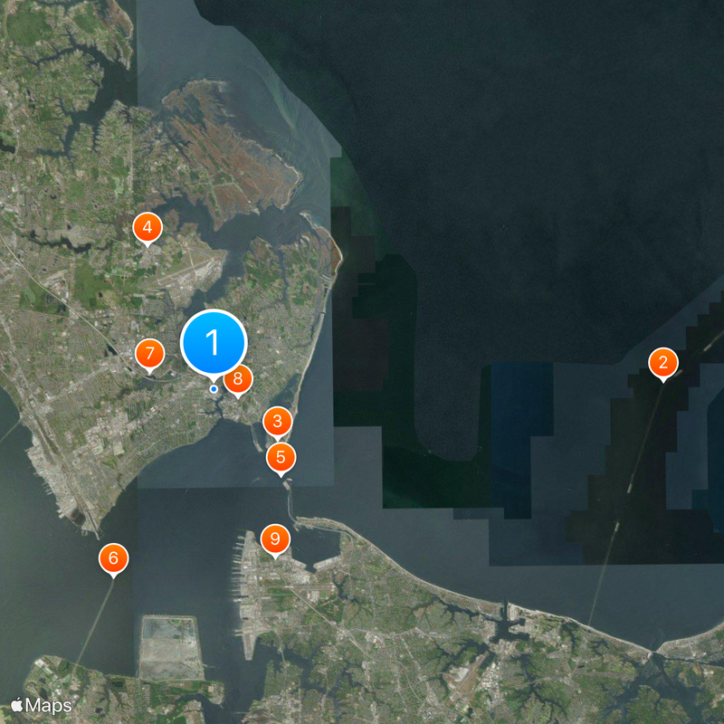
Hampton lies on the northern shore of Hampton Roads and stretches across 136 square kilometers (52 square miles) in southeastern Virginia with numerous waterfront areas and marinas. The city encompasses both residential neighborhoods and military installations along Chesapeake Bay.

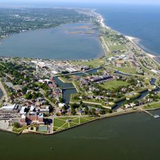
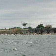
The city began in 1610 when English settlers established a permanent community, making it the oldest continuous English settlement in North America. Fort Monroe was built in 1819 as a major coastal fortification.

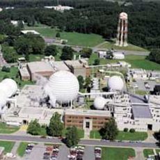
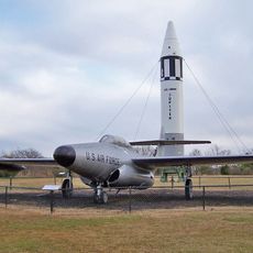
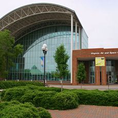
The Virginia Air and Space Center displays aeronautical artifacts and serves as the visitor center for NASA Langley Research Center and Langley Air Force Base. Visitors can view moon rocks, satellites, and aircraft models up close.

Fort Monroe National Monument offers public access to beaches, fishing spots, and walking paths beside military structures. The waterfront areas throughout the city are good for strolling and watching boats.

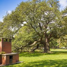
The Emancipation Oak at Hampton University marks where the first Southern reading of the Emancipation Proclamation took place in 1863. The old oak still stands on campus and is recognized as a national landmark.

The community of curious travelers

AroundUs brings together thousands of curated places, local tips, and hidden gems, enriched daily by 60,000 contributors worldwide.

Start exploring
Location
Inception
1610
Elevation above the sea
3 m
Part of
Hampton Roads
Shares border with
Poquoson, Norfolk, Newport News, York County, Portsmouth
GPS coordinates
37.02639,-76.34444
Latest update
December 16, 2025 11:56
Around this place
Chesapeake Bay Bridge-Tunnel
United States of America

Chesapeake Bay Bridge-Tunnel

23 km
Fort Monroe
United States of America

Fort Monroe

4.1 km
Langley Research Center
United States of America

Langley Research Center

8.1 km
Hampton Roads Bridge–Tunnel
United States of America

Hampton Roads Bridge–Tunnel

5.6 km
Monitor-Merrimac Memorial Bridge-Tunnel
United States of America

Monitor-Merrimac Memorial Bridge-Tunnel

10.8 km
Hampton Coliseum
United States of America

Hampton Coliseum

3.4 km
Emancipation Oak
United States of America

Emancipation Oak

1.3 km
Jamestown Exposition
United States of America

Jamestown Exposition

9.1 km
Fort Wool
United States of America

Fort Wool

5.9 km
Langley Speedway
United States of America

Langley Speedway

7.7 km
United States of America

Ocean View Amusement Park

11.6 km
The Chamberlin
United States of America

The Chamberlin

4 km
Thimble Shoal Light
United States of America

Thimble Shoal Light

9.4 km
Air Power Park
United States of America

Air Power Park

2.7 km
Hampton National Cemetery
United States of America

Hampton National Cemetery

1.5 km
Armstrong Stadium
United States of America

Armstrong Stadium

1.2 km
Plum Tree Island National Wildlife Refuge
United States of America

Plum Tree Island National Wildlife Refuge

12.7 km
Landing and Impact Research Facility
United States of America

Landing and Impact Research Facility

9.3 km
Newport News Middle Ground Light
United States of America

Newport News Middle Ground Light

10 km
Bluebird Gap Farm
United States of America

Bluebird Gap Farm

3.9 km
Newport News Victory Arch
United States of America

Newport News Victory Arch

9.6 km
Variable Density Tunnel
United States of America

Variable Density Tunnel

5.8 km
Langley Full-Scale Tunnel
United States of America

Langley Full-Scale Tunnel

6.1 km
United States of America

Hampton University Museum

729 m
Commodore Levy Chapel
United States of America

Commodore Levy Chapel

9.2 km
United States of America

Hampton VA National Cemetery

1.4 km
United States of America

Bay Shore Beach

6.1 km
Virginia Air and Space Science Center
United States of America

Virginia Air and Space Science Center

277 m
Show the full map
« Hampton - Independent city in Chesapeake Bay, United States » is provided by Around Us (aroundus.com). Images and texts are derived from Wikimedia project under a Creative Commons license. You are allowed to copy, distribute, and modify copies of this page, under the conditions set by the license, as long as this note is clearly visible.

Discover hidden gems everywhere you go!

From secret cafés to breathtaking viewpoints, skip the crowded tourist spots and find places that match your style. Our app makes it easy with voice search, smart filtering, route optimization, and insider tips from travelers worldwide. Download now for the complete mobile experience.

Around Us App Screenshot

A unique approach to discovering new places

Le Figaro

All the places worth exploring

France Info

A tailor-made excursion in just a few clicks

20 Minutes

Around Us
Travel Guide & Maps
Download

Send to your phone

QR Code
1

Open the camera app on your mobile.

2

Point at the QR code with your camera. A notification will appear.

3

Tap the notification to open the link.