Ponce

Log in to your account

AroundUs is a community-driven map of interesting places, built by curious explorers like you. It grows with every review, story, and photo you share.
Connect to save your favorite spots, contribute locations, and create personalized routes.
Continue with Google
Continue with Apple
Continue with X
Continue with Facebook
Continue with email
By continuing, you accept our Terms and Conditions and our Privacy Policy
Create an account
Add to collection
Map
Suggest a change
Share

Ponce, Cultural center in southern Puerto Rico, United States

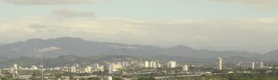
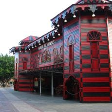
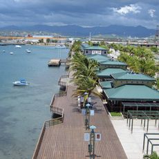
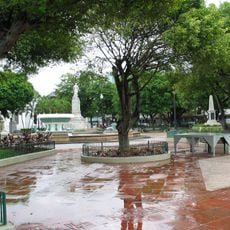
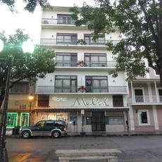
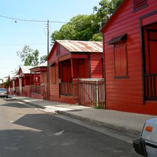
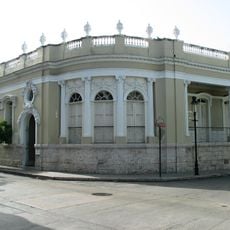
Ponce is a coastal city in southern Puerto Rico built around a central square that features the red and black firehouse from the late 1800s. The streets in the old quarter run in a grid pattern and are lined with two-story buildings with balconies and wrought-iron railings, gradually giving way to newer neighborhoods toward the sea.

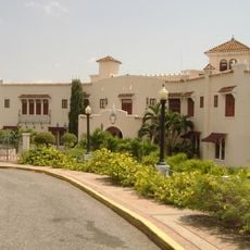
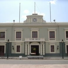
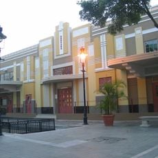
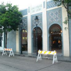
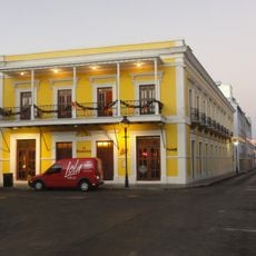
The city received its name in 1692 after Juan Ponce de León y Loayza and grew into a major port for exporting sugar starting in the 18th century. Rum and sugar production brought wealth in the 1800s that allowed for the construction of the grand homes and public buildings in the downtown area.

The Museo de Arte de Ponce contains over 4,500 works of art, including extensive collections of European paintings, Puerto Rican art, and African artifacts.

Mercedita Airport sits about 3 miles (5 km) east of the center and offers connections to the United States mainland as well as to other cities in Puerto Rico. Most of the sights in the historic center can be reached on foot, while more distant locations such as the Serrallés Castle are easier to reach by car or taxi.

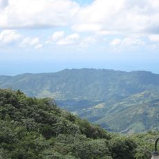
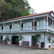
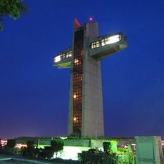
The Serrallés Castle on a hill outside the center belonged to the family that produced Don Q rum and now displays rooms with original furniture from the 1930s. From the cross next to the building, you can see all the way to the coast and the offshore islands on clear days.

Location: Puerto Rico

Inception: 1692

Capital city: Ponce

Elevation above the sea: 10 m

Shares border with: Juana Díaz, Jayuya, Adjuntas, Peñuelas, Utuado

GPS coordinates: 18.01083,-66.61361

Latest update: December 15, 2025 08:15

Photos
Around this place
Cerro de Punta
United States of America

Cerro de Punta

18.1 km
Parque de Bombas
United States of America

Parque de Bombas

315 m
Museo Parque de Bombas
United States of America

Museo Parque de Bombas

120 m
Agüeybaná El Bravo
United States of America

Agüeybaná El Bravo

1.7 km
Castillo Serrallés
United States of America

Castillo Serrallés

1.1 km
Tibes Indigenous Ceremonial Center
United States of America

Tibes Indigenous Ceremonial Center

3.5 km
Toro Negro State Forest
United States of America

Toro Negro State Forest

18.7 km
Hacienda Buena Vista
United States of America

Hacienda Buena Vista

9.3 km
Paseo Tablado La Guancha
United States of America

Paseo Tablado La Guancha

4.9 km
Ponce City Hall
United States of America

Ponce City Hall

29 m
El Tuque
United States of America

El Tuque

8.1 km
Parque de la Ceiba
United States of America

Parque de la Ceiba

825 m
Cruceta del Vigía
United States of America

Cruceta del Vigía

1.1 km
Plaza las Delicias
United States of America

Plaza las Delicias

95 m
United States of America

Reserva Natural Punta Cucharas

8 km
Letras de Ponce
United States of America

Letras de Ponce

4.9 km
Statue of Héctor Lavoe
United States of America

Statue of Héctor Lavoe

5.1 km
Hotel Meliá
United States of America

Hotel Meliá

110 m
Museo de la Masacre de Ponce
United States of America

Museo de la Masacre de Ponce

172 m
Plaza del Mercado de Ponce
United States of America

Plaza del Mercado de Ponce

420 m
Portugués Dam
United States of America

Portugués Dam

6.1 km
Mercado de las Carnes
United States of America

Mercado de las Carnes

521 m
Calle 25 de Enero
United States of America

Calle 25 de Enero

990 m
Ponce Ramada Hotel
United States of America

Ponce Ramada Hotel

182 m
Román Baldorioty de Castro National Pantheon
United States of America

Román Baldorioty de Castro National Pantheon

710 m
Wiechers–Villaronga House
United States of America

Wiechers–Villaronga House

287 m
Museo Castillo Serrallés
United States of America

Museo Castillo Serrallés

1.1 km
Museo de la Música Puertorriqueña
United States of America

Museo de la Música Puertorriqueña

359 m
Show the full map
Reviews

Visited this place? Tap the stars to rate it and share your experience / photos with the community! Try now! You can cancel it anytime.

« Ponce - Cultural center in southern Puerto Rico, United States » is provided by Around Us (aroundus.com). Images and texts are derived from Wikimedia project under a Creative Commons license. You are allowed to copy, distribute, and modify copies of this page, under the conditions set by the license, as long as this note is clearly visible.

Discover hidden gems everywhere you go!

From secret cafés to breathtaking viewpoints, skip the crowded tourist spots and find places that match your style. Our app makes it easy with voice search, smart filtering, route optimization, and insider tips from travelers worldwide. Download now for the complete mobile experience.

Around Us App Screenshot

A unique approach to discovering new places

Le Figaro

All the places worth exploring

France Info

A tailor-made excursion in just a few clicks

20 Minutes