Chest opened
+${chestReward.xp} XP
Explorer
NOUVEAU ×${chestReward.collectible.quantity}
tapez pour fermer
Chest locked

Open chests in the app

Around Us is built for your phone — chests unlock when you walk, explore and capture nearby places.

Enable Location

We need your location to show you interesting places around you

Discover nearby places

Find interesting locations and hidden gems around you

Precise directions

Get accurate directions and distances to places

Your location is never shared with other users. It's only used when you tap the location button.

Cumberland Plateau

Log in to your account

Start exploring — it's free

Trusted by 72,880 travelers worldwide

Continue with Google
Continue with Apple
or

We will send you a code to connect

By continuing, you accept our Terms and Conditions and our Privacy Policy

Check your inbox

We've sent a pincode in your inbox. Please enter the code below.

Cumberland Plateau
Discussion Reviews 1 Photos
67.3k Popularity

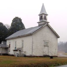
Cumberland Plateau, Elevated plateau region in Alabama and Kentucky, United States.

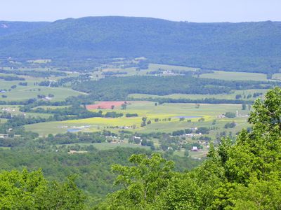
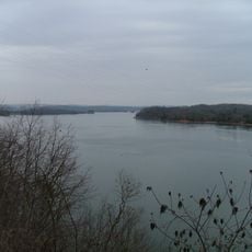
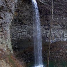
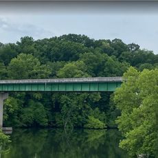
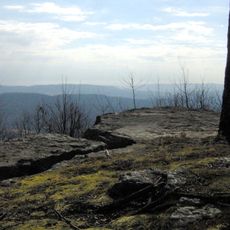
The Cumberland Plateau is an elevated landform in Alabama, Kentucky, Tennessee, and Georgia that rises roughly 1,000 feet (300 meters) above the surrounding terrain and is marked by sandstone cliffs, bluffs, and continuous forest cover. The vegetation covers gentle slopes and wide valleys, while several rivers cut through the rock and carve deep gorges.

The Cumberland Gap, a natural pass through the plateau, served for centuries as a route for travelers and opened the way westward for settlers in the 18th and 19th centuries. During the Civil War, the region became a theater of military movements as both sides recognized the strategic value of the passes.

The name comes from the Cumberland River, which flows through part of the region and was named by early explorers after an English duke. Hikers and nature lovers come here to experience the quiet of the forests and explore the deep gorges that cut through the land.

Several parks within the plateau offer marked trails with varying difficulty levels, from short walks to multi-hour routes through dense woodland. Visitors should wear sturdy footwear and bring enough water, as some sections are steep and rocky.

Beneath the surface lie thick layers of bituminous coal that formed millions of years ago in widespread swamp environments and were later covered by sediments washed from the Appalachian highlands. These deposits appear today in road cuts and along riverbanks, where layers from different geological periods become visible.

The community of curious travelers

AroundUs brings together thousands of curated places, local tips, and hidden gems, enriched daily by 60,000 contributors worldwide.

Start exploring
Location
Location
Location
Location
Part of
Appalachian Plateau
GPS coordinates
36.00000,-85.00000
Latest update
December 13, 2025 18:09
Around this place
X-10 Graphite Reactor
United States of America

X-10 Graphite Reactor

62 km
Manhattan Project National Historical Park
United States of America

Manhattan Project National Historical Park

55.1 km
United States of America

Spallation Neutron Source

63.1 km
Horace Burgess's Treehouse
United States of America

Horace Burgess's Treehouse

1.7 km
Watts Bar Lake
United States of America

Watts Bar Lake

46.6 km
Cumberland Mountain State Park
United States of America

Cumberland Mountain State Park

11.1 km
Ozone Falls State Natural Area
United States of America

Ozone Falls State Natural Area

21.7 km
Cumberland Homesteads
United States of America

Cumberland Homesteads

10.6 km
Ozone Falls
United States of America

Ozone Falls

21.3 km
Fort Southwest Point
United States of America

Fort Southwest Point

45.2 km
George Jones Memorial Baptist Church
United States of America

George Jones Memorial Baptist Church

56.9 km
Palace Theater
United States of America

Palace Theater

6.3 km
American Temperance University
United States of America

American Temperance University

41 km
Children's Museum of Oak Ridge
United States of America

Children's Museum of Oak Ridge

65.6 km
Cornstalk Heights
United States of America

Cornstalk Heights

41.5 km
New Bethel Baptist Church
United States of America

New Bethel Baptist Church

63 km
Tamke-Allan Observatory
United States of America

Tamke-Allan Observatory

39.2 km
Roane County Courthouse
United States of America

Roane County Courthouse

45.9 km
Post Oak Springs Christian Church
United States of America

Post Oak Springs Christian Church

35.9 km
Colonial Hall
United States of America

Colonial Hall

59.6 km
Cumberland County Courthouse
United States of America

Cumberland County Courthouse

6.3 km
Col. Gideon Morgan House
United States of America

Col. Gideon Morgan House

45.9 km
Plateau Bowling Lanes
United States of America

Plateau Bowling Lanes

5.6 km
Charles Vanden Bulck Bridge
United States of America

Charles Vanden Bulck Bridge

62.2 km
Crossville Model Railroad Club
United States of America

Crossville Model Railroad Club

2.6 km
Lone Mountain State Forest
United States of America

Lone Mountain State Forest

41.2 km
Obed Wild and Scenic River Visitor Center
United States of America

Obed Wild and Scenic River Visitor Center

38 km
Princess Theatre
United States of America

Princess Theatre

41.1 km
Show the full map
Reviews
Share your experience

No review yet

Discussions
Start a discussion...

No discussion yet

« Cumberland Plateau - Elevated plateau region in Alabama and Kentucky, United States » is provided by Around Us (aroundus.com). Images and texts are derived from Wikimedia project under a Creative Commons license. You are allowed to copy, distribute, and modify copies of this page, under the conditions set by the license, as long as this note is clearly visible.

Discover hidden gems everywhere you go!

From secret cafés to breathtaking viewpoints, skip the crowded tourist spots and find places that match your style. Our app makes it easy with voice search, smart filtering, route optimization, and insider tips from travelers worldwide. Download now for the complete mobile experience.

Around Us App Screenshot

A unique approach to discovering new places

Le Figaro

All the places worth exploring

France Info

A tailor-made excursion in just a few clicks

20 Minutes

Around Us
Travel Guide & Maps
Download

Send to your phone

QR Code
1

Open the camera app on your mobile.

2

Point at the QR code with your camera. A notification will appear.

3

Tap the notification to open the link.