Chest opened
+${chestReward.xp} XP
Explorer
NOUVEAU ×${chestReward.collectible.quantity}
tapez pour fermer
Chest locked

Open chests in the app

Around Us is built for your phone — chests unlock when you walk, explore and capture nearby places.

Enable Location

We need your location to show you interesting places around you

Discover nearby places

Find interesting locations and hidden gems around you

Precise directions

Get accurate directions and distances to places

Your location is never shared with other users. It's only used when you tap the location button.

Fire Island

Log in to your account

Start exploring — it's free

Trusted by 72,888 travelers worldwide

Continue with Google
Continue with Apple
or

We will send you a code to connect

By continuing, you accept our Terms and Conditions and our Privacy Policy

Check your inbox

We've sent a pincode in your inbox. Please enter the code below.

Discussion Reviews 2 Photos
261k Popularity

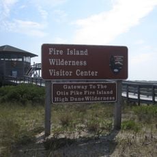
Fire Island, Barrier island in Suffolk County, United States.

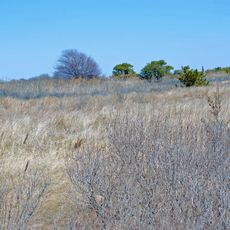
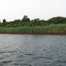
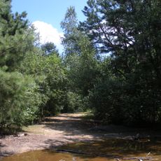
Fire Island is a narrow strip of sand that runs parallel to the south shore of Long Island, stretching about 31 miles and covered with dunes, grasses and low shrubs. At its widest point it measures roughly 1,300 feet across, while in other sections it narrows to around 500 feet, giving the sense of walking along a ribbon of land between the ocean and the bay.

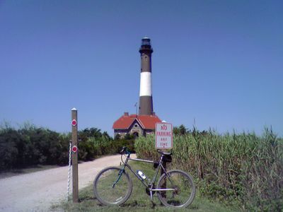
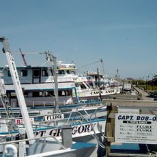
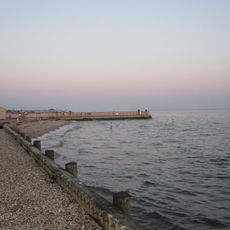
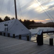
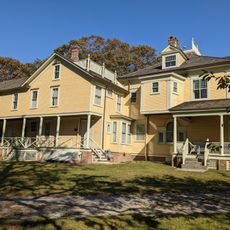
The island was claimed for England by William Smith during the 17th century, and small communities later formed along the shore, attracting fishermen and whalers. A lighthouse was built in 1825 to warn ships of the dangerous sandbars that caused many wrecks.

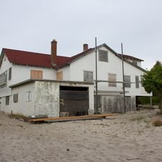
The communities of Cherry Grove and Fire Island Pines emerged as notable summer destinations for LGBTQ+ visitors starting in the mid-twentieth century.

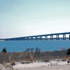
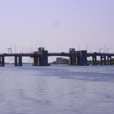
Most places on the island can only be reached by ferry from Long Island terminals, since there are almost no roads for cars. Comfortable shoes and a light jacket are helpful, as wind can pick up quickly and the sandy paths are uneven.

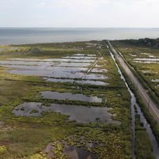
Hurricane Sandy in 2012 tore several new inlets through the sand, permanently reshaping the shoreline. Scientists have since worked to understand the balance between natural erosion and community protection.

The community of curious travelers

AroundUs brings together thousands of curated places, local tips, and hidden gems, enriched daily by 60,000 contributors worldwide.

Start exploring
Location
GPS coordinates
40.64750,-73.14667
Latest update
December 15, 2025 00:00
Around this place
Heckscher State Park
United States of America

Heckscher State Park

6.8 km
Fire Island Light
United States of America

Fire Island Light

6.3 km
Bayard Cutting Arboretum State Park
United States of America

Bayard Cutting Arboretum State Park

11.2 km
Bayport - Blue Point High School
United States of America

Bayport - Blue Point High School

13.1 km
United States of America

Islip Speedway

12.6 km
Captree State Park
United States of America

Captree State Park

9.2 km
Lighthouse Beach
United States of America

Lighthouse Beach

6.3 km
Connetquot River State Park Preserve
United States of America

Connetquot River State Park Preserve

11.4 km
Great South Bay Bridge
United States of America

Great South Bay Bridge

11.2 km
Alfonse M. D'Amato United States Courthouse
United States of America

Alfonse M. D'Amato United States Courthouse

13 km
Otis Pike Fire Island High Dune Wilderness
United States of America

Otis Pike Fire Island High Dune Wilderness

19.8 km
Fire Island Inlet
United States of America

Fire Island Inlet

13.8 km
William Floyd House
United States of America

William Floyd House

30.5 km
Fire Island Inlet Bridge
United States of America

Fire Island Inlet Bridge

10 km
Westbrook, Suffolk County, New York
United States of America

Westbrook, Suffolk County, New York

11.2 km
Sagtikos Manor
United States of America

Sagtikos Manor

12.6 km
Seatuck National Wildlife Refuge
United States of America

Seatuck National Wildlife Refuge

8.9 km
Bayport Aerodrome
United States of America

Bayport Aerodrome

14.6 km
Sayville National Wildlife Refuge
United States of America

Sayville National Wildlife Refuge

11.7 km
Carrington House
United States of America

Carrington House

6.1 km
Smith Point Bridge
United States of America

Smith Point Bridge

25.6 km
Sandspit Park Beach & Marina
United States of America

Sandspit Park Beach & Marina

15.8 km
Priscilla
United States of America

Priscilla

9.4 km
State Boat Channel Bridge
United States of America

State Boat Channel Bridge

9.9 km
John Ellis Roosevelt Estate
United States of America

John Ellis Roosevelt Estate

12 km
Long Island Maritime Museum
United States of America

Long Island Maritime Museum

9.4 km
Modesty
United States of America

Modesty

9.4 km
Patchogue-Medford Library
United States of America

Patchogue-Medford Library

17.3 km
Show the full map
Reviews
Share your experience

No review yet

Discussions
Start a discussion...

No discussion yet

« Fire Island - Barrier island in Suffolk County, United States » is provided by Around Us (aroundus.com). Images and texts are derived from Wikimedia project under a Creative Commons license. You are allowed to copy, distribute, and modify copies of this page, under the conditions set by the license, as long as this note is clearly visible.

Discover hidden gems everywhere you go!

From secret cafés to breathtaking viewpoints, skip the crowded tourist spots and find places that match your style. Our app makes it easy with voice search, smart filtering, route optimization, and insider tips from travelers worldwide. Download now for the complete mobile experience.

Around Us App Screenshot

A unique approach to discovering new places

Le Figaro

All the places worth exploring

France Info

A tailor-made excursion in just a few clicks

20 Minutes

Around Us
Travel Guide & Maps
Download

Send to your phone

QR Code
1

Open the camera app on your mobile.

2

Point at the QR code with your camera. A notification will appear.

3

Tap the notification to open the link.